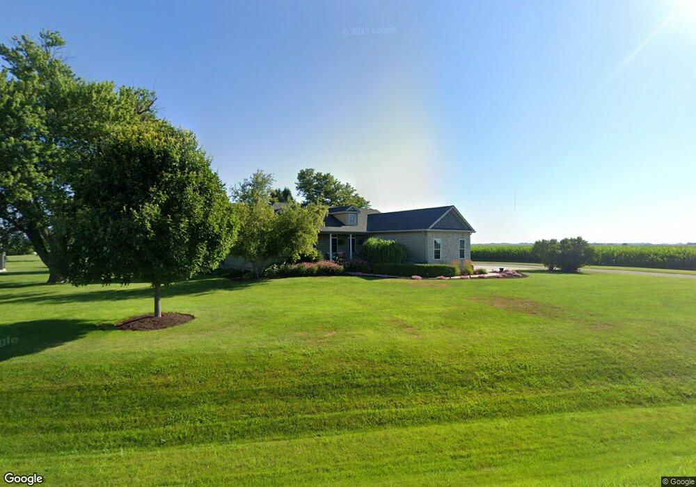
24100 Territorial Rd Le Claire, IA 52753
Estimated Value: $461,798 - $530,000
4
Beds
6
Baths
2,008
Sq Ft
$244/Sq Ft
Est. Value
About This Home
This home is located at 24100 Territorial Rd, Le Claire, IA 52753 and is currently estimated at $488,950, approximately $243 per square foot. 24100 Territorial Rd is a home located in Scott County with nearby schools including Cody Elementary School, Pleasant Valley Junior High School, and Pleasant Valley High School.
Ownership History
Date
Name
Owned For
Owner Type
Purchase Details
Closed on
Mar 3, 2020
Sold by
Fox Roger
Bought by
Fox Leann
Current Estimated Value
Home Financials for this Owner
Home Financials are based on the most recent Mortgage that was taken out on this home.
Original Mortgage
$127,449
Interest Rate
3.4%
Mortgage Type
New Conventional
Create a Home Valuation Report for This Property
The Home Valuation Report is an in-depth analysis detailing your home's value as well as a comparison with similar homes in the area
Home Values in the Area
Average Home Value in this Area
Purchase History
| Date | Buyer | Sale Price | Title Company |
|---|---|---|---|
| Fox Leann | -- | None Available |
Source: Public Records
Mortgage History
| Date | Status | Borrower | Loan Amount |
|---|---|---|---|
| Closed | Fox Leann | $127,449 |
Source: Public Records
Tax History Compared to Growth
Tax History
| Year | Tax Paid | Tax Assessment Tax Assessment Total Assessment is a certain percentage of the fair market value that is determined by local assessors to be the total taxable value of land and additions on the property. | Land | Improvement |
|---|---|---|---|---|
| 2025 | $4,598 | $455,700 | $89,400 | $366,300 |
| 2024 | $4,752 | $436,600 | $89,400 | $347,200 |
| 2023 | $4,474 | $436,600 | $89,400 | $347,200 |
| 2022 | $4,434 | $348,090 | $47,800 | $300,290 |
| 2021 | $4,434 | $348,090 | $47,800 | $300,290 |
| 2020 | $4,338 | $328,490 | $47,800 | $280,690 |
| 2019 | $4,340 | $322,980 | $47,800 | $275,180 |
| 2018 | $4,262 | $322,980 | $47,800 | $275,180 |
| 2017 | $1,796 | $322,980 | $47,800 | $275,180 |
| 2016 | $4,304 | $319,030 | $0 | $0 |
| 2015 | $4,304 | $305,460 | $0 | $0 |
| 2014 | $4,194 | $305,460 | $0 | $0 |
| 2013 | $4,128 | $0 | $0 | $0 |
| 2012 | -- | $308,510 | $47,800 | $260,710 |
Source: Public Records
Map
Nearby Homes
- 21669 235th Ave
- 6774 Saint Marie Ct
- 00 Wells Ferry Rd
- 7123 Alvie Ln
- 7131 Alvie Ln
- 7091 Spring Creek Dr
- Lot 33 Timber Ridge Ln
- 7169 Spring Creek Dr
- 19456 250th Ave
- 19468 250th Ave
- 6734 Pelican St
- 6702 Pelican St
- 6455 Pelican St
- 6414 Pelican St
- 6659 Pelican St
- 6670 Pelican St
- 6822 Summerfield Dr
- 26 Blackstone Cir
- 6638 Pelican St
- 6691 Spring Creek Dr
- 24110 Territorial Rd
- 21985 240th Ave
- 24147 Territorial Rd
- 21920 240th Ave
- 22005 240th Ave
- 23941 Territorial Rd
- 21824 240th Ave
- 24230 Territorial Rd
- 22020 240th Ave
- 23923 Territorial Rd
- 24240 Territorial Rd
- 23889 Territorial Rd
- 23910 Territorial Rd
- 23857 Territorial Rd
- 23860 Territorial Rd
- 23780 Territorial Rd
- 22021 240th Ave
- 23840 Territorial Rd
- 23730 220th St
- 23699 220th St