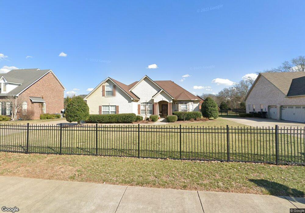
2411 Saint Andrews Dr Murfreesboro, TN 37128
Estimated Value: $425,772 - $472,000
--
Bed
3
Baths
2,004
Sq Ft
$228/Sq Ft
Est. Value
About This Home
This home is located at 2411 Saint Andrews Dr, Murfreesboro, TN 37128 and is currently estimated at $457,693, approximately $228 per square foot. 2411 Saint Andrews Dr is a home located in Rutherford County with nearby schools including Scales Elementary School, Rockvale Middle School, and Rockvale High School.
Ownership History
Date
Name
Owned For
Owner Type
Purchase Details
Closed on
Mar 24, 2022
Sold by
Salem Land Company Llc
Bought by
Jones Company Of Tennessee Llc
Current Estimated Value
Purchase Details
Closed on
Jan 19, 2018
Sold by
Weeks Linda Susan
Bought by
Alvey Sherry A
Purchase Details
Closed on
Jul 26, 2017
Sold by
Alvey Sherry A
Bought by
Alvey Sherry A and Weeks Linda Susan
Purchase Details
Closed on
Nov 7, 2008
Sold by
Dickenson Steven E
Bought by
Alvey James N
Purchase Details
Closed on
Feb 25, 2005
Sold by
First Frontier Enterprises
Bought by
Edward Dickenson Steven and Edward Crys
Create a Home Valuation Report for This Property
The Home Valuation Report is an in-depth analysis detailing your home's value as well as a comparison with similar homes in the area
Home Values in the Area
Average Home Value in this Area
Purchase History
| Date | Buyer | Sale Price | Title Company |
|---|---|---|---|
| Jones Company Of Tennessee Llc | $387,500 | Stewart Title Company | |
| Alvey Sherry A | -- | None Available | |
| Alvey Sherry A | -- | Realty Title & Escrow Co | |
| Alvey James N | $207,000 | -- | |
| Edward Dickenson Steven | $193,999 | -- |
Source: Public Records
Tax History Compared to Growth
Tax History
| Year | Tax Paid | Tax Assessment Tax Assessment Total Assessment is a certain percentage of the fair market value that is determined by local assessors to be the total taxable value of land and additions on the property. | Land | Improvement |
|---|---|---|---|---|
| 2025 | -- | $91,000 | $13,750 | $77,250 |
| 2024 | $2,574 | $91,000 | $13,750 | $77,250 |
| 2023 | $1,707 | $91,000 | $13,750 | $77,250 |
| 2022 | $1,471 | $91,000 | $13,750 | $77,250 |
| 2021 | $1,387 | $62,475 | $13,750 | $48,725 |
| 2020 | $1,387 | $62,475 | $13,750 | $48,725 |
| 2019 | $1,387 | $62,475 | $13,750 | $48,725 |
| 2018 | $1,905 | $62,475 | $0 | $0 |
| 2017 | $1,937 | $49,850 | $0 | $0 |
| 2016 | $1,937 | $49,850 | $0 | $0 |
| 2015 | $1,937 | $49,850 | $0 | $0 |
| 2014 | $1,240 | $49,850 | $0 | $0 |
| 2013 | -- | $53,225 | $0 | $0 |
Source: Public Records
Map
Nearby Homes
- 3429 Deerview Dr
- 2339 Shafer Dr
- 3409 Nightshade Dr
- 1315 Elevation ABC Plan at Evergreen Farms
- 3217 Mapleside Ln
- 3525 Nightshade Dr
- 3116 Mapleside Ln
- 2003 Tabasco Way
- 3508 Donerail Cir
- 2044 Alysheba Run
- 2040 Alysheba Run
- 1944 Colyn Ave
- 2017 Victory Gallop Ln
- 2018 Debonair Ln
- 1943 Odessa Ave
- 1919 Debonair Ln
- 2012 Victory Gallop Ln
- 3216 Terrapin Ct
- 1924 Oak Dr
- 1920 Oak Dr
- 2362 Will Drew Dr
- 2358 Will Drew Dr
- 2356 Will Drew Dr
- 2353 Saint Andrews Dr
- 2410 Saint Andrews Dr
- 3345 Mershon Dr
- 3345 Mershon Dr Unit 3345
- 2352 Will Drew Dr
- 2350 Will Drew Dr
- 2356 Saint Andrews Dr
- 3343 Mershon Dr
- 3343 Mershon Dr Unit 3343
- 2349 Saint Andrews Dr
- 2346 Will Drew Dr
- 3339 Mershon Dr
- 3409 Salem Cove Ln
- 2344 Will Drew Dr
- 2353 Will Drew Dr
- 3337 Mershon Dr
- 3408 Salem Cove Ln