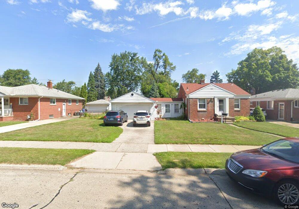
24114 Andover Dr Dearborn Heights, MI 48125
Estimated Value: $170,000 - $190,282
3
Beds
1
Bath
921
Sq Ft
$193/Sq Ft
Est. Value
About This Home
This home is located at 24114 Andover Dr, Dearborn Heights, MI 48125 and is currently estimated at $178,071, approximately $193 per square foot. 24114 Andover Dr is a home located in Wayne County with nearby schools including West Village Academy.
Ownership History
Date
Name
Owned For
Owner Type
Purchase Details
Closed on
Jan 25, 2017
Sold by
Keith Brecque Adele
Bought by
Dailey Susan Flaine
Current Estimated Value
Purchase Details
Closed on
Nov 11, 2003
Sold by
Bretz James F
Bought by
Keith Brecque
Purchase Details
Closed on
Sep 22, 1994
Sold by
Kasunic Daniel N
Bought by
Bretz James F
Home Financials for this Owner
Home Financials are based on the most recent Mortgage that was taken out on this home.
Original Mortgage
$38,500
Interest Rate
8.64%
Mortgage Type
New Conventional
Create a Home Valuation Report for This Property
The Home Valuation Report is an in-depth analysis detailing your home's value as well as a comparison with similar homes in the area
Home Values in the Area
Average Home Value in this Area
Purchase History
| Date | Buyer | Sale Price | Title Company |
|---|---|---|---|
| Dailey Susan Flaine | -- | None Available | |
| Dailey Susan Elaine | -- | None Available | |
| Keith Brecque | $119,000 | Multiple | |
| Bretz James F | $60,500 | -- |
Source: Public Records
Mortgage History
| Date | Status | Borrower | Loan Amount |
|---|---|---|---|
| Previous Owner | Bretz James F | $38,500 |
Source: Public Records
Tax History Compared to Growth
Tax History
| Year | Tax Paid | Tax Assessment Tax Assessment Total Assessment is a certain percentage of the fair market value that is determined by local assessors to be the total taxable value of land and additions on the property. | Land | Improvement |
|---|---|---|---|---|
| 2025 | $1,494 | $92,500 | $0 | $0 |
| 2024 | $1,494 | $74,500 | $0 | $0 |
| 2023 | $1,342 | $63,800 | $0 | $0 |
| 2022 | $1,824 | $54,300 | $0 | $0 |
| 2021 | $1,824 | $48,500 | $0 | $0 |
| 2019 | $1,662 | $38,400 | $0 | $0 |
| 2018 | $1,162 | $35,500 | $0 | $0 |
| 2017 | $914 | $34,700 | $0 | $0 |
| 2016 | $1,580 | $35,100 | $0 | $0 |
| 2015 | $3,260 | $32,600 | $0 | $0 |
| 2013 | $3,490 | $36,300 | $0 | $0 |
| 2010 | -- | $42,700 | $0 | $0 |
Source: Public Records
Map
Nearby Homes
- 24337 Ross St
- 24313 Carlysle St
- 3841 Westpoint St
- 24409 Stanford St
- 24426 Lehigh St
- 24716 Ross St
- 24800 Dartmouth St
- 24635 Stanford St
- 4193 Cornell St
- 24440 Penn St
- 3604 Syracuse St
- 4155 Syracuse St
- 24170 Calvin St
- 3425 Westpoint St
- 24517 Calvin St
- 3925 Madison St
- 4489 Westpoint St
- 4474 Syracuse St
- 4147 Westlake St
- 4506 Syracuse St
- 24100 Andover Dr
- 24086 Andover Dr
- 24142 Andover Dr
- VAC Andover
- 24072 Andover Dr
- 24156 Andover Dr
- 24079 Dartmouth St
- 24087 Dartmouth St
- 24071 Dartmouth St
- 24058 Andover Dr
- 24063 Dartmouth St
- 24095 Dartmouth St
- 24113 Andover Dr
- 24099 Andover Dr
- 24127 Andover Dr
- 24055 Dartmouth St
- 24103 Dartmouth St
- 24141 Andover Dr
- 24044 Andover Dr
- 24155 Andover Dr