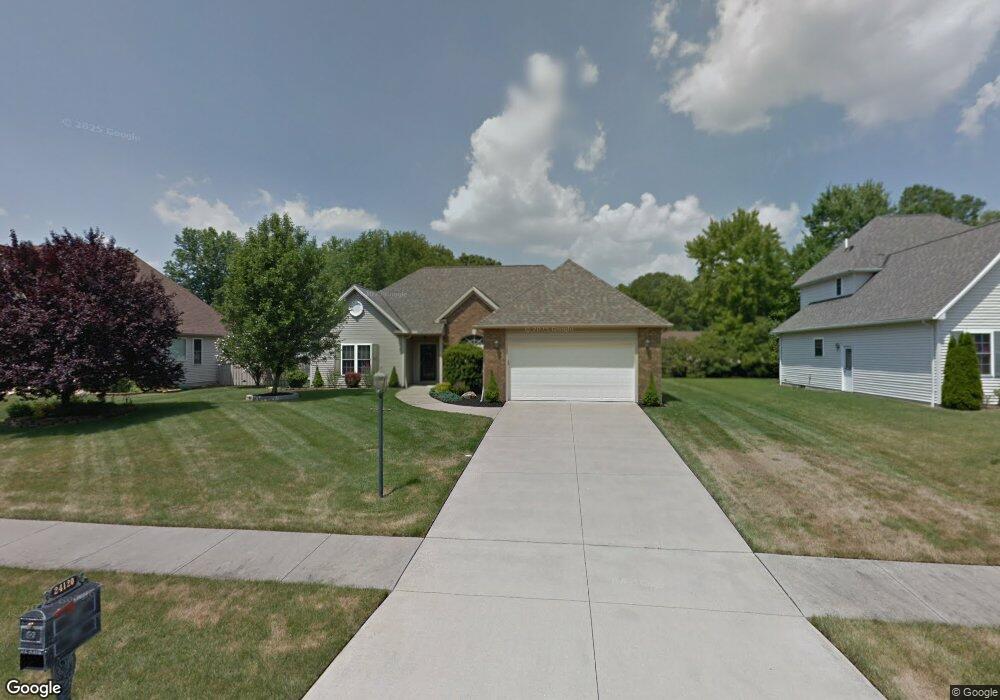
24120 Briar Patch Dr Olmsted Falls, OH 44138
Estimated Value: $296,000 - $406,000
3
Beds
3
Baths
1,735
Sq Ft
$193/Sq Ft
Est. Value
About This Home
This home is located at 24120 Briar Patch Dr, Olmsted Falls, OH 44138 and is currently estimated at $334,200, approximately $192 per square foot. 24120 Briar Patch Dr is a home located in Cuyahoga County with nearby schools including Falls-Lenox Primary Elementary School, Olmsted Falls Intermediate Building, and Olmsted Falls Middle School.
Ownership History
Date
Name
Owned For
Owner Type
Purchase Details
Closed on
Jan 25, 2023
Sold by
Anne Marie Reesing Trust and Reesing Randall L
Bought by
Randall L Reesing Trust and Reesing
Current Estimated Value
Purchase Details
Closed on
Mar 27, 2001
Sold by
Reesing Randall L and Reesing Ann M
Bought by
Reesing Randall L and Reesing Anne Marie
Purchase Details
Closed on
Feb 15, 2000
Sold by
Williams Clint and Williams Carolyn H
Bought by
Reesing Randall L and Reesing Ann M
Home Financials for this Owner
Home Financials are based on the most recent Mortgage that was taken out on this home.
Original Mortgage
$90,000
Interest Rate
8.21%
Purchase Details
Closed on
Oct 26, 1999
Sold by
Rogerson Carol
Bought by
Williams Clint and Williams Carolyn H
Create a Home Valuation Report for This Property
The Home Valuation Report is an in-depth analysis detailing your home's value as well as a comparison with similar homes in the area
Home Values in the Area
Average Home Value in this Area
Purchase History
| Date | Buyer | Sale Price | Title Company |
|---|---|---|---|
| Randall L Reesing Trust | -- | None Listed On Document | |
| Reesing Randall L | -- | -- | |
| Reesing Randall L | $207,000 | -- | |
| Williams Clint | -- | -- |
Source: Public Records
Mortgage History
| Date | Status | Borrower | Loan Amount |
|---|---|---|---|
| Previous Owner | Reesing Randall L | $90,000 |
Source: Public Records
Tax History Compared to Growth
Tax History
| Year | Tax Paid | Tax Assessment Tax Assessment Total Assessment is a certain percentage of the fair market value that is determined by local assessors to be the total taxable value of land and additions on the property. | Land | Improvement |
|---|---|---|---|---|
| 2024 | $5,194 | $89,390 | $22,820 | $66,570 |
| 2023 | $5,296 | $75,950 | $21,490 | $54,460 |
| 2022 | $5,287 | $75,950 | $21,490 | $54,460 |
| 2021 | $5,234 | $75,950 | $21,490 | $54,460 |
| 2020 | $5,228 | $68,430 | $19,360 | $49,070 |
| 2019 | $4,639 | $195,500 | $55,300 | $140,200 |
| 2018 | $4,864 | $68,430 | $19,360 | $49,070 |
| 2017 | $5,056 | $69,130 | $18,380 | $50,750 |
| 2016 | $5,032 | $69,130 | $18,380 | $50,750 |
| 2015 | $4,833 | $69,130 | $18,380 | $50,750 |
| 2014 | $4,833 | $65,210 | $17,330 | $47,880 |
Source: Public Records
Map
Nearby Homes
- 9855 Dupont Dr
- 23514 Grist Mill Ct Unit 4
- 24628 Sprague Rd
- V/L Aldridge Dr
- 23390 Wainwright Terrace
- 9797 Sugarbush Cir
- 23155 Wainwright Terrace
- 8809 Leatherleaf Dr
- 549 Wyleswood Dr
- 543 Wyleswood Dr
- 537 Wyleswood Dr
- 23002 Chandlers Ln
- 23002 Chandlers Ln Unit 342
- 23002 Chandlers Ln Unit 221
- 23003 Chandlers Ln Unit 219
- 23003 Chandlers Ln Unit 230
- 8896 Firethorne Dr
- 8960 Leatherleaf Dr
- 396 Crossbrook Dr
- 9190 Waterfall Dr
- 24150 Briar Patch Dr
- 24100 Briar Patch Dr
- 24100 Briarpatch Dr
- 24145 Lantern Dr
- 24115 Lantern Dr
- 24175 Lantern Dr
- 24180 Briar Patch Dr
- 24125 Briar Patch Dr
- 24125 Briarpatch Dr
- 24080 Briar Patch Dr
- 24151 Briar Patch Dr
- 24101 Briar Patch Dr
- 24083 Lantern Dr
- 24207 Lantern Dr
- 24175 Briar Patch Dr
- 24210 Briar Patch Dr
- 24085 Briar Patch Dr
- 24050 Briar Patch Dr
- 24144 Lantern Dr
- 24201 Briar Patch Dr