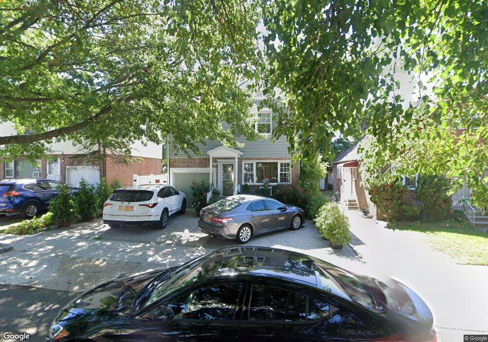
24148 132nd Rd Rosedale, NY 11422
Rosedale NeighborhoodEstimated Value: $679,358 - $733,000
3
Beds
2
Baths
1,232
Sq Ft
$580/Sq Ft
Est. Value
About This Home
This home is located at 24148 132nd Rd, Rosedale, NY 11422 and is currently estimated at $714,090, approximately $579 per square foot. 24148 132nd Rd is a home located in Queens County with nearby schools including P.S. 38 - Rosedale, Collaborative Arts Middle School, and Mona Prep.
Ownership History
Date
Name
Owned For
Owner Type
Purchase Details
Closed on
Jun 14, 2024
Sold by
Stimpson Beverly and Stimpson Trevor
Bought by
Stimpson Living Trust and Stimpson Trustee Beverly
Current Estimated Value
Purchase Details
Closed on
Jan 14, 2003
Sold by
Melbourne Ava S
Bought by
Stimpson Beverley and Stimpson Trevor
Create a Home Valuation Report for This Property
The Home Valuation Report is an in-depth analysis detailing your home's value as well as a comparison with similar homes in the area
Home Values in the Area
Average Home Value in this Area
Purchase History
| Date | Buyer | Sale Price | Title Company |
|---|---|---|---|
| Stimpson Living Trust | -- | -- | |
| Stimpson Beverley | $310,000 | -- | |
| Stimpson Beverley | $310,000 | -- |
Source: Public Records
Mortgage History
| Date | Status | Borrower | Loan Amount |
|---|---|---|---|
| Closed | Stimpson Beverley | $0 |
Source: Public Records
Tax History Compared to Growth
Tax History
| Year | Tax Paid | Tax Assessment Tax Assessment Total Assessment is a certain percentage of the fair market value that is determined by local assessors to be the total taxable value of land and additions on the property. | Land | Improvement |
|---|---|---|---|---|
| 2025 | $5,718 | $30,096 | $6,704 | $23,392 |
| 2024 | $5,730 | $29,871 | $7,683 | $22,188 |
| 2023 | $5,379 | $28,180 | $7,327 | $20,853 |
| 2022 | $5,020 | $30,240 | $8,580 | $21,660 |
| 2021 | $4,982 | $25,080 | $8,580 | $16,500 |
| 2020 | $5,356 | $26,700 | $8,580 | $18,120 |
| 2019 | $5,431 | $29,400 | $8,580 | $20,820 |
| 2018 | $4,966 | $25,821 | $8,411 | $17,410 |
| 2017 | $4,666 | $24,360 | $8,580 | $15,780 |
| 2016 | $4,428 | $24,360 | $8,580 | $15,780 |
| 2015 | $2,706 | $23,720 | $9,524 | $14,196 |
| 2014 | $2,706 | $22,800 | $9,540 | $13,260 |
Source: Public Records
Map
Nearby Homes
- 132-29 Brookville Blvd
- 131- 44 Laurelton Pkwy Unit Lower
- 131-30 Laurelton Pkwy Unit Upper
- 23432 133rd Ave Unit LOWER
- 11 Jefferson Ave
- 234-5 133rd Ave Unit Lower
- 131-31 234th St Unit 2nd Fl
- 134-33 242nd St
- 131-09 234th St Unit Lower Level
- 131-56 234th St Unit Lower
- 131-66 234th St Unit Lower
- 131-74 234th St Unit 1
- 130-21 235th St
- 211 Ash St
- 133-18 233rd St
- 233-6 131st Ave Unit 1
- 35 Harvard St
- 13515 243rd St
- 135-15 243rd St
- 13124 233rd St
- 24148 132nd Rd
- 24144 132nd Rd
- 241-52 132nd Rd
- 24152 132nd Rd
- 24140 132nd Rd
- 241-36 132nd Rd
- 24231 133rd Ave
- 24136 132nd Rd
- 24147 132nd Rd
- 242-31 133rd Ave
- 24227 133rd Ave
- 24235 133rd Ave
- 24147 132nd Rd
- 24235 133rd Ave
- 24227 133rd Ave
- 24302 132nd Rd
- 24151 132nd Rd
- 24143 132nd Rd
- 24223 133rd Ave
- 242-23 133rd Ave