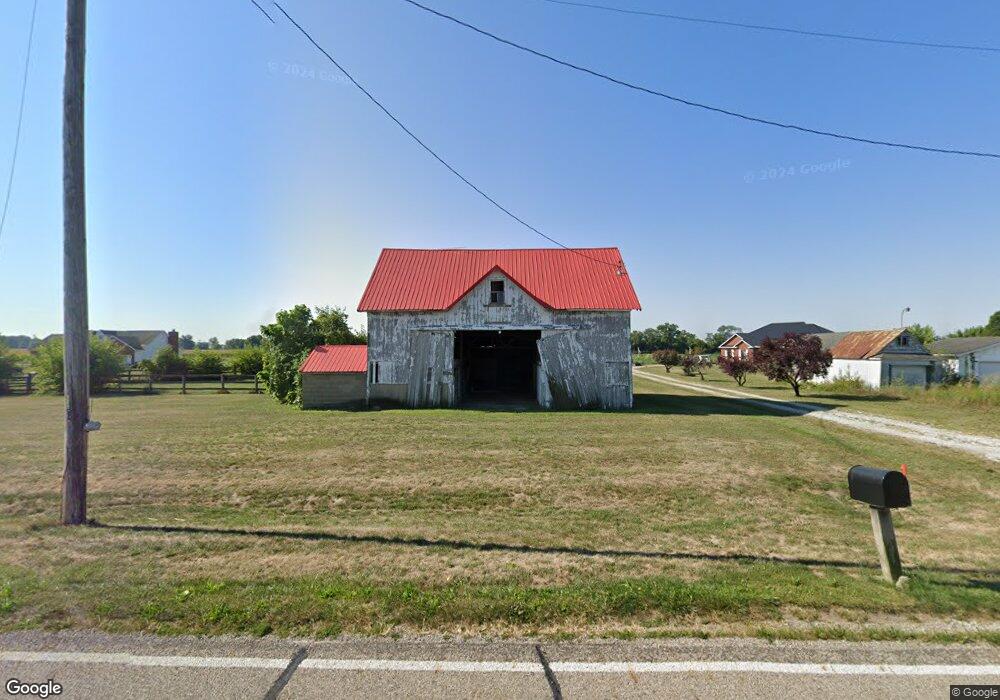
2415 Weigand Rd Lockbourne, OH 43137
Estimated Value: $459,000 - $548,000
3
Beds
2
Baths
1,952
Sq Ft
$250/Sq Ft
Est. Value
About This Home
This home is located at 2415 Weigand Rd, Lockbourne, OH 43137 and is currently estimated at $488,914, approximately $250 per square foot. 2415 Weigand Rd is a home.
Ownership History
Date
Name
Owned For
Owner Type
Purchase Details
Closed on
Apr 11, 2018
Sold by
Duty Curtis E and Duty Patsy A
Bought by
Duty Curtis E and Duty Patsy A
Current Estimated Value
Purchase Details
Closed on
Aug 21, 2007
Sold by
Havens Michael C and Havens Ellen F
Bought by
Duty Curtis E and Duty Patsy A
Purchase Details
Closed on
Dec 8, 2003
Sold by
Havens Michael C and Havens Ellen F
Bought by
Reynolds Ivan Scott and Reynolds Kelly A
Create a Home Valuation Report for This Property
The Home Valuation Report is an in-depth analysis detailing your home's value as well as a comparison with similar homes in the area
Purchase History
| Date | Buyer | Sale Price | Title Company |
|---|---|---|---|
| Duty Curtis E | -- | None Available | |
| Pence Christopher P | $130,000 | None Available | |
| Duty Curtis E | $140,000 | Clt | |
| Reynolds Ivan Scott | $45,166 | None Available |
Source: Public Records
Tax History
| Year | Tax Paid | Tax Assessment Tax Assessment Total Assessment is a certain percentage of the fair market value that is determined by local assessors to be the total taxable value of land and additions on the property. | Land | Improvement |
|---|---|---|---|---|
| 2025 | $6,417 | $129,870 | $20,210 | $109,660 |
| 2024 | $6,417 | $129,870 | $20,210 | $109,660 |
| 2023 | $4,573 | $129,870 | $20,210 | $109,660 |
| 2022 | $4,095 | $108,080 | $16,620 | $91,460 |
| 2021 | $3,876 | $108,080 | $16,620 | $91,460 |
| 2020 | $3,884 | $108,080 | $16,620 | $91,460 |
| 2019 | $0 | $92,280 | $15,820 | $76,460 |
| 2018 | $4,007 | $130,720 | $54,260 | $76,460 |
| 2017 | $4,148 | $130,720 | $54,260 | $76,460 |
| 2016 | $3,989 | $115,960 | $48,310 | $67,650 |
| 2015 | $1,996 | $115,960 | $48,310 | $67,650 |
| 2014 | $3,993 | $115,960 | $48,310 | $67,650 |
| 2013 | $3,914 | $119,860 | $43,900 | $75,960 |
Source: Public Records
Map
Nearby Homes
- 54 Cider Mill Dr
- 57 Cider Mill Dr
- 62 Cider Mill Dr
- 61 Cider Mill Dr
- 59 Cider Mill Dr
- 44 Cider Mill Dr
- 60 Cider Mill Dr
- 50 Cider Mill Dr
- 53 Cider Mill Dr
- 3 Grismill Dr
- 2713 W Old Duvall Ct
- 39 Thoreau Dr
- 2767 W Old Duvall Ct
- 11280 U S 23
- 2901 W Old Duvall Ct
- 5 Thurber Rd
- 10976 Bulen Pierce Rd
- 1 Hemingway Ave
- 2864 W Old Duvall Ct
- 5 Burroughs Dr
- 2395 Weigand Rd
- 2363 Weigand Rd
- 12465 Bulen Pierce Rd
- 0 Weigand Rd
- 0 Weigand Rd
- 2358 Weigand Rd
- 2339 Weigand Rd
- 12417 Bulen Pierce Rd
- 2325 Weigand Rd
- 2520 Weigand Rd
- 12399 Bulen Pierce Rd
- 2301 Weigand Rd
- 2542 Weigand Rd
- 2318 Weigand Rd
- 2271 Weigand Rd
- 2271 Weigand Rd Unit L 2
- 12402 Bulen Pierce Rd
- 2600 Weigand Rd
- 2245 Weigand Rd
- 2234 Weigand Rd
Your Personal Tour Guide
Ask me questions while you tour the home.