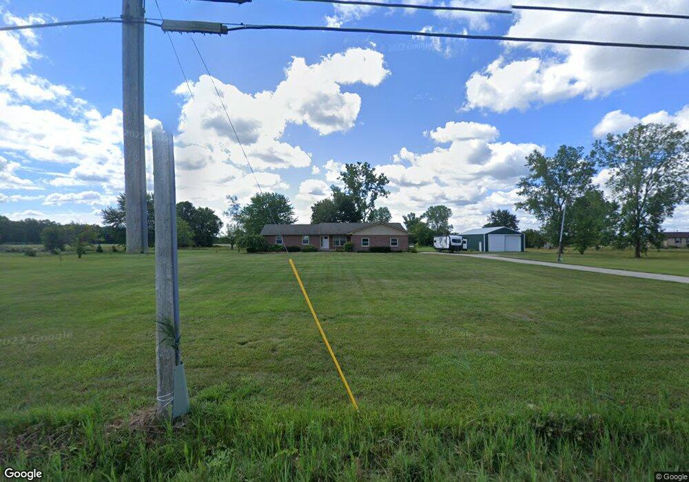
24160 Pratt Rd Armada, MI 48005
Estimated Value: $391,000 - $517,000
Studio
2
Baths
1,622
Sq Ft
$273/Sq Ft
Est. Value
About This Home
This home is located at 24160 Pratt Rd, Armada, MI 48005 and is currently estimated at $442,445, approximately $272 per square foot. 24160 Pratt Rd is a home located in Macomb County with nearby schools including Orville C. Krause Elementary School, Armada Middle School, and Armada High School.
Ownership History
Date
Name
Owned For
Owner Type
Purchase Details
Closed on
Jun 9, 2004
Sold by
Daly Nina and Daly Robert
Bought by
Schneider Frank M
Current Estimated Value
Home Financials for this Owner
Home Financials are based on the most recent Mortgage that was taken out on this home.
Original Mortgage
$235,800
Interest Rate
5.93%
Mortgage Type
Purchase Money Mortgage
Purchase Details
Closed on
Jun 4, 2004
Sold by
Daly Mildred W and Daly William S
Bought by
Schneider Frank M
Home Financials for this Owner
Home Financials are based on the most recent Mortgage that was taken out on this home.
Original Mortgage
$235,800
Interest Rate
5.93%
Mortgage Type
Purchase Money Mortgage
Create a Home Valuation Report for This Property
The Home Valuation Report is an in-depth analysis detailing your home's value as well as a comparison with similar homes in the area
Home Values in the Area
Average Home Value in this Area
Purchase History
| Date | Buyer | Sale Price | Title Company |
|---|---|---|---|
| Schneider Frank M | -- | Lawyers Title Ins | |
| Sturtevant Steven J | $262,000 | Lawyers Title Ins | |
| Schneider Frank M | -- | Lawyers Title Ins |
Source: Public Records
Mortgage History
| Date | Status | Borrower | Loan Amount |
|---|---|---|---|
| Previous Owner | Sturtevant Steven J | $235,800 |
Source: Public Records
Tax History
| Year | Tax Paid | Tax Assessment Tax Assessment Total Assessment is a certain percentage of the fair market value that is determined by local assessors to be the total taxable value of land and additions on the property. | Land | Improvement |
|---|---|---|---|---|
| 2025 | $2,582 | $193,600 | $0 | $0 |
| 2024 | $25 | $186,500 | $0 | $0 |
| 2023 | $2,380 | $161,700 | $0 | $0 |
| 2022 | $3,603 | $147,300 | $0 | $0 |
| 2021 | $3,504 | $140,900 | $0 | $0 |
| 2020 | $2,105 | $130,500 | $0 | $0 |
| 2019 | $3,095 | $124,600 | $0 | $0 |
| 2018 | $3,031 | $128,700 | $0 | $0 |
| 2017 | $2,798 | $122,100 | $41,700 | $80,400 |
| 2016 | $2,778 | $122,100 | $0 | $0 |
| 2015 | -- | $113,400 | $0 | $0 |
| 2011 | -- | $97,877 | $38,588 | $59,289 |
Source: Public Records
Map
Nearby Homes
- 23100 Pratt Rd
- 23335 McPhall Rd
- 0 Fox Ridge 1-A Unit 50200438
- 77177 Omo Rd
- 0 Irwin Unit 20251018591
- 00 Irwin Rd
- 21830 Bordman Rd
- 27780 Pratt Rd
- 14150 Hough Rd
- 26850 Irwin Rd
- 75901 North Ave
- 00 Angling Rd #6 Rd
- 23644 E Main St
- 22601 W Main St
- 408 Howell Rd
- 73615 Church St
- 73763 Coon Creek Rd
- 2.0 Acres Vacant Lan Coon Creek Rd
- 73385 Floral St
- 79446 Deland Rd
- 24320 Pratt Rd
- 24111 Pratt Rd
- 24100 Pratt Rd
- 24000 Pratt Rd
- 0 Pratt Unit 28112745
- 0 Pratt Unit 210110311
- 0 Pratt Unit 213064712
- 0 Pratt Unit 4561650
- 0 Pratt Unit 4920048
- 0 Pratt Unit 4252154
- 0 Pratt Unit 4973285
- 0 Pratt Unit 4524263
- 0 Pratt Unit 885832
- 0 Pratt Unit 886307
- 0 Pratt Unit 4698067
- 0 Pratt Unit 5504540
- 0 Pratt Unit 5574511
- 0 Pratt Unit 5581237
- 0 Pratt Unit 31024849
- 0 Pratt Unit 31154954
Your Personal Tour Guide
Ask me questions while you tour the home.