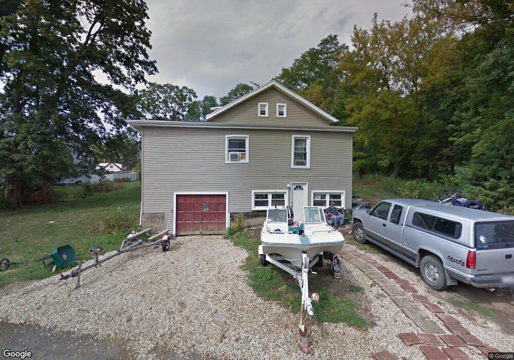
24180 N Riverside Dr Cary, IL 60013
Lyons Prairie NeighborhoodEstimated Value: $198,000 - $312,000
--
Bed
1
Bath
1,433
Sq Ft
$170/Sq Ft
Est. Value
About This Home
This home is located at 24180 N Riverside Dr, Cary, IL 60013 and is currently estimated at $244,304, approximately $170 per square foot. 24180 N Riverside Dr is a home located in Lake County with nearby schools including Deer Path Elementary School, Cary Jr High School, and Cary Grove High School.
Ownership History
Date
Name
Owned For
Owner Type
Purchase Details
Closed on
Sep 17, 2024
Sold by
Enright Patricia
Bought by
Raye Kyle M
Current Estimated Value
Home Financials for this Owner
Home Financials are based on the most recent Mortgage that was taken out on this home.
Original Mortgage
$181,649
Outstanding Balance
$179,668
Interest Rate
6.63%
Mortgage Type
FHA
Estimated Equity
$64,636
Purchase Details
Closed on
Dec 22, 1997
Sold by
Enright Patricia
Bought by
Enright Patricia and Enright Edward P
Purchase Details
Closed on
Oct 15, 1997
Sold by
Enright Patricia and Penright Freda
Bought by
Enright Patricia
Create a Home Valuation Report for This Property
The Home Valuation Report is an in-depth analysis detailing your home's value as well as a comparison with similar homes in the area
Home Values in the Area
Average Home Value in this Area
Purchase History
| Date | Buyer | Sale Price | Title Company |
|---|---|---|---|
| Raye Kyle M | $185,000 | Chicago Title | |
| Enright Patricia | -- | -- | |
| Enright Patricia | -- | -- |
Source: Public Records
Mortgage History
| Date | Status | Borrower | Loan Amount |
|---|---|---|---|
| Open | Raye Kyle M | $181,649 |
Source: Public Records
Tax History Compared to Growth
Tax History
| Year | Tax Paid | Tax Assessment Tax Assessment Total Assessment is a certain percentage of the fair market value that is determined by local assessors to be the total taxable value of land and additions on the property. | Land | Improvement |
|---|---|---|---|---|
| 2024 | $2,082 | $44,048 | $14,235 | $29,813 |
| 2023 | $1,880 | $41,752 | $13,493 | $28,259 |
| 2022 | $1,880 | $34,103 | $15,265 | $18,838 |
| 2021 | $1,877 | $33,523 | $15,005 | $18,518 |
| 2020 | $917 | $33,420 | $14,959 | $18,461 |
| 2019 | $937 | $32,538 | $14,564 | $17,974 |
| 2018 | $974 | $24,820 | $21,176 | $3,644 |
| 2017 | $1,000 | $24,322 | $20,751 | $3,571 |
| 2016 | $1,041 | $23,404 | $19,968 | $3,436 |
| 2015 | $1,112 | $21,951 | $18,728 | $3,223 |
| 2014 | $1,521 | $25,941 | $22,192 | $3,749 |
| 2012 | $1,881 | $26,387 | $22,574 | $3,813 |
Source: Public Records
Map
Nearby Homes
- 28740 W Bloners Dr
- 24211 N Riverside Dr
- 28876 W Pioneer Grove Rd
- 28413 W Harvest Glen Cir
- 24744 N Golden Oat Cir
- Lot 7 Hickory Nut Grove Rd
- 23490 N Spring Dr
- Lot 1 N Owl Ct
- 23433 N Summit Dr
- 0000 Newbold Rd
- 28629 W Ravine Dr
- 28442 W Main St
- 911 Johnson St
- 902 Spring Beach Way
- 71 Flint Dr
- 23277 Enclave Ln
- 9209 Jasmine Way
- 1034 Heather Ct
- 806 Norge Pkwy
- 26495 Southgate Trail
- 24166 N Riverside Dr
- 24165 N Riverside Dr
- 24191 N Riverside Dr
- 24219 N Riverside Dr
- 24150 N Riverside Dr
- 28695 W Pittner Ave
- 24175 N Riverside Dr
- 24157 N Riverside Dr
- 28688 W Bloners Dr
- 24179 N Riverside Dr
- 24151 N Riverside Dr
- 28716 W Bloners Dr
- 28721 W Pittner Ave
- 28718 W Bloners Dr
- 28679 W Rivers Edge Dr
- 28737 W Pittner Ave
- 28741 W Pittner Ave
- 28770 W Pittner Ave
- 28757 W Pittner Ave
- 28683 W Rivers Edge Dr