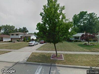
24189 Palm Dr North Olmsted, OH 44070
Estimated Value: $258,307 - $268,000
3
Beds
2
Baths
1,488
Sq Ft
$176/Sq Ft
Est. Value
About This Home
This home is located at 24189 Palm Dr, North Olmsted, OH 44070 and is currently estimated at $261,577, approximately $175 per square foot. 24189 Palm Dr is a home located in Cuyahoga County with nearby schools including Maple Intermediate Elementary School, Pine Intermediate School, and North Olmsted Middle School.
Ownership History
Date
Name
Owned For
Owner Type
Purchase Details
Closed on
Apr 23, 2004
Sold by
Crowley Robert M and Crowley Patricia F
Bought by
Beno Daniel M
Current Estimated Value
Home Financials for this Owner
Home Financials are based on the most recent Mortgage that was taken out on this home.
Original Mortgage
$120,000
Outstanding Balance
$60,231
Interest Rate
5.46%
Mortgage Type
Purchase Money Mortgage
Estimated Equity
$192,254
Purchase Details
Closed on
May 4, 2003
Sold by
Beno Daniel M
Bought by
Beno Daniel M and Beno Daniel
Purchase Details
Closed on
Jul 18, 1997
Sold by
Garland Matthew A
Bought by
Crowley Robert M and Crowley Patricia T
Home Financials for this Owner
Home Financials are based on the most recent Mortgage that was taken out on this home.
Original Mortgage
$58,500
Interest Rate
7.94%
Mortgage Type
New Conventional
Purchase Details
Closed on
Jun 27, 1997
Sold by
Dimitri Kathryn A
Bought by
Garland Matthew A
Home Financials for this Owner
Home Financials are based on the most recent Mortgage that was taken out on this home.
Original Mortgage
$58,500
Interest Rate
7.94%
Mortgage Type
New Conventional
Purchase Details
Closed on
May 6, 1991
Sold by
Dimitri Chris
Bought by
Dimitri Kathryn A
Purchase Details
Closed on
Oct 12, 1990
Sold by
Theiss Norbert L
Bought by
Dimitri Chris
Purchase Details
Closed on
Jan 1, 1975
Bought by
Theiss Norbert L and Theiss Mary E
Create a Home Valuation Report for This Property
The Home Valuation Report is an in-depth analysis detailing your home's value as well as a comparison with similar homes in the area
Home Values in the Area
Average Home Value in this Area
Purchase History
| Date | Buyer | Sale Price | Title Company |
|---|---|---|---|
| Beno Daniel M | $150,000 | Real Living Title Agency Ltd | |
| Crowley Robert M | $118,500 | -- | |
| Garland Matthew A | $100,000 | -- | |
| Dimitri Kathryn A | -- | -- | |
| Dimitri Chris | $89,000 | -- | |
| Theiss Norbert L | -- | -- | |
| Theiss Norbert L3 | -- | -- | |
| Theiss Norbert L | -- | -- |
Source: Public Records
Mortgage History
| Date | Status | Borrower | Loan Amount |
|---|---|---|---|
| Open | Beno Daniel M | $72,630 | |
| Open | Beno Daniel M | $120,000 | |
| Previous Owner | Crowley Robert M | $50,000 | |
| Previous Owner | Crowley Robert M | $58,500 | |
| Previous Owner | Garland Matthew A | $75,000 |
Source: Public Records
Tax History Compared to Growth
Tax History
| Year | Tax Paid | Tax Assessment Tax Assessment Total Assessment is a certain percentage of the fair market value that is determined by local assessors to be the total taxable value of land and additions on the property. | Land | Improvement |
|---|---|---|---|---|
| 2024 | $5,738 | $83,720 | $12,775 | $70,945 |
| 2023 | $5,046 | $61,780 | $11,830 | $49,950 |
| 2022 | $5,019 | $61,775 | $11,830 | $49,945 |
| 2021 | $4,542 | $61,780 | $11,830 | $49,950 |
| 2020 | $4,170 | $50,230 | $9,630 | $40,600 |
| 2019 | $4,057 | $143,500 | $27,500 | $116,000 |
| 2018 | $3,988 | $50,230 | $9,630 | $40,600 |
| 2017 | $3,926 | $44,110 | $7,390 | $36,720 |
| 2016 | $3,891 | $44,110 | $7,390 | $36,720 |
| 2015 | $3,836 | $44,110 | $7,390 | $36,720 |
| 2014 | $3,836 | $43,230 | $7,250 | $35,980 |
Source: Public Records
Map
Nearby Homes
- 23810 Oak Ln
- 4849 Grace Rd Unit 111
- 24232 Moonlight Dr
- 24930 Mitchell Dr
- 4980 Greenflower St
- 4429 Michael Ave
- 23855 David Dr Unit 115
- 23855 David Dr Unit 105
- 23865 David Dr Unit 204
- 23845 David Dr Unit 104
- 0 Mastick Rd Unit 5112571
- 3920 Brendan Ln Unit H612
- 24326 Mastick Rd
- 24341 Gessner Rd
- 4120 Clague Rd
- 24065 Fairlawn Dr
- 24868 Gessner Rd
- 24836 Kennedy Ridge Rd
- 22865 Haber Dr
- 24861 Antler Dr