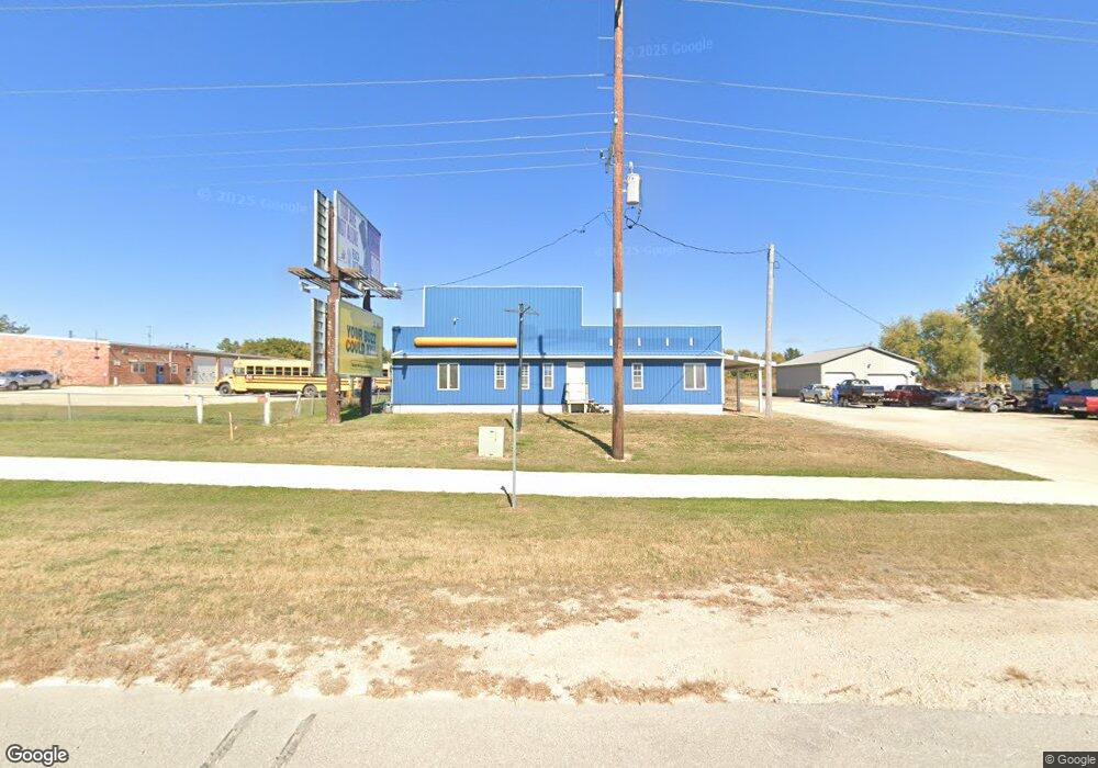
24191 Highway 9 Cresco, IA 52136
Estimated Value: $146,198
--
Bed
--
Bath
7,380
Sq Ft
$20/Sq Ft
Est. Value
About This Home
This home is located at 24191 Highway 9, Cresco, IA 52136 and is currently estimated at $146,198, approximately $19 per square foot. 24191 Highway 9 is a home located in Howard County with nearby schools including Crestwood High School and Notre Dame Catholic School.
Ownership History
Date
Name
Owned For
Owner Type
Purchase Details
Closed on
Nov 20, 2024
Sold by
Peter James H
Bought by
Mlady Marinus G and Mlady Susan
Current Estimated Value
Purchase Details
Closed on
Oct 20, 2004
Sold by
Fortrees Bank Of Cresco
Bought by
Peter James H
Home Financials for this Owner
Home Financials are based on the most recent Mortgage that was taken out on this home.
Original Mortgage
$35,150
Interest Rate
6.45%
Mortgage Type
New Conventional
Create a Home Valuation Report for This Property
The Home Valuation Report is an in-depth analysis detailing your home's value as well as a comparison with similar homes in the area
Home Values in the Area
Average Home Value in this Area
Purchase History
| Date | Buyer | Sale Price | Title Company |
|---|---|---|---|
| Mlady Marinus G | $140,500 | None Listed On Document | |
| Mlady Marinus G | $140,500 | None Listed On Document | |
| Peter James H | $55,000 | None Available |
Source: Public Records
Mortgage History
| Date | Status | Borrower | Loan Amount |
|---|---|---|---|
| Previous Owner | Peter James H | $35,150 |
Source: Public Records
Tax History Compared to Growth
Tax History
| Year | Tax Paid | Tax Assessment Tax Assessment Total Assessment is a certain percentage of the fair market value that is determined by local assessors to be the total taxable value of land and additions on the property. | Land | Improvement |
|---|---|---|---|---|
| 2024 | $1,780 | $144,510 | $36,950 | $107,560 |
| 2023 | $1,312 | $144,510 | $36,950 | $107,560 |
| 2022 | $1,240 | $90,230 | $31,850 | $58,380 |
| 2021 | $1,278 | $90,230 | $31,850 | $58,380 |
| 2020 | $1,260 | $88,030 | $31,850 | $56,180 |
| 2019 | $1,274 | $86,830 | $0 | $0 |
| 2018 | $1,236 | $86,830 | $0 | $0 |
| 2017 | $1,028 | $69,710 | $0 | $0 |
| 2016 | $1,014 | $69,710 | $0 | $0 |
| 2015 | $1,014 | $69,710 | $0 | $0 |
| 2014 | $1,094 | $69,710 | $0 | $0 |
Source: Public Records
Map
Nearby Homes
- 530 4th Ave E
- 511 3rd Ave E
- 737 6th St E Unit Nelson
- 120 5th Ave E
- 113 5th Ave E
- 111 4th Ave SW
- 106 6th Ave W
- 511 2nd St W
- 732 N Elm St
- 205 6th Ave W
- 303 3rd St SW Unit Farley
- 729 2nd St SW
- 309 Vernon Rd
- 1014 Division St
- 306 5th Ave W Unit Condo
- 418 2nd Ave W
- 211 Royal Oaks Dr
- 6549 Willow Ave
- 0 50th St
- Tbd
- 24191 Iowa 9
- 24203 Highway 9
- 24203 Iowa 9
- 24233 Highway 9
- 24283 Highway 9
- 24096 Highway 9
- 24325 Highway 9
- 24325 Highway 9
- 1031 2nd Ave SE
- 1021 2nd Ave SE
- 1020 2nd Ave SE
- 1013 2nd Ave SE
- 1003 2nd Ave SE
- 462 York St
- 927 2nd Ave SE
- 478 York St
- 492 York St
- 1115 Cambridge St
- 3-1114 Canterbury St Unit 3
- 24542 Highway 9