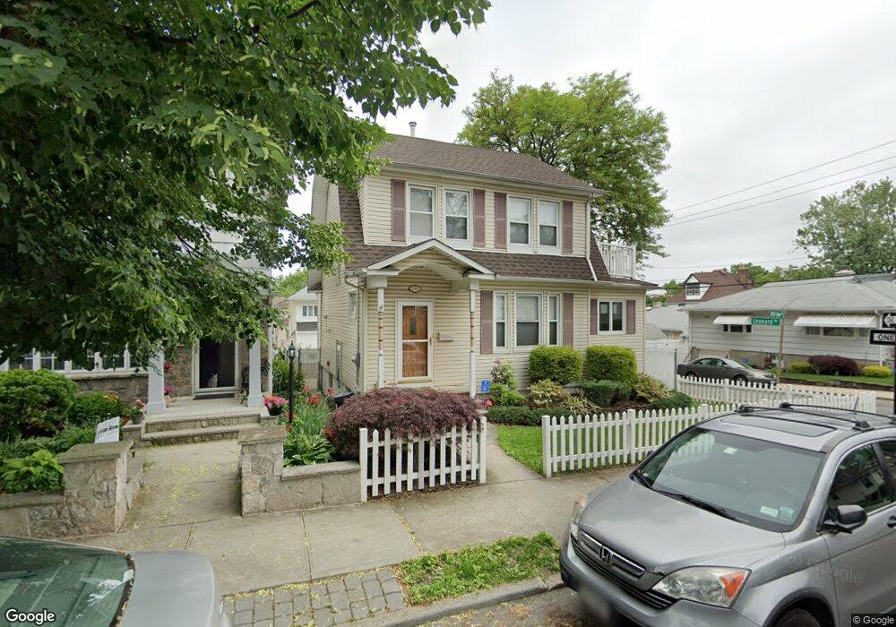
242 Neal Dow Ave Staten Island, NY 10314
Westerleigh NeighborhoodEstimated Value: $664,000 - $805,000
3
Beds
2
Baths
1,188
Sq Ft
$611/Sq Ft
Est. Value
About This Home
This home is located at 242 Neal Dow Ave, Staten Island, NY 10314 and is currently estimated at $726,149, approximately $611 per square foot. 242 Neal Dow Ave is a home located in Richmond County with nearby schools including P.S. 30 Westerleigh, I.S. 51 Edwin Markham, and Port Richmond High School.
Ownership History
Date
Name
Owned For
Owner Type
Purchase Details
Closed on
Jan 5, 2010
Sold by
Simone Michael and Simone Tonia
Bought by
Rooney Patrick J and Rooney Maryellen
Current Estimated Value
Home Financials for this Owner
Home Financials are based on the most recent Mortgage that was taken out on this home.
Original Mortgage
$417,000
Outstanding Balance
$270,431
Interest Rate
4.71%
Mortgage Type
New Conventional
Estimated Equity
$455,718
Purchase Details
Closed on
Dec 28, 2000
Sold by
The Estate Of Clement Loffredo
Bought by
Simone Michael and Simone Tonia
Home Financials for this Owner
Home Financials are based on the most recent Mortgage that was taken out on this home.
Original Mortgage
$159,000
Interest Rate
7.08%
Create a Home Valuation Report for This Property
The Home Valuation Report is an in-depth analysis detailing your home's value as well as a comparison with similar homes in the area
Home Values in the Area
Average Home Value in this Area
Purchase History
| Date | Buyer | Sale Price | Title Company |
|---|---|---|---|
| Rooney Patrick J | $476,500 | None Available | |
| Simone Michael | $199,000 | -- |
Source: Public Records
Mortgage History
| Date | Status | Borrower | Loan Amount |
|---|---|---|---|
| Open | Rooney Patrick J | $417,000 | |
| Previous Owner | Simone Michael | $159,000 |
Source: Public Records
Tax History Compared to Growth
Tax History
| Year | Tax Paid | Tax Assessment Tax Assessment Total Assessment is a certain percentage of the fair market value that is determined by local assessors to be the total taxable value of land and additions on the property. | Land | Improvement |
|---|---|---|---|---|
| 2025 | $6,457 | $40,800 | $12,864 | $27,936 |
| 2024 | $6,738 | $41,580 | $11,908 | $29,672 |
| 2023 | $6,143 | $31,649 | $10,578 | $21,071 |
| 2022 | $6,031 | $37,080 | $14,760 | $22,320 |
| 2021 | $6,307 | $36,240 | $14,760 | $21,480 |
| 2020 | $5,976 | $33,120 | $14,760 | $18,360 |
| 2019 | $5,555 | $33,660 | $14,760 | $18,900 |
| 2018 | $5,079 | $26,374 | $14,514 | $11,860 |
| 2017 | $5,077 | $26,374 | $12,672 | $13,702 |
| 2016 | $4,923 | $26,174 | $12,478 | $13,696 |
| 2015 | $4,166 | $24,693 | $14,259 | $10,434 |
| 2014 | $4,166 | $23,296 | $14,046 | $9,250 |
Source: Public Records
Map
Nearby Homes
- 204 Demorest Ave
- 249 Dickie Ave
- 251 Saint John Ave
- 0 Willard Ave
- 284 Bidwell Ave
- 279 Saint John Ave
- 282 Willard Ave
- 116 Bidwell Ave
- 202 Watchogue Rd
- 127 Glascoe Ave
- 307 Clinton B Fiske Ave
- 307 Fiske Ave
- 290 Woolley Ave
- 262 Maine Ave
- 292 Woolley Ave
- 14 Leonard Ave
- 63 Avon Ln
- 751 Jewett Ave Unit 17
- 751 Jewett Ave
- 75 Muller Ave
- 244 Neal Dow Ave
- 243 Demorest Ave
- 246 Neal Dow Ave
- 226 Neal Dow Ave
- 247 Demorest Ave
- 251 Demorest Ave
- 151 Leonard Ave
- 243 Neal Dow Ave
- 250 Neal Dow Ave
- 222 Neal Dow Ave
- 247 Neal Dow Ave
- 225 Neal Dow Ave
- 253 Demorest Ave
- 221 Demorest Ave
- 218 Neal Dow Ave
- 256 Neal Dow Ave
- 221 Neal Dow Ave
- 251 Neal Dow Ave
- 257 Demorest Ave
- 217 Demorest Ave