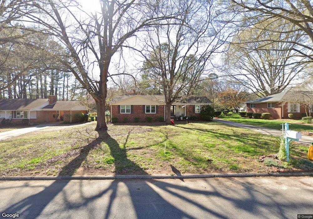
242 S Mccoy Rd Salisbury, NC 28144
Estimated Value: $233,000 - $272,000
3
Beds
2
Baths
1,563
Sq Ft
$161/Sq Ft
Est. Value
About This Home
This home is located at 242 S Mccoy Rd, Salisbury, NC 28144 and is currently estimated at $251,392, approximately $160 per square foot. 242 S Mccoy Rd is a home located in Rowan County with nearby schools including H D Isenberg Elementary, Knox Middle School, and North Rowan Middle School.
Ownership History
Date
Name
Owned For
Owner Type
Purchase Details
Closed on
May 27, 2010
Sold by
Branch Banking & Trust Company
Bought by
Ryerson Christie L
Current Estimated Value
Home Financials for this Owner
Home Financials are based on the most recent Mortgage that was taken out on this home.
Original Mortgage
$93,737
Outstanding Balance
$64,433
Interest Rate
5.5%
Mortgage Type
FHA
Estimated Equity
$186,959
Purchase Details
Closed on
Sep 29, 2009
Sold by
Riley Reuben Jacob and Riley Kerri L
Bought by
Branch Banking & Trust Company
Purchase Details
Closed on
Dec 29, 2006
Sold by
Allen Cornelia L
Bought by
Riley Reuben Jacob
Home Financials for this Owner
Home Financials are based on the most recent Mortgage that was taken out on this home.
Original Mortgage
$55,000
Interest Rate
6.06%
Mortgage Type
New Conventional
Create a Home Valuation Report for This Property
The Home Valuation Report is an in-depth analysis detailing your home's value as well as a comparison with similar homes in the area
Home Values in the Area
Average Home Value in this Area
Purchase History
| Date | Buyer | Sale Price | Title Company |
|---|---|---|---|
| Ryerson Christie L | $95,000 | None Available | |
| Branch Banking & Trust Company | $93,500 | None Available | |
| Riley Reuben Jacob | -- | None Available |
Source: Public Records
Mortgage History
| Date | Status | Borrower | Loan Amount |
|---|---|---|---|
| Open | Ryerson Christie L | $93,737 | |
| Previous Owner | Riley Reuben Jacob | $55,000 |
Source: Public Records
Tax History Compared to Growth
Tax History
| Year | Tax Paid | Tax Assessment Tax Assessment Total Assessment is a certain percentage of the fair market value that is determined by local assessors to be the total taxable value of land and additions on the property. | Land | Improvement |
|---|---|---|---|---|
| 2025 | $2,125 | $177,685 | $22,425 | $155,260 |
| 2024 | $2,125 | $177,685 | $22,425 | $155,260 |
| 2023 | $2,125 | $177,685 | $22,425 | $155,260 |
| 2022 | $1,705 | $123,807 | $20,631 | $103,176 |
| 2021 | $1,705 | $123,807 | $20,631 | $103,176 |
| 2020 | $1,705 | $123,807 | $20,631 | $103,176 |
| 2019 | $1,705 | $123,807 | $20,631 | $103,176 |
| 2018 | $1,447 | $106,462 | $20,631 | $85,831 |
| 2017 | $1,439 | $106,462 | $20,631 | $85,831 |
| 2016 | $1,399 | $106,462 | $20,631 | $85,831 |
| 2015 | $1,408 | $106,462 | $20,631 | $85,831 |
| 2014 | $1,433 | $109,617 | $20,631 | $88,986 |
Source: Public Records
Map
Nearby Homes
- 1521 W Colonial Dr
- 1638 W Colonial Dr
- 1300 Larchmont Place Unit 208
- 1300 Larchmont Place Unit 107
- 1300 Larchmont Place
- 1300 Larchmont Place Unit 210
- 1441 Statesville Blvd
- 103 Spring Dr
- 1317 Arden Dr
- 1612 Statesville Blvd
- 1218 Forestdale Dr
- 207 N Milford Dr
- 636 Statesville Blvd
- 1931 Calvin Ave
- BEAUMONT Plan at Milford Terrace
- 306 N Milford Dr
- 305 N Milford Dr
- 523 Riviera Dr
- 519 Riviera Dr
- 515 Riviera Dr
- 246 S Mccoy Rd
- 244 S Mccoy Rd
- 238 S Mccoy Rd
- 248 S Mccoy Rd
- 263 S Milford Dr
- 241 S Mccoy Rd
- 259 S Milford Dr
- 1527 W Colonial Dr
- 265 S Milford Dr
- 267 S Milford Dr
- 253 S Milford Dr
- 245 S Mccoy Rd
- 237 S Mccoy Rd
- 252 S Mccoy Rd
- 1533 W Colonial Dr
- 247 S Mccoy Rd
- 233 S Mccoy Rd
- 232 S Mccoy Rd
- 235 S Milford Dr
- 1541 W Colonial Dr