Estimated Value: $340,000 - $455,000
--
Bed
--
Bath
2,464
Sq Ft
$169/Sq Ft
Est. Value
About This Home
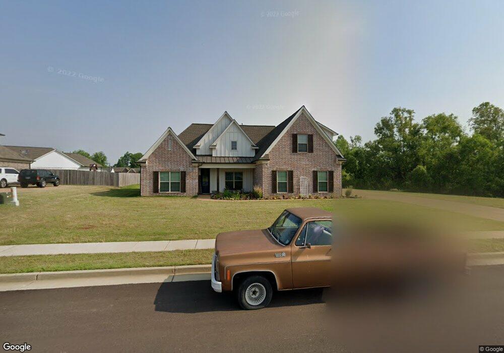
This home is located at 242 Walker Pkwy E, Atoka, TN 38004 and is currently estimated at $416,806, approximately $169 per square foot. 242 Walker Pkwy E is a home with nearby schools including Atoka Elementary School, Brighton Middle School, and Brighton High School.
Ownership History
Date
Name
Owned For
Owner Type
Purchase Details
Closed on
Aug 31, 2018
Sold by
W & W Homwbuilders Inc
Bought by
Harvell James M and Harvell Sonia M
Current Estimated Value
Home Financials for this Owner
Home Financials are based on the most recent Mortgage that was taken out on this home.
Original Mortgage
$211,000
Outstanding Balance
$124,417
Interest Rate
4.6%
Mortgage Type
New Conventional
Estimated Equity
$292,389
Purchase Details
Closed on
Jun 6, 2017
Sold by
Munford Development Co
Bought by
W & W Homwbuilders Inc
Purchase Details
Closed on
Apr 23, 2004
Bought by
Munford Development Co
Create a Home Valuation Report for This Property
The Home Valuation Report is an in-depth analysis detailing your home's value as well as a comparison with similar homes in the area
Home Values in the Area
Average Home Value in this Area
Purchase History
| Date | Buyer | Sale Price | Title Company |
|---|---|---|---|
| Harvell James M | $271,000 | -- | |
| W & W Homwbuilders Inc | $1,596,000 | -- | |
| Munford Development Co | $190,000 | -- |
Source: Public Records
Mortgage History
| Date | Status | Borrower | Loan Amount |
|---|---|---|---|
| Open | Harvell James M | $211,000 |
Source: Public Records
Tax History Compared to Growth
Tax History
| Year | Tax Paid | Tax Assessment Tax Assessment Total Assessment is a certain percentage of the fair market value that is determined by local assessors to be the total taxable value of land and additions on the property. | Land | Improvement |
|---|---|---|---|---|
| 2024 | $2,405 | $111,875 | $14,375 | $97,500 |
| 2023 | $2,405 | $111,875 | $14,375 | $97,500 |
| 2022 | $2,405 | $78,325 | $10,575 | $67,750 |
| 2021 | $2,366 | $78,325 | $10,575 | $67,750 |
| 2020 | $2,363 | $78,325 | $10,575 | $67,750 |
| 2019 | $2,071 | $57,675 | $8,125 | $49,550 |
| 2018 | $2,071 | $57,675 | $8,125 | $49,550 |
| 2017 | $262 | $8,125 | $8,125 | $0 |
Source: Public Records
Map
Nearby Homes
- 189 Cotton Fall Dr
- 78 Doe Trail
- 93 Sterling Farm Dr
- 61 Como Ln
- 284 Merino Dr
- 170 Como Ln
- 371 Beverly Dr
- 125 Columbia Way
- 29 Merino Dr
- 236 Como Ln
- 102 Trinity Cove
- 35 Drysdale Cove
- 33 Ward Ln
- 50 Drysdale Cove
- 60 Drysdale Cove
- 425 Eureka Trail
- 336 Sterling Ridge Dr
- 210 Duncan Dr
- 0 Smith Dr Unit 10202728
- 00 Atoka Idaville Rd
- 214 Walker Pkwy E
- 34 Deer Skin Cove
- 205 Walker Pkwy
- 498 Sterling Farm Dr
- 182 Walker Pkwy E
- 44 Deer Skin Cove
- 185 Walker Pkwy E
- 74 Deer Ridge Cove
- 31 Hays Run
- 474 Sterling Farm Dr
- 54 Deer Ridge Cove
- 18 Deer Crossing Cove
- 40 Deer Crossing Cove
- 26 Deer Ridge Cove
- 112 Deer Ridge Cove
- 454 Sterling Farm Dr
- 56 Deer Crossing Cove
- 67 Hays Run
- 87 Deer Ridge Cove
- 18 Hays Run