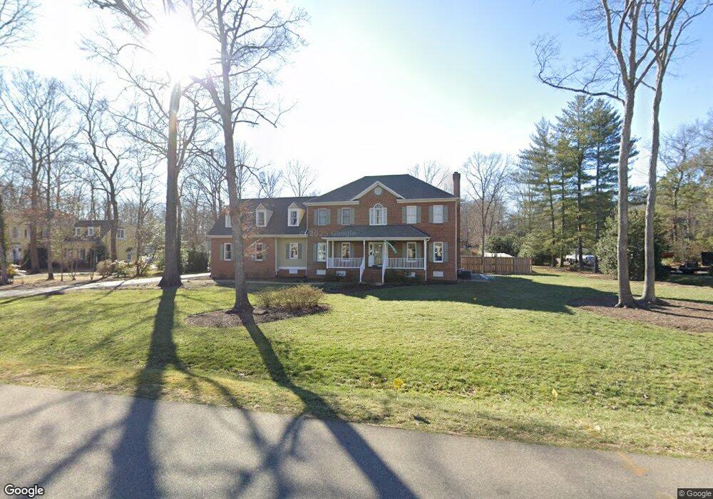
2420 Chartstone Dr Midlothian, VA 23113
Roxshire NeighborhoodEstimated Value: $837,932 - $888,000
5
Beds
4
Baths
3,880
Sq Ft
$220/Sq Ft
Est. Value
About This Home
This home is located at 2420 Chartstone Dr, Midlothian, VA 23113 and is currently estimated at $852,233, approximately $219 per square foot. 2420 Chartstone Dr is a home located in Chesterfield County with nearby schools including Robious Elementary School, Robious Middle School, and James River High School.
Ownership History
Date
Name
Owned For
Owner Type
Purchase Details
Closed on
Dec 13, 2000
Bought by
Taylor John G
Current Estimated Value
Home Financials for this Owner
Home Financials are based on the most recent Mortgage that was taken out on this home.
Original Mortgage
$100,225
Outstanding Balance
$36,934
Interest Rate
7.7%
Mortgage Type
New Conventional
Estimated Equity
$815,299
Purchase Details
Closed on
Oct 12, 2000
Sold by
Taylor John G
Bought by
Kemp Brian and Kemp Gail K
Purchase Details
Closed on
Nov 9, 1999
Sold by
Taylor John G
Bought by
Taylor John G
Create a Home Valuation Report for This Property
The Home Valuation Report is an in-depth analysis detailing your home's value as well as a comparison with similar homes in the area
Home Values in the Area
Average Home Value in this Area
Purchase History
| Date | Buyer | Sale Price | Title Company |
|---|---|---|---|
| Taylor John G | -- | -- | |
| Kemp Brian | $317,000 | -- | |
| Taylor John G | -- | -- |
Source: Public Records
Mortgage History
| Date | Status | Borrower | Loan Amount |
|---|---|---|---|
| Open | Taylor John G | $100,225 |
Source: Public Records
Tax History
| Year | Tax Paid | Tax Assessment Tax Assessment Total Assessment is a certain percentage of the fair market value that is determined by local assessors to be the total taxable value of land and additions on the property. | Land | Improvement |
|---|---|---|---|---|
| 2025 | $6,979 | $781,300 | $146,000 | $635,300 |
| 2024 | $6,979 | $743,300 | $136,000 | $607,300 |
| 2023 | $5,799 | $637,300 | $126,000 | $511,300 |
| 2022 | $5,497 | $597,500 | $116,000 | $481,500 |
| 2021 | $5,166 | $539,000 | $105,000 | $434,000 |
| 2020 | $4,980 | $517,400 | $105,000 | $412,400 |
| 2019 | $4,887 | $514,400 | $102,000 | $412,400 |
| 2018 | $4,768 | $495,000 | $100,000 | $395,000 |
| 2017 | $4,783 | $493,000 | $98,000 | $395,000 |
| 2016 | $4,713 | $490,900 | $98,000 | $392,900 |
| 2015 | $4,661 | $482,900 | $90,000 | $392,900 |
| 2014 | $4,490 | $465,100 | $83,000 | $382,100 |
Source: Public Records
Map
Nearby Homes
- 2101 Normandstone Dr
- 12901 River Hills Dr
- 2940 River Hills Ln
- 13111 Powderham Ln
- 2303 Bream Dr
- 12111 Framar Dr
- 1860 Glamorgan Ln
- 12212 Deerhurst Dr
- 12505 Mandolin Dr
- 2540 Kentford Rd
- 12213 Capwell Dr
- 13155 Sodbury Dr
- 3107 Handley Rd
- 11911 Kilrenny Rd
- 13637 Langford Dr
- 11803 N Briar Patch Dr
- 11823 N Briar Patch Dr
- 3030 Mount Hill Dr
- 11611 E Briar Patch Dr
- 12813 Yatesbury Ln
- 2400 Chartstone Dr
- 2500 Chartstone Dr
- 12921 Framar Dr
- 2411 Chartstone Dr
- 2421 Chartstone Dr
- 2551 Salisbury Rd
- 2601 Salisbury Rd
- 12804 Trenadier Cir
- 2340 Chartstone Dr
- 12850 Framar Dr
- 12841 Framar Dr
- 2510 Chartstone Dr
- 12802 Trenadier Cir
- 2545 Salisbury Rd
- 2615 Salisbury Rd
- 12805 Trenadier Cir
- 2511 Chartstone Dr
- 12831 Framar Dr
- 2330 Chartstone Dr
- 12840 Framar Dr
Your Personal Tour Guide
Ask me questions while you tour the home.