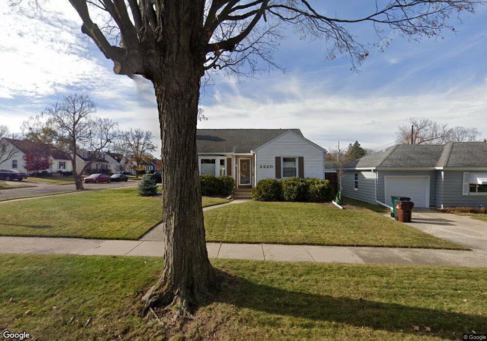
2420 Devonshire Ave Lansing, MI 48910
Clifford Park NeighborhoodEstimated Value: $169,000 - $248,000
3
Beds
2
Baths
1,277
Sq Ft
$152/Sq Ft
Est. Value
About This Home
This home is located at 2420 Devonshire Ave, Lansing, MI 48910 and is currently estimated at $194,045, approximately $151 per square foot. 2420 Devonshire Ave is a home located in Ingham County with nearby schools including Lyons Elementary School, Pattengill Academy, and Eastern High School.
Ownership History
Date
Name
Owned For
Owner Type
Purchase Details
Closed on
Aug 5, 2008
Sold by
Orr Jakubiak Mary and Orr Mary
Bought by
Peaney James B and Peaney Karen L
Current Estimated Value
Home Financials for this Owner
Home Financials are based on the most recent Mortgage that was taken out on this home.
Original Mortgage
$125,775
Outstanding Balance
$82,792
Interest Rate
6.39%
Mortgage Type
FHA
Estimated Equity
$111,253
Create a Home Valuation Report for This Property
The Home Valuation Report is an in-depth analysis detailing your home's value as well as a comparison with similar homes in the area
Home Values in the Area
Average Home Value in this Area
Purchase History
| Date | Buyer | Sale Price | Title Company |
|---|---|---|---|
| Peaney James B | $127,750 | Tri County Title Agency Llc |
Source: Public Records
Mortgage History
| Date | Status | Borrower | Loan Amount |
|---|---|---|---|
| Open | Peaney James B | $125,775 |
Source: Public Records
Tax History
| Year | Tax Paid | Tax Assessment Tax Assessment Total Assessment is a certain percentage of the fair market value that is determined by local assessors to be the total taxable value of land and additions on the property. | Land | Improvement |
|---|---|---|---|---|
| 2025 | $3,804 | $94,200 | $11,500 | $82,700 |
| 2024 | $30 | $86,100 | $11,500 | $74,600 |
| 2023 | $3,565 | $76,400 | $11,500 | $64,900 |
| 2022 | $3,212 | $66,600 | $11,700 | $54,900 |
| 2021 | $3,145 | $62,400 | $9,300 | $53,100 |
| 2020 | $3,126 | $60,800 | $9,300 | $51,500 |
| 2019 | $2,998 | $56,600 | $9,300 | $47,300 |
| 2018 | $2,808 | $52,700 | $9,300 | $43,400 |
| 2017 | $2,689 | $52,700 | $9,300 | $43,400 |
| 2016 | $2,571 | $49,500 | $9,300 | $40,200 |
| 2015 | $2,571 | $47,400 | $18,664 | $28,736 |
| 2014 | $2,571 | $46,000 | $21,775 | $24,225 |
Source: Public Records
Map
Nearby Homes
- 2215 Alpha St
- 2311 S Pennsylvania Ave
- 2309 S Pennsylvania Ave
- 2237 Sunnyside Ave
- 2201 S Pennsylvania Ave
- 1406 E Mount Hope Ave
- 0 E Mount Hope Ave
- 704 Mckim Ave
- 2118 Roberts Ln
- 555 Tisdale Ave
- 1731 Lyons Ave
- 2015 Forest Rd
- 560 Paris Ave
- 1701 Lyons Ave
- 1501 Shubel Ave
- 1601 Bailey St
- 534 Isbell St
- 1535 Linval St
- 1437 Ada St
- 1522 Bailey St
- 2414 Devonshire Ave
- 1131 Lincoln Ave
- 2500 Devonshire Ave
- 1125 Lincoln Ave
- 2408 Devonshire Ave
- 2421 Devonshire Ave
- 1130 Lincoln Ave
- 1121 Lincoln Ave
- 2415 Devonshire Ave
- 1130 Tisdale Ave
- 2508 Devonshire Ave
- 2400 Devonshire Ave
- 2501 Devonshire Ave
- 1124 Tisdale Ave
- 2409 Devonshire Ave
- 1117 Lincoln Ave
- 1120 Lincoln Ave
- 1120 Tisdale Ave
- 2509 Devonshire Ave
- 2514 Devonshire Ave
Your Personal Tour Guide
Ask me questions while you tour the home.