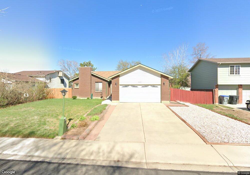
2420 Gordon Ct Longmont, CO 80501
Garden Acres NeighborhoodEstimated Value: $500,187 - $547,000
3
Beds
2
Baths
1,436
Sq Ft
$360/Sq Ft
Est. Value
About This Home
This home is located at 2420 Gordon Ct, Longmont, CO 80501 and is currently estimated at $516,797, approximately $359 per square foot. 2420 Gordon Ct is a home located in Boulder County with nearby schools including Northridge Elementary School, Longs Peak Middle School, and Longmont High School.
Ownership History
Date
Name
Owned For
Owner Type
Purchase Details
Closed on
Apr 26, 2002
Sold by
Martinez Michael D and Martinez Lori E
Bought by
Aviles Juan
Current Estimated Value
Home Financials for this Owner
Home Financials are based on the most recent Mortgage that was taken out on this home.
Original Mortgage
$217,742
Outstanding Balance
$93,107
Interest Rate
7.11%
Mortgage Type
VA
Estimated Equity
$423,690
Purchase Details
Closed on
Apr 5, 1996
Sold by
Zwiebel Susan K and Schumann Sherri R
Bought by
Martinez Michael D
Home Financials for this Owner
Home Financials are based on the most recent Mortgage that was taken out on this home.
Original Mortgage
$130,500
Interest Rate
7.42%
Purchase Details
Closed on
Apr 22, 1993
Bought by
Aviles Juan
Purchase Details
Closed on
Jun 27, 1988
Bought by
Aviles Juan
Purchase Details
Closed on
Jul 14, 1987
Bought by
Aviles Juan
Create a Home Valuation Report for This Property
The Home Valuation Report is an in-depth analysis detailing your home's value as well as a comparison with similar homes in the area
Home Values in the Area
Average Home Value in this Area
Purchase History
| Date | Buyer | Sale Price | Title Company |
|---|---|---|---|
| Aviles Juan | $211,400 | -- | |
| Martinez Michael D | $145,000 | Commonwealth Land Title | |
| Aviles Juan | $115,300 | -- | |
| Aviles Juan | -- | -- | |
| Aviles Juan | $88,900 | -- |
Source: Public Records
Mortgage History
| Date | Status | Borrower | Loan Amount |
|---|---|---|---|
| Open | Aviles Juan | $217,742 | |
| Previous Owner | Martinez Michael D | $130,500 |
Source: Public Records
Tax History Compared to Growth
Tax History
| Year | Tax Paid | Tax Assessment Tax Assessment Total Assessment is a certain percentage of the fair market value that is determined by local assessors to be the total taxable value of land and additions on the property. | Land | Improvement |
|---|---|---|---|---|
| 2025 | $2,978 | $31,612 | $5,806 | $25,806 |
| 2024 | $2,978 | $31,612 | $5,806 | $25,806 |
| 2023 | $2,937 | $31,128 | $6,512 | $28,301 |
| 2022 | $2,654 | $26,821 | $4,789 | $22,032 |
| 2021 | $2,688 | $27,592 | $4,926 | $22,666 |
| 2020 | $2,485 | $25,583 | $4,934 | $20,649 |
| 2019 | $2,446 | $25,583 | $4,934 | $20,649 |
| 2018 | $2,066 | $21,751 | $4,392 | $17,359 |
| 2017 | $2,038 | $24,048 | $4,856 | $19,192 |
| 2016 | $1,873 | $19,590 | $5,174 | $14,416 |
| 2015 | $1,784 | $16,111 | $5,094 | $11,017 |
| 2014 | $1,505 | $16,111 | $5,094 | $11,017 |
Source: Public Records
Map
Nearby Homes
- 1140 Parker Dr
- 2339 Bowen St
- 2131 Bowen St
- 1005 Harmon Place
- 1512 Flemming Dr
- 2102 Lincoln St
- 2018 Lincoln St
- 2213 Emery St Unit C
- 2244 Vivian St
- 1852 Gay St
- 1513 Calkins Ave
- 1838 Gay St
- 2412 Sunset Dr
- 1877 Queens Dr
- 12967 Woodridge Dr
- 207 23rd Ave
- 2144 Collyer St
- 2456 Sunset Dr
- 22 Emery Way
- 2143 Meadow Ct