Estimated Value: $260,000 - $272,000
Studio
--
Bath
1,857
Sq Ft
$143/Sq Ft
Est. Value
About This Home
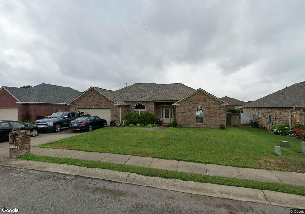
This home is located at 2420 Palisade Dr, Cabot, AR 72023 and is currently estimated at $266,443, approximately $143 per square foot. 2420 Palisade Dr is a home with nearby schools including Westside Elementary School, Cabot Middle School South, and Cabot Junior High South.
Ownership History
Date
Name
Owned For
Owner Type
Purchase Details
Closed on
Nov 4, 2025
Sold by
Bush Juanita
Bought by
Bush Steven
Current Estimated Value
Purchase Details
Closed on
Sep 12, 2012
Bought by
Bush Steven P
Purchase Details
Closed on
Aug 8, 2011
Sold by
Girner John Scott
Bought by
Bush Jim and Bush Juanita
Purchase Details
Closed on
Jul 27, 2011
Sold by
Girner John Scott
Bought by
Bush Jim and Bush Juanita
Purchase Details
Closed on
Dec 2, 2005
Bought by
Amended Ii Plat Pc and Amended 812
Purchase Details
Closed on
Nov 4, 2005
Bought by
Girner
Purchase Details
Closed on
Oct 20, 2005
Bought by
Rerec Ba 14530
Purchase Details
Closed on
Oct 19, 2005
Bought by
Plat Pcii and Plat 4
Create a Home Valuation Report for This Property
The Home Valuation Report is an in-depth analysis detailing your home's value as well as a comparison with similar homes in the area
Purchase History
| Date | Buyer | Sale Price | Title Company |
|---|---|---|---|
| Bush Steven | -- | None Listed On Document | |
| Bush Steven P | -- | -- | |
| Bush Jim | -- | Lenders Title Co | |
| Bush Jim | -- | Lenders Title Co | |
| Amended Ii Plat Pc | -- | -- | |
| Girner | $498,000 | -- | |
| Rerec Ba 14530 | -- | -- | |
| Plat Pcii | -- | -- |
Source: Public Records
Tax History
| Year | Tax Paid | Tax Assessment Tax Assessment Total Assessment is a certain percentage of the fair market value that is determined by local assessors to be the total taxable value of land and additions on the property. | Land | Improvement |
|---|---|---|---|---|
| 2025 | $1,860 | $36,550 | $4,800 | $31,750 |
| 2024 | $1,860 | $36,550 | $4,800 | $31,750 |
| 2023 | $1,860 | $36,550 | $4,800 | $31,750 |
| 2022 | $1,812 | $36,550 | $4,800 | $31,750 |
| 2021 | $1,661 | $36,550 | $4,800 | $31,750 |
| 2020 | $1,510 | $29,660 | $4,800 | $24,860 |
| 2019 | $1,510 | $29,660 | $4,800 | $24,860 |
| 2018 | $1,465 | $29,660 | $4,800 | $24,860 |
| 2017 | $347 | $7,560 | $4,800 | $2,760 |
| 2016 | $373 | $7,560 | $4,800 | $2,760 |
| 2015 | $1,469 | $29,730 | $4,800 | $24,930 |
| 2014 | $1,469 | $29,730 | $4,800 | $24,930 |
Source: Public Records
Map
Nearby Homes
- 2410 Toccata Ln
- 2414 Toccata Ln
- 2419 Toccata Ln
- 2422 Canterbury Ct
- 2213 S 2nd St
- 19 Trinity Dr
- 51 Fieldcrest Cir
- 34 Cimarron Cir
- 44 Cimarron Cir
- 28 Pheasant Run Dr
- 30 Mcarthur Dr
- 20 Paige Ave
- 921 Villa Vista Loop
- 15513 & 15517 Ar Hwy 5
- 914 W Dell Vista Cove
- 912 W Dell Vista Cove
- 10 Brixton
- 911 W Dell Vista Cove
- 20 Albion Ct
- 2779 S 2nd Unit Hwy 367
- 2422 Palisade Dr
- 2442 Palisade Dr
- 2418 Palisade Dr
- 2444 Palisade Dr
- 2403 Toccata Ln
- 2405 Toccata Ln
- 2433 Palisade Dr
- 2439 Palisade Dr
- 2435 Palisade Dr
- 2437 Palisade Dr
- 2440 Palisade Dr
- 2436 Palisade Dr
- 2438 Palisade Dr
- 2415 Palisade Dr
- 2419 Palisade Dr
- 2417 Palisade Dr
- 2401 Toccata Ln
- 0 Toccata Ln Unit 15023098
- 0 Toccata Ln Unit 16009221
- 0 Toccata Ln Unit 16018856
Your Personal Tour Guide
Ask me questions while you tour the home.