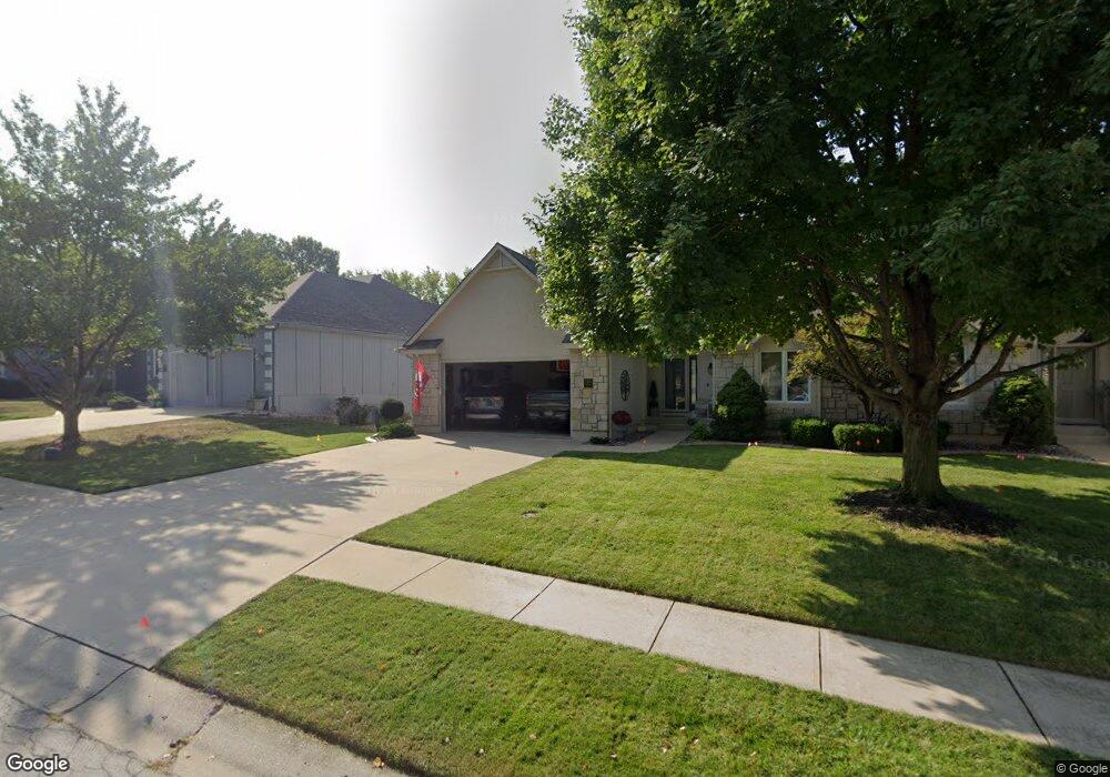
2423 NW Ashurst Dr Lees Summit, MO 64081
Estimated Value: $355,957 - $395,000
2
Beds
2
Baths
1,639
Sq Ft
$225/Sq Ft
Est. Value
About This Home
This home is located at 2423 NW Ashurst Dr, Lees Summit, MO 64081 and is currently estimated at $369,489, approximately $225 per square foot. 2423 NW Ashurst Dr is a home with nearby schools including Cedar Creek Elementary School, Pleasant Lea Middle School, and Lee's Summit Senior High School.
Ownership History
Date
Name
Owned For
Owner Type
Purchase Details
Closed on
Jun 29, 2020
Sold by
Uhlig Kirk T and Uhlig Kathy
Bought by
Uhlig Kirk T and Uhlig Kathy
Current Estimated Value
Purchase Details
Closed on
Mar 23, 2017
Sold by
Paul Richard R and Vaughn Janet Sue
Bought by
Uhlig Kirk T and Uhlig Kathy
Purchase Details
Closed on
Oct 20, 2000
Sold by
Steve Thomas Homes Inc
Bought by
Paul Robert E and Paul Jane Ann
Create a Home Valuation Report for This Property
The Home Valuation Report is an in-depth analysis detailing your home's value as well as a comparison with similar homes in the area
Home Values in the Area
Average Home Value in this Area
Purchase History
| Date | Buyer | Sale Price | Title Company |
|---|---|---|---|
| Uhlig Kirk T | -- | None Available | |
| Uhlig Kirk T | $190,000 | Alpha Title | |
| Paul Robert E | -- | Security Land Title Company |
Source: Public Records
Tax History
| Year | Tax Paid | Tax Assessment Tax Assessment Total Assessment is a certain percentage of the fair market value that is determined by local assessors to be the total taxable value of land and additions on the property. | Land | Improvement |
|---|---|---|---|---|
| 2025 | $4,038 | $58,295 | $13,862 | $44,433 |
| 2024 | $4,009 | $55,930 | $5,094 | $50,836 |
| 2023 | $4,009 | $55,930 | $6,650 | $49,280 |
| 2022 | $3,558 | $44,080 | $4,494 | $39,586 |
| 2021 | $3,632 | $44,080 | $4,494 | $39,586 |
| 2020 | $3,224 | $38,742 | $4,494 | $34,248 |
| 2019 | $3,136 | $38,742 | $4,494 | $34,248 |
| 2018 | $2,896 | $33,208 | $3,238 | $29,970 |
| 2017 | $2,896 | $33,208 | $3,238 | $29,970 |
| 2016 | $2,853 | $32,376 | $2,470 | $29,906 |
Source: Public Records
Map
Nearby Homes
- 2635 NW Ashurst Ln
- 130 NW Ambersham Dr
- 334 NW Ambersham Dr
- 209 NW Cody Dr
- 2214 NW Killarney Ln
- 2090 NW O'Brien Rd
- 2122 NW Ashurst Dr
- 2086 NW O'Brien Rd
- 433 NW Kaylea Ct
- 2070 NW O'Brien Rd
- 321 NW Nutall Dr
- 2809 NW Audubon Ln
- 129 NW Morton Dr
- 955 NW High Point Dr
- 2127 NW Killarney Ln
- 2123 NW Killarney Ln
- 2114 NW Killarney Ln
- 248 SW Winterpark Cir
- 317 NW Lovins
- 316 NW Lovins
- 2425 NW Ashurst Dr
- 2421 NW Ashurst Dr
- 2419 NW Ashurst Dr
- 2427 NW Ashurst Dr
- 2422 NW Ashurst Dr
- 2429 NW Ashurst Dr
- 2417 NW Ashurst Dr
- 469 NW Riven Rock Place
- 2424 NW Ashurst Dr
- 2420 NW Ashurst Dr
- 473 NW Riven Rock Place
- 2426 NW Ashurst Dr
- 2418 NW Ashurst Dr
- 2501 NW Ashurst Dr
- 2415 NW Ashurst Dr
- 2428 NW Ashurst Dr
- 504 NW Ashurst Ct
- 505 NW Ashurst Place
- 2503 NW Ashurst Dr
- 465 NW Riven Rock Place
Your Personal Tour Guide
Ask me questions while you tour the home.