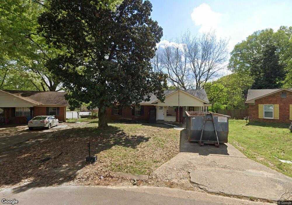
2425 Ashland Dr Southaven, MS 38671
Estimated Value: $168,000 - $185,000
3
Beds
--
Bath
1,369
Sq Ft
$128/Sq Ft
Est. Value
About This Home
This home is located at 2425 Ashland Dr, Southaven, MS 38671 and is currently estimated at $175,591, approximately $128 per square foot. 2425 Ashland Dr is a home located in DeSoto County with nearby schools including Hope Sullivan Elementary School, Southaven Intermediate School, and Southaven Middle School.
Ownership History
Date
Name
Owned For
Owner Type
Purchase Details
Closed on
Jul 25, 2025
Sold by
Thompson David
Bought by
Ki & Thompson Llc
Current Estimated Value
Purchase Details
Closed on
May 22, 2025
Sold by
Oak Avenue Development Llc
Bought by
Thompson David
Home Financials for this Owner
Home Financials are based on the most recent Mortgage that was taken out on this home.
Original Mortgage
$161,250
Interest Rate
6.62%
Mortgage Type
New Conventional
Purchase Details
Closed on
Mar 5, 2025
Sold by
Dean Morris Llc
Bought by
Oak Avenue Development Llc
Create a Home Valuation Report for This Property
The Home Valuation Report is an in-depth analysis detailing your home's value as well as a comparison with similar homes in the area
Home Values in the Area
Average Home Value in this Area
Purchase History
| Date | Buyer | Sale Price | Title Company |
|---|---|---|---|
| Ki & Thompson Llc | -- | None Listed On Document | |
| Ki & Thompson Llc | -- | None Listed On Document | |
| Thompson David | -- | None Listed On Document | |
| Thompson David | -- | None Listed On Document | |
| Oak Avenue Development Llc | $113,000 | None Listed On Document | |
| Oak Avenue Development Llc | $113,000 | None Listed On Document |
Source: Public Records
Mortgage History
| Date | Status | Borrower | Loan Amount |
|---|---|---|---|
| Previous Owner | Thompson David | $161,250 |
Source: Public Records
Tax History Compared to Growth
Tax History
| Year | Tax Paid | Tax Assessment Tax Assessment Total Assessment is a certain percentage of the fair market value that is determined by local assessors to be the total taxable value of land and additions on the property. | Land | Improvement |
|---|---|---|---|---|
| 2024 | $8 | $6,077 | $1,500 | $4,577 |
| 2023 | $8 | $6,077 | $0 | $0 |
| 2022 | $623 | $6,074 | $1,500 | $4,574 |
| 2021 | $623 | $6,074 | $1,500 | $4,574 |
| 2020 | $583 | $5,708 | $1,500 | $4,208 |
| 2019 | $583 | $5,708 | $1,500 | $4,208 |
| 2017 | $577 | $9,696 | $5,598 | $4,098 |
| 2016 | $577 | $5,598 | $1,500 | $4,098 |
| 2015 | $797 | $9,696 | $5,598 | $4,098 |
| 2014 | $577 | $5,598 | $0 | $0 |
| 2013 | $577 | $5,598 | $0 | $0 |
Source: Public Records
Map
Nearby Homes
- 2283 Natchez Cove
- 8147 Charleston Dr
- 7645 Coral Hills Cove
- 8376 Cedarcrest Dr E
- 8341 Whitehead Dr
- 8493 Cedarbrush Dr
- 1776 Brown Cove
- 1873 Merrimac Cove
- 1734 Brookhaven Dr
- 8505 Southaven Cir W
- 1821 Tad Cove
- 3031 Caitlynn Cir S
- 2388 Pappy Ln
- 7135 Hampton Dr
- 7088 Foxhall Dr
- 7429 Perrin Ln
- 7685 Davis Pkwy
- 375 Country Garden Dr
- 8710 Arendale Dr
- 0 Coventry Dr
- 7015 Carrolton Dr W
- 2411 Ashland Dr
- 7027 Carrolton Dr W
- 2399 Ashland Dr
- 7041 Carrolton Dr W
- 2383 Ashland Dr
- 2388 Ashland Dr
- 2371 Ashland Dr
- 7053 Carrolton Dr W
- 2404 Colonial Hills Dr
- 2372 Ashland Dr
- 2392 Colonial Hills Dr
- 2357 Ashland Dr
- 7058 Carrolton Dr W
- 7065 Carrolton Dr W
- 2376 Colonial Hills Dr
- 2358 Ashland Dr
- 2364 Colonial Hills Dr
- 2345 Ashland Dr
- 7077 Carrolton Dr W