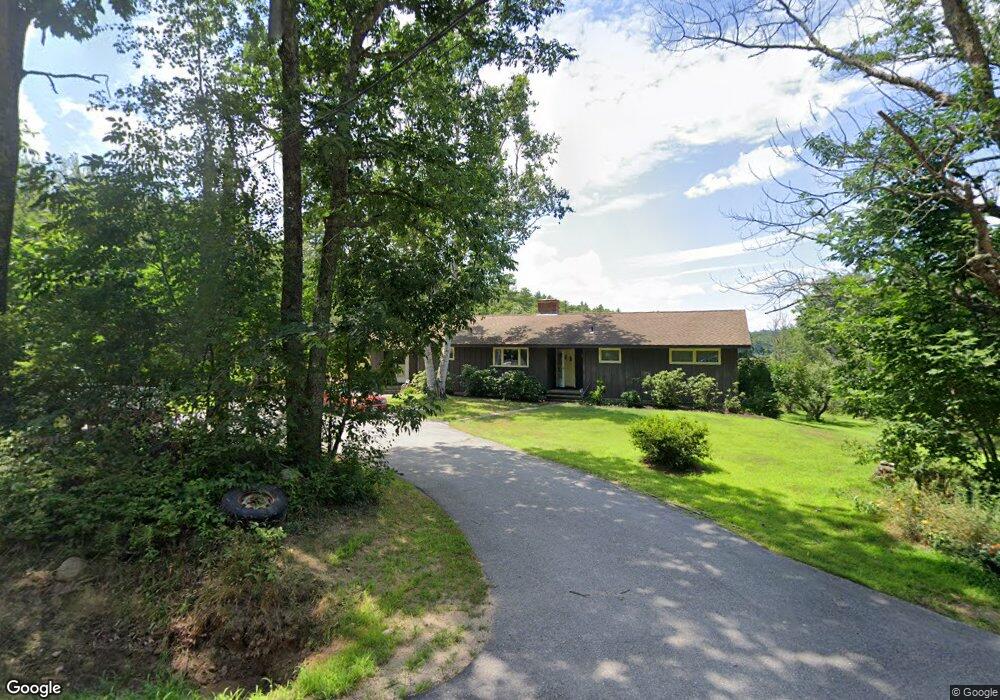
243 1st Crown Point Rd Strafford, NH 03884
Estimated Value: $439,000 - $552,000
2
Beds
2
Baths
1,632
Sq Ft
$313/Sq Ft
Est. Value
About This Home
This home is located at 243 1st Crown Point Rd, Strafford, NH 03884 and is currently estimated at $511,396, approximately $313 per square foot. 243 1st Crown Point Rd is a home with nearby schools including Strafford School and Coe-Brown Northwood Academy.
Ownership History
Date
Name
Owned For
Owner Type
Purchase Details
Closed on
May 26, 2021
Sold by
Arnold and Arnold Giimore F
Bought by
Hyland Terrence D and Hyland Brianna L
Current Estimated Value
Home Financials for this Owner
Home Financials are based on the most recent Mortgage that was taken out on this home.
Original Mortgage
$351,500
Outstanding Balance
$318,734
Interest Rate
3%
Mortgage Type
Purchase Money Mortgage
Estimated Equity
$192,662
Create a Home Valuation Report for This Property
The Home Valuation Report is an in-depth analysis detailing your home's value as well as a comparison with similar homes in the area
Home Values in the Area
Average Home Value in this Area
Purchase History
| Date | Buyer | Sale Price | Title Company |
|---|---|---|---|
| Hyland Terrence D | $370,000 | None Available | |
| Hyland Terrence D | $370,000 | None Available |
Source: Public Records
Mortgage History
| Date | Status | Borrower | Loan Amount |
|---|---|---|---|
| Open | Hyland Terrence D | $351,500 | |
| Closed | Hyland Terrence D | $351,500 |
Source: Public Records
Tax History Compared to Growth
Tax History
| Year | Tax Paid | Tax Assessment Tax Assessment Total Assessment is a certain percentage of the fair market value that is determined by local assessors to be the total taxable value of land and additions on the property. | Land | Improvement |
|---|---|---|---|---|
| 2024 | $6,215 | $314,500 | $67,100 | $247,400 |
| 2023 | $5,862 | $314,500 | $67,100 | $247,400 |
| 2022 | $5,417 | $316,200 | $68,800 | $247,400 |
| 2021 | $5,754 | $311,700 | $68,800 | $242,900 |
| 2020 | $5,594 | $218,100 | $62,500 | $155,600 |
| 2019 | $5,116 | $218,000 | $62,400 | $155,600 |
| 2018 | $5,151 | $218,000 | $62,400 | $155,600 |
| 2016 | $4,635 | $218,100 | $62,500 | $155,600 |
| 2015 | $4,901 | $224,700 | $76,400 | $148,300 |
| 2014 | $5,204 | $224,700 | $76,400 | $148,300 |
| 2013 | $5,114 | $225,500 | $76,400 | $149,100 |
| 2012 | $5,067 | $226,400 | $77,300 | $149,100 |
Source: Public Records
Map
Nearby Homes
- 948 Strafford Rd
- 345 Dry Hill Rd
- 38 Strafford Rd
- 243 Second Crown Point Rd
- 86 Long Shores Dr
- 68 Berry River Rd
- 0 Long Shores Dr Unit 5057687
- 83 Sloper Rd
- 00 Squire Rd
- 0 Sloper Rd Unit 6
- 30 Avalon Rd
- 272 Walnut St
- Map 220 Lot 16 Four Rod Rd
- 185 Mahala Way
- 40 Dry Hill Rd Unit Lot 0250/0006/0000
- 217-13 Washington St
- 212-0003-01 Washington St
- 207-002 Washington St
- 10 Blue Hills Dr
- 8 Juniper Ln
- 249 1st Crown Point Rd
- 6 Crown Point Rd
- 6 Crown Point Rd
- 3 Crown Point Rd
- 234 1st Crown Point Rd
- 227 1st Crown Point Rd
- 24 Crown Point Rd
- 213 1st Crown Point Rd
- 210 1st Crown Point Rd
- 210 1st Crown Point Rd
- 25 Crown Point Rd
- 00 Crown Point Rd
- 286 1st Crown Point Rd
- 296 1st Crown Point Rd
- 175 1st Crown Point Rd
- 171 1st Crown Point Rd
- 162 1st Crown Point Rd
- 162 1st Crown Point Rd
- 1041 1st Crown Point Rd
- 167 1st Crown Point Rd