Estimated Value: $336,000 - $375,000
--
Bed
3
Baths
2,356
Sq Ft
$151/Sq Ft
Est. Value
About This Home
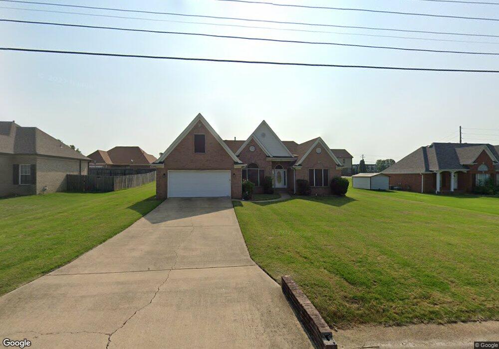
This home is located at 243 Beverly Dr, Atoka, TN 38004 and is currently estimated at $355,723, approximately $150 per square foot. 243 Beverly Dr is a home located in Tipton County with nearby schools including Atoka Elementary School, Brighton Middle School, and Brighton High School.
Ownership History
Date
Name
Owned For
Owner Type
Purchase Details
Closed on
Apr 17, 2013
Sold by
Crawford Rueben C
Bought by
Crawford Evangeline J
Current Estimated Value
Purchase Details
Closed on
Aug 25, 2004
Sold by
Rw Wilson Builders
Bought by
Crawford Rueben C
Home Financials for this Owner
Home Financials are based on the most recent Mortgage that was taken out on this home.
Original Mortgage
$18,450
Interest Rate
5.97%
Purchase Details
Closed on
Dec 10, 2003
Sold by
Munford Development Co
Bought by
R W Wilson Builders
Home Financials for this Owner
Home Financials are based on the most recent Mortgage that was taken out on this home.
Original Mortgage
$140,000
Interest Rate
5.98%
Purchase Details
Closed on
Oct 4, 1990
Bought by
Munford Development Co
Create a Home Valuation Report for This Property
The Home Valuation Report is an in-depth analysis detailing your home's value as well as a comparison with similar homes in the area
Home Values in the Area
Average Home Value in this Area
Purchase History
| Date | Buyer | Sale Price | Title Company |
|---|---|---|---|
| Crawford Evangeline J | -- | -- | |
| Crawford Rueben C | $184,500 | -- | |
| R W Wilson Builders | $18,000 | -- | |
| Munford Development Co | -- | -- |
Source: Public Records
Mortgage History
| Date | Status | Borrower | Loan Amount |
|---|---|---|---|
| Previous Owner | Munford Development Co | $18,450 | |
| Previous Owner | Munford Development Co | $140,000 |
Source: Public Records
Tax History Compared to Growth
Tax History
| Year | Tax Paid | Tax Assessment Tax Assessment Total Assessment is a certain percentage of the fair market value that is determined by local assessors to be the total taxable value of land and additions on the property. | Land | Improvement |
|---|---|---|---|---|
| 2024 | $1,823 | $80,850 | $8,675 | $72,175 |
| 2023 | $1,823 | $80,850 | $8,675 | $72,175 |
| 2022 | $1,735 | $56,500 | $6,375 | $50,125 |
| 2021 | $1,706 | $56,500 | $6,375 | $50,125 |
| 2020 | $1,705 | $56,500 | $6,375 | $50,125 |
| 2019 | $1,739 | $48,450 | $6,375 | $42,075 |
| 2018 | $1,739 | $48,450 | $6,375 | $42,075 |
| 2017 | $1,560 | $48,450 | $6,375 | $42,075 |
| 2016 | $1,560 | $48,450 | $6,375 | $42,075 |
| 2015 | $1,559 | $48,450 | $6,375 | $42,075 |
| 2014 | $1,440 | $48,457 | $0 | $0 |
Source: Public Records
Map
Nearby Homes
- 371 Beverly Dr
- 538 Rosemark Rd
- 189 Cotton Fall Dr
- 93 Sterling Farm Dr
- 78 Doe Trail
- 128 Loch Haven Cove S
- 170 Como Ln
- 125 Columbia Way
- 61 Como Ln
- 104 Lochmeade Dr
- 420 Trebing Pkwy
- 29 Merino Dr
- 00 Atoka Idaville Rd
- 0 Smith Dr Unit 10202728
- 236 Como Ln
- 35 Drysdale Cove
- 284 Merino Dr
- 50 Drysdale Cove
- 60 Drysdale Cove
- 33 Ward Ln
- 261 Beverly Dr
- 225 Beverly Dr
- 469 Rosemark Rd
- 449 Rosemark Rd
- 485 Rosemark Rd
- 281 Beverly Dr
- 256 Beverly Dr
- 234 Beverly Dr
- 431 Rosemark Rd
- 208 Beverly Dr
- 290 Beverly Dr
- 193 Beverly Dr
- 301 Beverly Dr
- 521 Rosemark Rd
- 133 Dogwood Trace
- 411 Rosemark Rd
- 101 Dogwood Trace
- 310 Beverly Dr
- 184 Beverly Dr
- 25 Wheat Rum