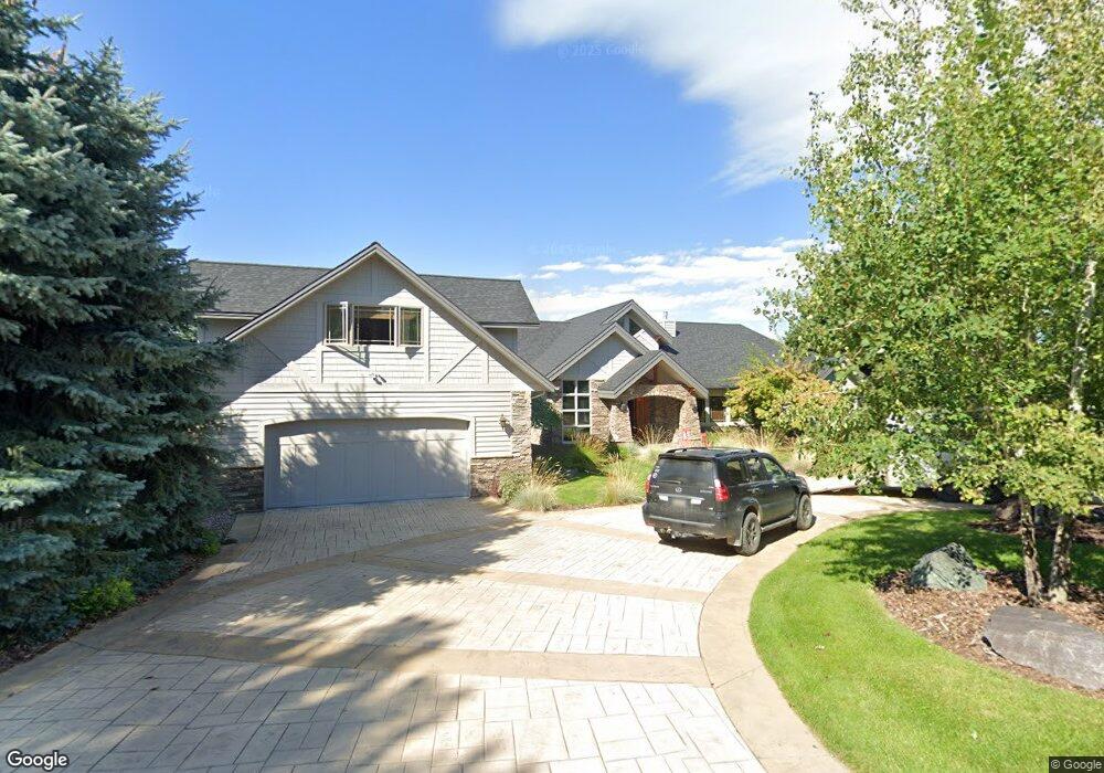
243 Bridger Dr Bigfork, MT 59911
Estimated Value: $1,610,000 - $2,457,473
4
Beds
7
Baths
3,459
Sq Ft
$572/Sq Ft
Est. Value
About This Home
This home is located at 243 Bridger Dr, Bigfork, MT 59911 and is currently estimated at $1,976,868, approximately $571 per square foot. 243 Bridger Dr is a home located in Flathead County with nearby schools including Bigfork Elementary School, Bigfork Middle School, and Bigfork High School.
Ownership History
Date
Name
Owned For
Owner Type
Purchase Details
Closed on
May 1, 2017
Sold by
Chesnos Frank and Chesnos Kathryn
Bought by
Charboneau Frank and Charboneau Hildy M
Current Estimated Value
Home Financials for this Owner
Home Financials are based on the most recent Mortgage that was taken out on this home.
Original Mortgage
$424,000
Outstanding Balance
$353,858
Interest Rate
4.23%
Mortgage Type
New Conventional
Estimated Equity
$1,623,010
Purchase Details
Closed on
Dec 29, 2006
Sold by
Chesnos Frank J and Chesnos Kathryn A
Bought by
Chesnos Frank and Chesnos Kathryn
Create a Home Valuation Report for This Property
The Home Valuation Report is an in-depth analysis detailing your home's value as well as a comparison with similar homes in the area
Home Values in the Area
Average Home Value in this Area
Purchase History
| Date | Buyer | Sale Price | Title Company |
|---|---|---|---|
| Charboneau Frank | -- | Fidelity National Title | |
| Chesnos Frank | -- | None Available |
Source: Public Records
Mortgage History
| Date | Status | Borrower | Loan Amount |
|---|---|---|---|
| Open | Charboneau Frank | $424,000 |
Source: Public Records
Tax History
| Year | Tax Paid | Tax Assessment Tax Assessment Total Assessment is a certain percentage of the fair market value that is determined by local assessors to be the total taxable value of land and additions on the property. | Land | Improvement |
|---|---|---|---|---|
| 2025 | $10,663 | $1,986,200 | $0 | $0 |
| 2024 | $7,899 | $1,415,400 | $0 | $0 |
| 2023 | $7,857 | $1,415,400 | $0 | $0 |
| 2022 | $9,923 | $1,281,964 | $0 | $0 |
| 2021 | $9,560 | $1,281,964 | $0 | $0 |
| 2020 | $9,519 | $1,191,998 | $0 | $0 |
| 2019 | $9,174 | $1,191,998 | $0 | $0 |
| 2018 | $8,908 | $1,101,285 | $0 | $0 |
| 2017 | $9,003 | $1,138,545 | $0 | $0 |
| 2016 | $8,712 | $1,111,811 | $0 | $0 |
| 2015 | $8,134 | $1,111,811 | $0 | $0 |
| 2014 | $6,726 | $552,207 | $0 | $0 |
Source: Public Records
Map
Nearby Homes
- 351 Chapman Ln
- 1358 Ponderosa Ridge Dr
- 220 Bridger Dr
- 116 Golden Bear Dr
- 112 Golden Bear Dr
- 106 Golden Bear Dr
- 175 Aerie Place
- 486 Hogue Dr
- 181 Fox Run Ct
- 161 Fox Run Ct
- 145 Fox Run Ct
- 153 Fox Run Ct
- 394 Windsor Ct
- 151 Bjork Dr
- 266 Eagle Bend Dr
- 147 Bjork Dr
- 324 Lake Hills Dr
- 29 Bearpaw Loop
- 7945 Mt Highway 35
- 623 Mill Pond Place
- 243 Bridger Dr
- 245 Bridger Dr
- 241 Bridger Dr
- 101 Cougar Loop
- 244 Bridger Dr
- 247 Bridger Dr
- 247 Bridger Dr
- 239 Bridger Dr
- 240 Bridger Dr
- 101 Badger Ct
- 100 Cougar Loop
- 99 Cougar Loop
- 240 Bridger Drive Lot95n
- 105 Cougar Loop
- 103 Cougar Loop
- 249 Bridger Dr
- 237 Bridger Dr
- 103 Badger Ct
- 0 Badger Ct
- 100 Badger Ct
Your Personal Tour Guide
Ask me questions while you tour the home.