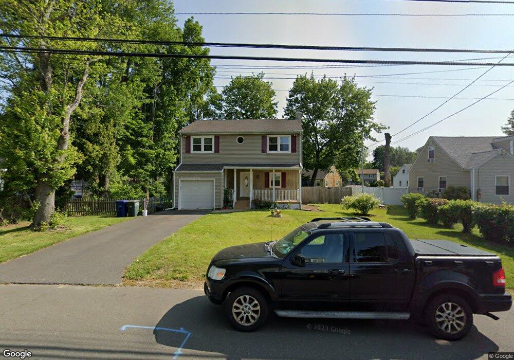
243 Evers St Bridgeport, CT 06610
North Bridgeport NeighborhoodEstimated Value: $379,000 - $414,000
3
Beds
1
Bath
1,393
Sq Ft
$284/Sq Ft
Est. Value
About This Home
This home is located at 243 Evers St, Bridgeport, CT 06610 and is currently estimated at $395,880, approximately $284 per square foot. 243 Evers St is a home located in Fairfield County with nearby schools including Hooker School and Harding High School.
Ownership History
Date
Name
Owned For
Owner Type
Purchase Details
Closed on
Aug 18, 2003
Sold by
Duggan William J and Duggan Barbara J
Bought by
Leon Samuel
Current Estimated Value
Home Financials for this Owner
Home Financials are based on the most recent Mortgage that was taken out on this home.
Original Mortgage
$125,000
Outstanding Balance
$54,403
Interest Rate
5.46%
Estimated Equity
$341,477
Create a Home Valuation Report for This Property
The Home Valuation Report is an in-depth analysis detailing your home's value as well as a comparison with similar homes in the area
Home Values in the Area
Average Home Value in this Area
Purchase History
| Date | Buyer | Sale Price | Title Company |
|---|---|---|---|
| Leon Samuel | $190,000 | -- | |
| Leon Samuel | $190,000 | -- |
Source: Public Records
Mortgage History
| Date | Status | Borrower | Loan Amount |
|---|---|---|---|
| Closed | Leon Samuel | $40,000 | |
| Open | Leon Samuel | $125,000 | |
| Closed | Leon Samuel | $125,000 |
Source: Public Records
Tax History
| Year | Tax Paid | Tax Assessment Tax Assessment Total Assessment is a certain percentage of the fair market value that is determined by local assessors to be the total taxable value of land and additions on the property. | Land | Improvement |
|---|---|---|---|---|
| 2025 | $6,305 | $145,100 | $62,300 | $82,800 |
| 2024 | $6,305 | $145,100 | $62,300 | $82,800 |
| 2023 | $6,305 | $145,100 | $62,300 | $82,800 |
| 2022 | $6,305 | $145,100 | $62,300 | $82,800 |
| 2021 | $6,305 | $145,100 | $62,300 | $82,800 |
| 2020 | $6,445 | $119,370 | $51,110 | $68,260 |
| 2019 | $6,445 | $119,370 | $51,110 | $68,260 |
| 2018 | $6,490 | $119,370 | $51,110 | $68,260 |
| 2017 | $6,490 | $119,370 | $51,110 | $68,260 |
| 2016 | $6,490 | $119,370 | $51,110 | $68,260 |
| 2015 | $5,443 | $128,990 | $49,940 | $79,050 |
| 2014 | $5,443 | $128,990 | $49,940 | $79,050 |
Source: Public Records
Map
Nearby Homes
- 119 Jennings Ave
- 120 Huntington Turnpike Unit 202
- 132 Virginia Ave Unit 132
- 211 Louisiana Ave Unit D
- 186 Louisiana Ave Unit D
- 11 Nob Hill Cir
- 261 Pennsylvania Ave
- 33 Louisiana Ave Unit 35
- 154 Virginia Ave Unit B
- 285 Hillcrest Rd
- 250 Dayton Rd
- 207 Hillcrest Rd
- 156 Dayton Rd
- 3699 Broadbridge Ave Unit 330
- 3699 Broadbridge Ave Unit 101
- 74 Hollywood Ave
- 11 Knollcrest Dr
- 769 Sylvan Ave Unit 13
- 2100-2102 E Main St
- 2092-2096 E Main St
- 257 Evers St
- 84 Nutmeg Cir
- 256 Evers St
- 273 Evers St
- 246 Evers St
- 94 Nutmeg Cir
- 78 Nutmeg Cir
- 270 Evers St Unit 272
- 289 Evers St
- 59 Evers Place Unit 61
- 110 Nutmeg Cir
- 45 Evers Place
- 494 Huntington Turnpike
- 468 Huntington Turnpike
- 56 Nutmeg Cir
- 30 Nutmeg Rd
- 303 Evers St
- 43 Evers Place
- 31 Evers Place
- 29 Evers Place Unit 31
Your Personal Tour Guide
Ask me questions while you tour the home.