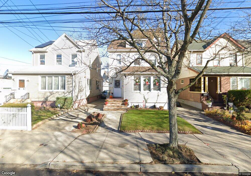
24315 Mayda Rd Rosedale, NY 11422
Rosedale NeighborhoodEstimated Value: $640,876 - $825,000
--
Bed
--
Bath
1,624
Sq Ft
$458/Sq Ft
Est. Value
About This Home
This home is located at 24315 Mayda Rd, Rosedale, NY 11422 and is currently estimated at $744,469, approximately $458 per square foot. 24315 Mayda Rd is a home located in Queens County with nearby schools including P.S. / M.S. 138 Sunrise, Collaborative Arts Middle School, and Success Academy Charter School - Rosedale.
Ownership History
Date
Name
Owned For
Owner Type
Purchase Details
Closed on
Jun 15, 2017
Sold by
Thercellya Marie and Thercellya Serge
Bought by
Thercellya Stanley and Thercellya Whanda R
Current Estimated Value
Home Financials for this Owner
Home Financials are based on the most recent Mortgage that was taken out on this home.
Original Mortgage
$285,300
Outstanding Balance
$237,505
Interest Rate
4.05%
Mortgage Type
Purchase Money Mortgage
Estimated Equity
$506,964
Create a Home Valuation Report for This Property
The Home Valuation Report is an in-depth analysis detailing your home's value as well as a comparison with similar homes in the area
Home Values in the Area
Average Home Value in this Area
Purchase History
| Date | Buyer | Sale Price | Title Company |
|---|---|---|---|
| Thercellya Stanley | $317,000 | -- |
Source: Public Records
Mortgage History
| Date | Status | Borrower | Loan Amount |
|---|---|---|---|
| Open | Thercellya Stanley | $285,300 |
Source: Public Records
Tax History Compared to Growth
Tax History
| Year | Tax Paid | Tax Assessment Tax Assessment Total Assessment is a certain percentage of the fair market value that is determined by local assessors to be the total taxable value of land and additions on the property. | Land | Improvement |
|---|---|---|---|---|
| 2025 | $6,649 | $35,076 | $6,945 | $28,131 |
| 2024 | $6,649 | $33,106 | $6,880 | $26,226 |
| 2023 | $6,304 | $31,385 | $5,877 | $25,508 |
| 2022 | $5,922 | $42,480 | $8,280 | $34,200 |
| 2021 | $6,243 | $35,520 | $8,280 | $27,240 |
| 2020 | $6,187 | $33,720 | $8,280 | $25,440 |
| 2019 | $5,771 | $33,900 | $8,280 | $25,620 |
| 2018 | $5,331 | $26,154 | $6,696 | $19,458 |
| 2017 | $5,039 | $24,721 | $6,976 | $17,745 |
| 2016 | $4,942 | $24,721 | $6,976 | $17,745 |
| 2015 | $2,813 | $24,358 | $7,879 | $16,479 |
| 2014 | $2,813 | $22,990 | $8,558 | $14,432 |
Source: Public Records
Map
Nearby Homes
- 138-28 242 Street 242 St
- 146-15 243rd St
- 24111 Newhall Ave
- 241-08 Newhall Ave
- 24026 Mayda Rd
- 24533 147th Rd
- 24027 Newhall Ave
- 14632 Huxley St
- 24519 147th Dr
- 245-39 147th Dr
- 24111 Weller Ave
- 253-22 147th Ave
- 25311 147th Rd
- 24005 Weller Ave
- 25340 147th Ave
- 14224 250th St
- 26 240th St
- 25301 148th Ave
- 23915 147th Rd
- 248-18 Memphis Ave
- 24319 Mayda Rd
- 24311 Mayda Rd
- 243-11 Mayda Rd
- 24321 Mayda Rd
- 24325 Mayda Rd
- 243-25 Mayda Rd Unit 2
- 243-25 Mayda Rd
- 24316 145th Ave
- 24320 145th Ave
- 24312 145th Ave
- 243-20 145th Ave
- 24322 145th Ave
- 24316 145th Ave
- 243-16 145th Ave
- 24327 Mayda Rd
- 24326 145th Ave
- 14515 243rd St
- 14511 243rd St
- 243-31 Mayda Rd
- 243-31 Mayda Rd Unit 2nd Fl