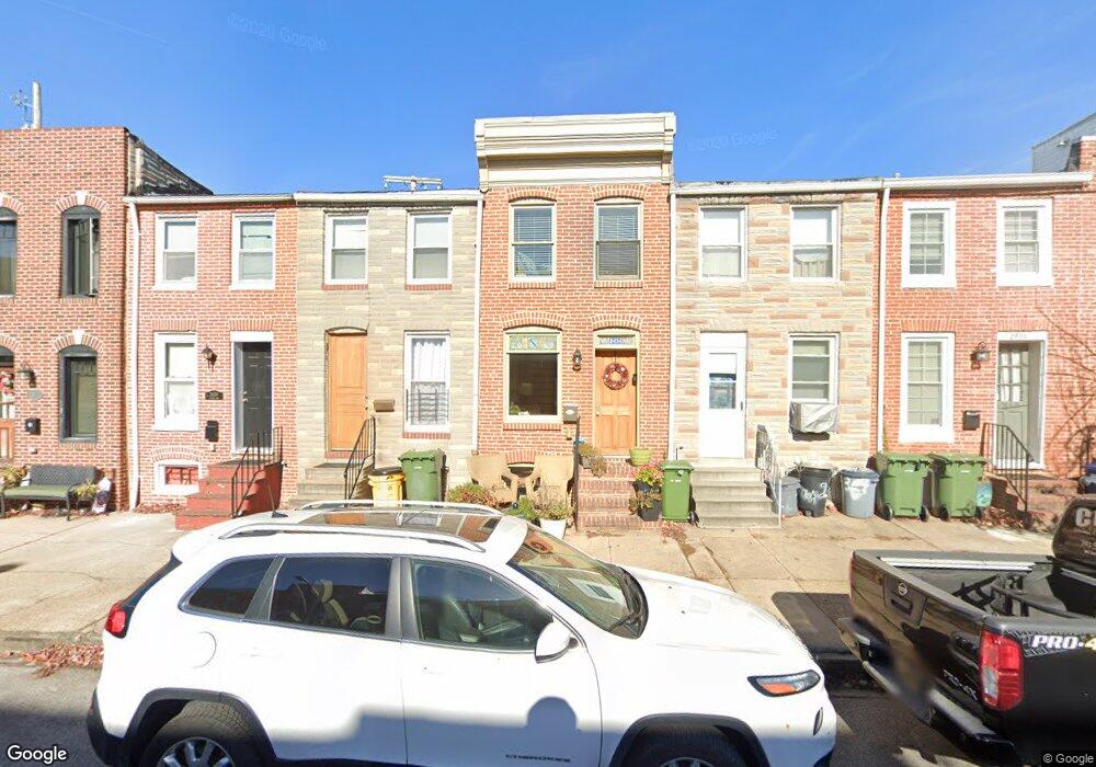
2432 Foster Ave Baltimore, MD 21224
Canton NeighborhoodEstimated Value: $165,000 - $191,813
1
Bed
2
Baths
682
Sq Ft
$262/Sq Ft
Est. Value
About This Home
This home is located at 2432 Foster Ave, Baltimore, MD 21224 and is currently estimated at $178,407, approximately $261 per square foot. 2432 Foster Ave is a home located in Baltimore City with nearby schools including Booker T. Washington Middle School, Paul Laurence Dunbar High School, and Patterson High School.
Ownership History
Date
Name
Owned For
Owner Type
Purchase Details
Closed on
Apr 8, 2010
Sold by
Nopulos James
Bought by
Federal National Mortgage Association
Current Estimated Value
Purchase Details
Closed on
Jan 16, 2002
Sold by
Chadwick Mortgage Inc
Bought by
Nopulos James
Purchase Details
Closed on
Nov 28, 2000
Sold by
Moncur Mario
Bought by
Chadwick Mortgage Inc
Purchase Details
Closed on
Mar 31, 2000
Sold by
Blankey Anna
Bought by
Moncur Mario
Create a Home Valuation Report for This Property
The Home Valuation Report is an in-depth analysis detailing your home's value as well as a comparison with similar homes in the area
Home Values in the Area
Average Home Value in this Area
Purchase History
| Date | Buyer | Sale Price | Title Company |
|---|---|---|---|
| Federal National Mortgage Association | $108,000 | -- | |
| Lincoln Jennifer | $85,000 | -- | |
| Nopulos James | $43,750 | -- | |
| Chadwick Mortgage Inc | $62,874 | -- | |
| Moncur Mario | $84,000 | -- | |
| Moncur Mario | $50,000 | -- |
Source: Public Records
Tax History Compared to Growth
Tax History
| Year | Tax Paid | Tax Assessment Tax Assessment Total Assessment is a certain percentage of the fair market value that is determined by local assessors to be the total taxable value of land and additions on the property. | Land | Improvement |
|---|---|---|---|---|
| 2025 | $3,251 | $141,000 | -- | -- |
| 2024 | $3,251 | $138,400 | $0 | $0 |
| 2023 | $3,190 | $135,800 | $100,000 | $35,800 |
| 2022 | $2,658 | $134,900 | $0 | $0 |
| 2021 | $3,162 | $134,000 | $0 | $0 |
| 2020 | $2,465 | $133,100 | $100,000 | $33,100 |
| 2019 | $2,360 | $133,100 | $100,000 | $33,100 |
| 2018 | $2,284 | $133,100 | $100,000 | $33,100 |
| 2017 | $2,196 | $133,100 | $0 | $0 |
| 2016 | $2,013 | $116,967 | $0 | $0 |
| 2015 | $2,013 | $100,833 | $0 | $0 |
| 2014 | $2,013 | $84,700 | $0 | $0 |
Source: Public Records
Map
Nearby Homes
- 638 S Montford Ave
- 624 S Milton Ave
- 2411 Fait Ave
- 2415 Fleet St
- 2433 Fleet St
- 2339 Cambridge Walk
- 2349 Cambridge Walk
- 2305 Essex St
- 612 S Rose St
- 2303 Essex St
- 2527 Foster Ave
- 816 S Milton Ave
- 2519 Fleet St
- 616 S Luzerne Ave
- 612 S Luzerne Ave
- 832 S Milton Ave
- 801 S Rose St
- 2335 Boston St Unit 4
- 2314 Fleet St
- 506 S Montford Ave
- 2430 Foster Ave
- 2434 Foster Ave
- 2436 Foster Ave
- 2438 Foster Ave
- 2424 Foster Ave
- 2440 Foster Ave
- 628 S Milton Ave
- 2442 Foster Ave
- 2422 Foster Ave
- 626 S Milton Ave
- 2420 Foster Ave
- 2418 Foster Ave
- 622 S Milton Ave
- 629 S Port St
- 627 S Port St
- 620 S Milton Ave
- 2416 Foster Ave
- 618 S Milton Ave
- 625 S Port St
- 623 S Port St