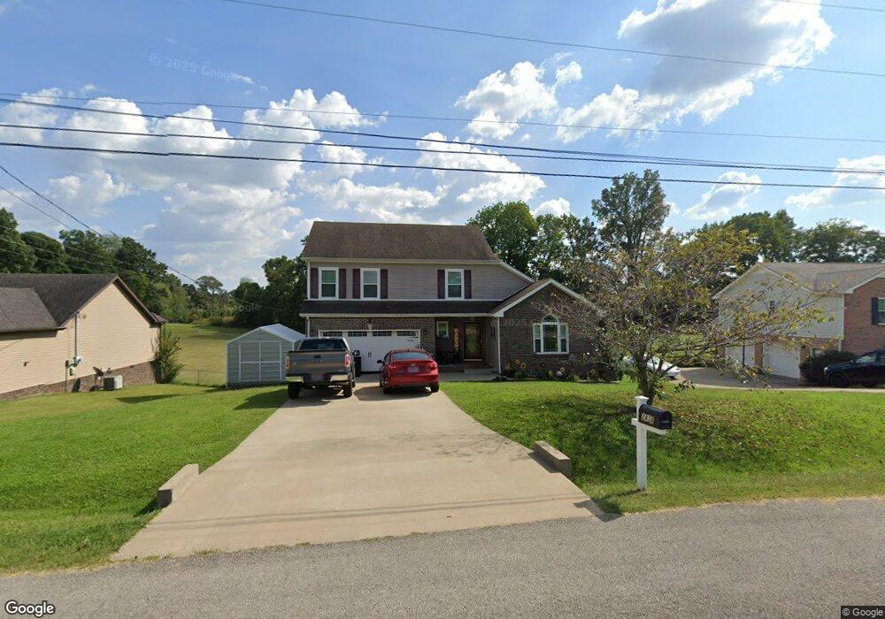
2434 Artie Manning Rd Clarksville, TN 37042
Patrick Place NeighborhoodEstimated Value: $320,747 - $350,000
--
Bed
--
Bath
1,766
Sq Ft
$187/Sq Ft
Est. Value
About This Home
This home is located at 2434 Artie Manning Rd, Clarksville, TN 37042 and is currently estimated at $330,687, approximately $187 per square foot. 2434 Artie Manning Rd is a home with nearby schools including Hazelwood Elementary School, West Creek Middle School, and West Creek High School.
Ownership History
Date
Name
Owned For
Owner Type
Purchase Details
Closed on
Dec 9, 2011
Sold by
Mace Billy
Bought by
Franks Mark B and Franks Terry L
Current Estimated Value
Home Financials for this Owner
Home Financials are based on the most recent Mortgage that was taken out on this home.
Original Mortgage
$173,655
Outstanding Balance
$119,077
Interest Rate
4.06%
Mortgage Type
VA
Estimated Equity
$211,610
Purchase Details
Closed on
Jul 12, 2011
Sold by
Peay Austin Vi
Bought by
Mace Billy
Create a Home Valuation Report for This Property
The Home Valuation Report is an in-depth analysis detailing your home's value as well as a comparison with similar homes in the area
Home Values in the Area
Average Home Value in this Area
Purchase History
| Date | Buyer | Sale Price | Title Company |
|---|---|---|---|
| Franks Mark B | $170,000 | -- | |
| Mace Billy | $60,000 | -- |
Source: Public Records
Mortgage History
| Date | Status | Borrower | Loan Amount |
|---|---|---|---|
| Open | Franks Mark B | $173,655 |
Source: Public Records
Tax History Compared to Growth
Tax History
| Year | Tax Paid | Tax Assessment Tax Assessment Total Assessment is a certain percentage of the fair market value that is determined by local assessors to be the total taxable value of land and additions on the property. | Land | Improvement |
|---|---|---|---|---|
| 2024 | $2,375 | $79,700 | $0 | $0 |
| 2023 | $2,375 | $48,450 | $0 | $0 |
| 2022 | $2,045 | $48,450 | $0 | $0 |
| 2021 | $2,045 | $48,450 | $0 | $0 |
| 2020 | $1,917 | $47,700 | $0 | $0 |
| 2019 | $1,917 | $47,700 | $0 | $0 |
| 2018 | $1,926 | $43,550 | $0 | $0 |
| 2017 | $554 | $44,700 | $0 | $0 |
| 2016 | $1,372 | $44,700 | $0 | $0 |
| 2015 | $1,884 | $44,700 | $0 | $0 |
| 2014 | $1,859 | $44,700 | $0 | $0 |
| 2013 | $1,861 | $42,475 | $0 | $0 |
Source: Public Records
Map
Nearby Homes
- 3332 Greenspoint Dr
- 2576 Leprechaun Ln
- 3324 Greenspoint Dr
- 2564 Leprechaun Ln
- 3321 Greenspoint Dr
- 321 Greenspoint Ct
- 2413 Tana Way
- 3413 E Henderson Way
- 3407 Oconnor Ln
- 3366 N Henderson Way
- 3545 Barkers Mill Rd
- 837 Macon Ln
- 3391 N Henderson Way
- 2592 Emerald Ct
- 3484 Cayuse Way
- 1599 Cobra Ln
- 1636 Apache Way
- 2770 Cascade Dr
- 3239 Tower Dr
- 1590 Cobra Ln
- 2432 Artie Manning Rd
- 2436 Artie Manning Rd
- 2435 Artie Manning Rd
- 2438 Artie Manning Rd
- 2437 Artie Manning Rd
- 2433 Artie Manning Rd
- 2439 Artie Manning Rd
- 2430 Artie Manning Rd
- 2440 Artie Manning Rd
- 2434 Widgeon Dr
- 2539 Emerald Ct
- 2431 Artie Manning Rd
- 2430 Widgeon Dr
- 2441 Artie Manning Rd
- 2442 Artie Manning Rd
- 2446 Widgeon Dr
- 2541 Emerald Ct
- 2426 Widgeon Dr
- 2443 Artie Manning Rd
- 2542 Emerald Ct