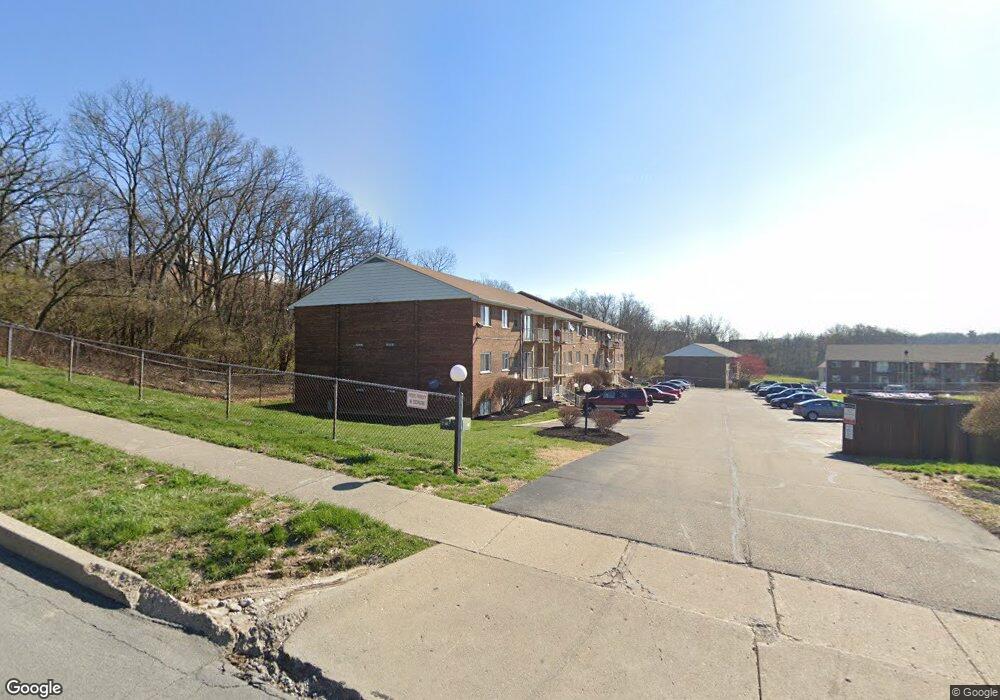
2435 Mustang Dr Cincinnati, OH 45211
Westwood NeighborhoodEstimated Value: $54,000 - $106,287
2
Beds
1
Bath
814
Sq Ft
$96/Sq Ft
Est. Value
About This Home
This home is located at 2435 Mustang Dr, Cincinnati, OH 45211 and is currently estimated at $78,429, approximately $96 per square foot. 2435 Mustang Dr is a home located in Hamilton County with nearby schools including Cheviot Elementary School, Western Hills High School, and Gilbert A. Dater High School.
Ownership History
Date
Name
Owned For
Owner Type
Purchase Details
Closed on
Mar 24, 2023
Sold by
Kfj Realty Group Llc
Bought by
Jones And Tuggle Rental Properties Llc
Current Estimated Value
Purchase Details
Closed on
Mar 10, 2023
Sold by
Adams Douglas and Adams Kimberly
Bought by
Kfj Realty Group Llc
Purchase Details
Closed on
May 17, 2002
Sold by
Ross Jason A
Bought by
Adams Douglas and Adams Kimberly
Home Financials for this Owner
Home Financials are based on the most recent Mortgage that was taken out on this home.
Original Mortgage
$26,400
Interest Rate
7.25%
Create a Home Valuation Report for This Property
The Home Valuation Report is an in-depth analysis detailing your home's value as well as a comparison with similar homes in the area
Home Values in the Area
Average Home Value in this Area
Purchase History
| Date | Buyer | Sale Price | Title Company |
|---|---|---|---|
| Jones And Tuggle Rental Properties Llc | $45,000 | None Listed On Document | |
| Kfj Realty Group Llc | $35,000 | None Listed On Document | |
| Kfj Realty Group Llc | $35,000 | None Listed On Document | |
| Adams Douglas | $33,000 | -- |
Source: Public Records
Mortgage History
| Date | Status | Borrower | Loan Amount |
|---|---|---|---|
| Previous Owner | Adams Douglas | $26,400 |
Source: Public Records
Tax History Compared to Growth
Tax History
| Year | Tax Paid | Tax Assessment Tax Assessment Total Assessment is a certain percentage of the fair market value that is determined by local assessors to be the total taxable value of land and additions on the property. | Land | Improvement |
|---|---|---|---|---|
| 2024 | $776 | $12,250 | $2,100 | $10,150 |
| 2023 | $928 | $12,250 | $2,100 | $10,150 |
| 2022 | $561 | $7,938 | $1,050 | $6,888 |
| 2021 | $551 | $7,938 | $1,050 | $6,888 |
| 2020 | $552 | $7,938 | $1,050 | $6,888 |
| 2019 | $816 | $10,693 | $1,050 | $9,643 |
| 2018 | $817 | $10,693 | $1,050 | $9,643 |
| 2017 | $787 | $10,693 | $1,050 | $9,643 |
| 2016 | $807 | $10,686 | $1,750 | $8,936 |
| 2015 | $721 | $10,686 | $1,750 | $8,936 |
| 2014 | $725 | $10,686 | $1,750 | $8,936 |
| 2013 | $737 | $10,686 | $1,750 | $8,936 |
Source: Public Records
Map
Nearby Homes
- 2469 Montana Ave
- 2454 Mustang Dr
- 2508 Mustang Dr
- 3427 Bighorn Ct
- 2099 W Fork Rd
- 3418 Millrich Ave
- 2424 Westwood Northern Blvd
- 3162 Sunshine Ave
- 3413 Fyffe Ave
- 3116 Gobel Ave
- 3353 Saffer St
- 256 Nottingham Rd
- 2315 Iroll Ave
- 3355 Cavanaugh Ave
- 2352 Iroll Ave
- 3072 Worthington Ave
- 2355 Baltimore Ave
- 2822 Montana Ave
- 3331 Felicity Dr
- 3064 Mchenry Ave
- 2435 Mustang Dr
- 2435 Mustang Dr Unit 9
- 2435 Mustang Dr Unit 12
- 2435 Mustang Dr
- 2435 Mustang Dr
- 2435 Mustang Dr
- 2435 Mustang Dr
- 2435 Mustang Dr
- 2435 Mustang Dr
- 2435 Mustang Dr
- 2435 Mustang Dr Unit 3
- 2435 Mustang Dr Unit 2
- 2435 Mustang Dr Unit 11
- 2435 Mustang Dr Unit 4
- 2435 Mustang Dr Unit 1
- 2431 Mustang Dr
- 2431 Mustang Dr Unit 24
- 2431 Mustang Dr
- 2431 Mustang Dr Unit 22
- 2431 Mustang Dr Unit 16