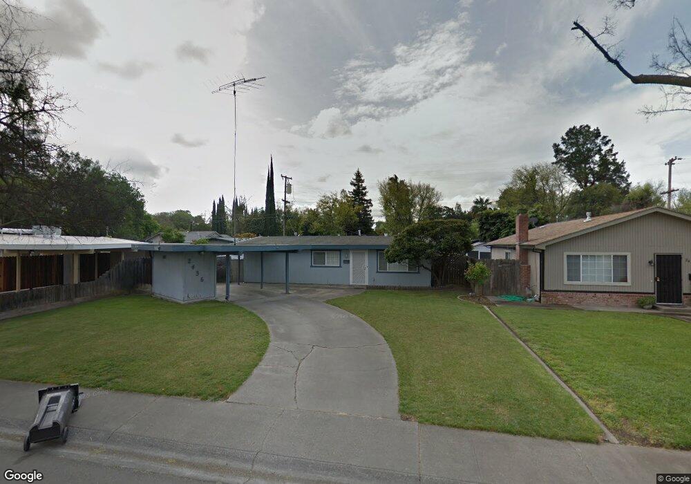
2436 Porter Way Unit 21 Stockton, CA 95207
Lincoln Village NeighborhoodEstimated Value: $313,000 - $384,000
3
Beds
1
Bath
1,134
Sq Ft
$306/Sq Ft
Est. Value
About This Home
This home is located at 2436 Porter Way Unit 21, Stockton, CA 95207 and is currently estimated at $347,486, approximately $306 per square foot. 2436 Porter Way Unit 21 is a home located in San Joaquin County with nearby schools including Tully C. Knoles School, Sierra Middle School, and Lincoln High School.
Ownership History
Date
Name
Owned For
Owner Type
Purchase Details
Closed on
Mar 23, 1994
Sold by
Caul Edward
Bought by
Byrne Christopher L
Current Estimated Value
Home Financials for this Owner
Home Financials are based on the most recent Mortgage that was taken out on this home.
Original Mortgage
$63,000
Interest Rate
7.21%
Create a Home Valuation Report for This Property
The Home Valuation Report is an in-depth analysis detailing your home's value as well as a comparison with similar homes in the area
Home Values in the Area
Average Home Value in this Area
Purchase History
| Date | Buyer | Sale Price | Title Company |
|---|---|---|---|
| Byrne Christopher L | $70,000 | Commonwealth Land Title Ins |
Source: Public Records
Mortgage History
| Date | Status | Borrower | Loan Amount |
|---|---|---|---|
| Closed | Byrne Christopher L | $63,000 |
Source: Public Records
Tax History Compared to Growth
Tax History
| Year | Tax Paid | Tax Assessment Tax Assessment Total Assessment is a certain percentage of the fair market value that is determined by local assessors to be the total taxable value of land and additions on the property. | Land | Improvement |
|---|---|---|---|---|
| 2025 | $3,479 | $118,942 | $67,967 | $50,975 |
| 2024 | $3,363 | $116,611 | $66,635 | $49,976 |
| 2023 | $3,272 | $114,326 | $65,329 | $48,997 |
| 2022 | $3,095 | $112,086 | $64,049 | $48,037 |
| 2021 | $3,037 | $109,890 | $62,794 | $47,096 |
| 2020 | $3,002 | $108,765 | $62,151 | $46,614 |
| 2019 | $2,982 | $106,633 | $60,933 | $45,700 |
| 2018 | $2,908 | $104,543 | $59,739 | $44,804 |
| 2017 | $2,882 | $102,494 | $58,568 | $43,926 |
| 2016 | $2,697 | $100,485 | $57,420 | $43,065 |
| 2014 | $2,690 | $97,038 | $55,450 | $41,588 |
Source: Public Records
Map
Nearby Homes
- 2447 Calhoun Way
- 2252 Canyon Creek Dr
- 2252 W Benjamin Holt Dr
- 2014 Douglas Rd
- 2128 Canyon Creek Dr
- 1929 W Swain Rd
- 2421 Meadow Lake Dr
- 2039 W Benjamin Holt Dr
- 2009 Cedar Ridge Dr
- 1864 Polk Way
- 2005 Cedar Ridge Dr
- 1860 Douglas Rd
- 5734 Turtle Valley Dr
- 2914 Prentiss Ct
- 5522 Teal Ct
- 2433 Pheasant Run Cir
- 6415 Plymouth Rd
- 2922 Prentiss Ct
- 1707 W Swain Rd Unit 5
- 2935 Prentiss Ct Unit 1844
- 2446 Porter Way
- 2426 Porter Way
- 2431 W Swain Rd
- 2443 W Swain Rd
- 2414 Porter Way
- 2456 Porter Way
- 2435 Porter Way
- 2413 W Swain Rd
- 2425 Porter Way
- 2445 Porter Way
- 2451 W Swain Rd
- 2406 Porter Way
- 2413 Porter Way Unit 21
- 2455 Porter Way
- 2405 W Swain Rd
- 2405 Porter Way
- 2428 W Swain Rd
- 2436 Douglas Rd
- 2426 Douglas Rd
- 2364 Porter Way