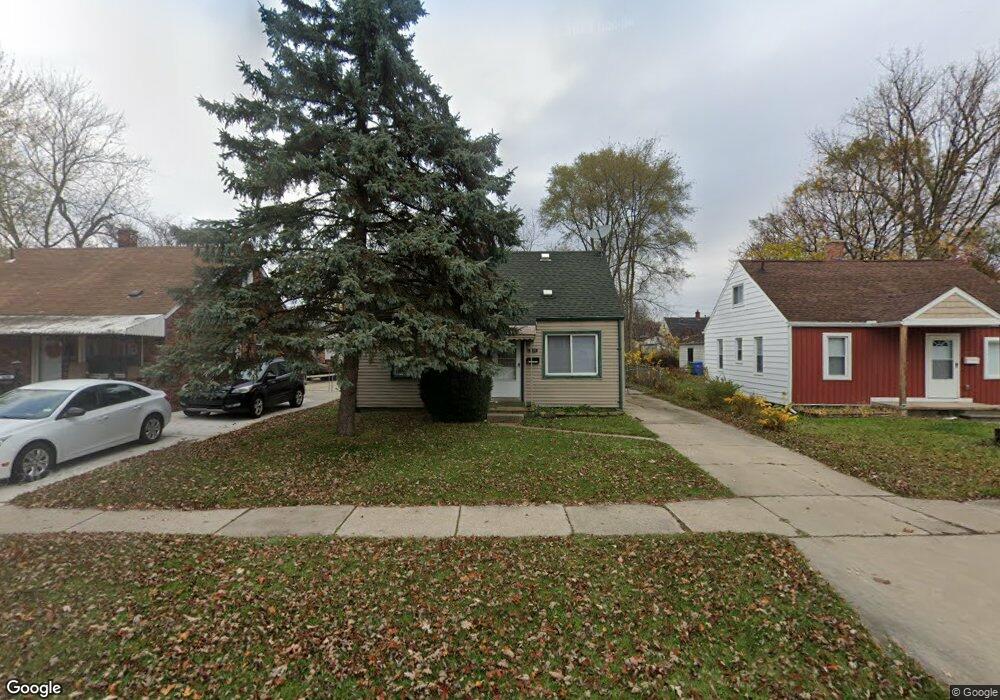
24370 Powers Ave Dearborn Heights, MI 48125
Estimated Value: $141,000 - $154,000
3
Beds
1
Bath
1,089
Sq Ft
$136/Sq Ft
Est. Value
About This Home
This home is located at 24370 Powers Ave, Dearborn Heights, MI 48125 and is currently estimated at $147,959, approximately $135 per square foot. 24370 Powers Ave is a home located in Wayne County with nearby schools including West Village Academy and Quest Charter Academy.
Ownership History
Date
Name
Owned For
Owner Type
Purchase Details
Closed on
Mar 27, 2009
Sold by
Mortgage Electronic Registration Systems
Bought by
Wells Fargo Bank Na
Current Estimated Value
Purchase Details
Closed on
May 16, 2007
Sold by
Conaway Elizabeth
Bought by
Mortgage Electronic Registration Systems
Purchase Details
Closed on
Aug 11, 2006
Sold by
Abbas Murray
Bought by
Conaway Elizabeth
Purchase Details
Closed on
Jul 25, 2001
Sold by
Reinagle Patricia
Bought by
Murray Abbas
Create a Home Valuation Report for This Property
The Home Valuation Report is an in-depth analysis detailing your home's value as well as a comparison with similar homes in the area
Home Values in the Area
Average Home Value in this Area
Purchase History
| Date | Buyer | Sale Price | Title Company |
|---|---|---|---|
| Wells Fargo Bank Na | -- | Prism Title & Closing Servic | |
| Mortgage Electronic Registration Systems | $89,000 | None Available | |
| Conaway Elizabeth | $120,000 | Multiple | |
| Murray Abbas | $84,400 | -- |
Source: Public Records
Tax History Compared to Growth
Tax History
| Year | Tax Paid | Tax Assessment Tax Assessment Total Assessment is a certain percentage of the fair market value that is determined by local assessors to be the total taxable value of land and additions on the property. | Land | Improvement |
|---|---|---|---|---|
| 2025 | $1,297 | $59,300 | $0 | $0 |
| 2024 | $1,297 | $53,100 | $0 | $0 |
| 2023 | $1,179 | $46,100 | $0 | $0 |
| 2022 | $1,736 | $39,700 | $0 | $0 |
| 2021 | $1,724 | $34,500 | $0 | $0 |
| 2019 | $1,593 | $27,100 | $0 | $0 |
| 2018 | $1,022 | $24,200 | $0 | $0 |
| 2017 | $1,056 | $24,100 | $0 | $0 |
| 2016 | $1,515 | $24,400 | $0 | $0 |
| 2015 | $2,270 | $22,700 | $0 | $0 |
| 2013 | $2,360 | $24,600 | $0 | $0 |
| 2010 | -- | $28,600 | $0 | $0 |
Source: Public Records
Map
Nearby Homes
- 24360 Pennie St
- 24339 Eton Ave
- 24443 Powers Ave
- 24117 Eton Ave
- 24035 Currier St
- 24727 Hopkins St
- 24754 Annapolis St
- 4856 Carolee Ln
- 24426 Lehigh St
- 4901 Cornell St
- 24409 Stanford St
- 4489 Westpoint St
- 24635 Stanford St
- 5689 Cornell St
- 4665 Syracuse St
- 4506 Syracuse St
- 4474 Syracuse St
- 4147 Westlake St
- 5671 Syracuse St
- 5118 Michael St
- 24380 Powers Ave
- 24362 Powers Ave
- 24388 Powers Ave Unit Bldg-Unit
- 24388 Powers Ave
- 24396 Powers Ave
- 24381 Pennie St
- 24389 Pennie St
- 24369 Pennie St
- 24381 Powers Ave
- 24369 Powers Ave
- 24405 Pennie St
- 24389 Powers Ave
- 24361 Powers Ave
- 24353 Pennie St
- 24401 Powers Ave Unit Bldg-Unit
- 24332 Powers Ave
- 24413 Pennie St
- 24414 Powers Ave
- 24351 Powers Ave
- 24345 Pennie St Unit Bldg-Unit