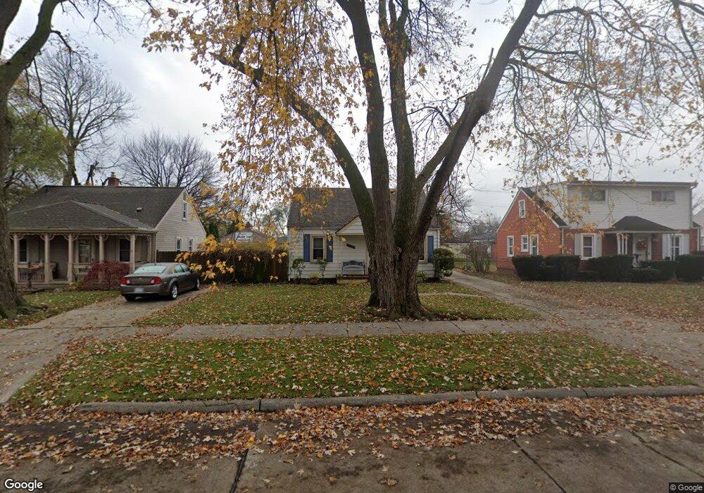
24389 Powers Ave Dearborn Heights, MI 48125
Estimated Value: $136,000 - $153,000
--
Bed
1
Bath
892
Sq Ft
$162/Sq Ft
Est. Value
About This Home
This home is located at 24389 Powers Ave, Dearborn Heights, MI 48125 and is currently estimated at $144,487, approximately $161 per square foot. 24389 Powers Ave is a home located in Wayne County with nearby schools including West Village Academy and Quest Charter Academy.
Ownership History
Date
Name
Owned For
Owner Type
Purchase Details
Closed on
May 6, 2008
Sold by
Henry H Phillips Revocable Trust
Bought by
Phillips John B
Current Estimated Value
Home Financials for this Owner
Home Financials are based on the most recent Mortgage that was taken out on this home.
Original Mortgage
$70,000
Outstanding Balance
$44,307
Interest Rate
5.87%
Mortgage Type
Seller Take Back
Estimated Equity
$100,180
Purchase Details
Closed on
Jun 3, 1998
Sold by
Brooks Jami and Fergu Jami
Bought by
Phillips Debra H
Purchase Details
Closed on
Mar 30, 1995
Sold by
Wojtylko Robert
Bought by
Brooks Joel and Brooks Jami
Create a Home Valuation Report for This Property
The Home Valuation Report is an in-depth analysis detailing your home's value as well as a comparison with similar homes in the area
Home Values in the Area
Average Home Value in this Area
Purchase History
| Date | Buyer | Sale Price | Title Company |
|---|---|---|---|
| Phillips John B | $70,000 | None Available | |
| Phillips Debra H | $61,000 | -- | |
| Brooks Joel | $36,900 | -- |
Source: Public Records
Mortgage History
| Date | Status | Borrower | Loan Amount |
|---|---|---|---|
| Open | Phillips John B | $70,000 |
Source: Public Records
Tax History Compared to Growth
Tax History
| Year | Tax Paid | Tax Assessment Tax Assessment Total Assessment is a certain percentage of the fair market value that is determined by local assessors to be the total taxable value of land and additions on the property. | Land | Improvement |
|---|---|---|---|---|
| 2025 | $1,068 | $60,500 | $0 | $0 |
| 2024 | $1,068 | $54,000 | $0 | $0 |
| 2023 | $959 | $46,800 | $0 | $0 |
| 2022 | $1,304 | $40,300 | $0 | $0 |
| 2021 | $1,306 | $35,000 | $0 | $0 |
| 2019 | $1,187 | $27,500 | $0 | $0 |
| 2018 | $831 | $24,800 | $0 | $0 |
| 2017 | $655 | $24,800 | $0 | $0 |
| 2016 | $1,130 | $25,100 | $0 | $0 |
| 2015 | $2,330 | $23,300 | $0 | $0 |
| 2013 | $2,430 | $25,200 | $0 | $0 |
| 2010 | -- | $29,500 | $0 | $0 |
Source: Public Records
Map
Nearby Homes
- 24443 Powers Ave
- 24360 Pennie St
- 24339 Eton Ave
- 24035 Currier St
- 24117 Eton Ave
- 4856 Carolee Ln
- 24754 Annapolis St
- 24727 Hopkins St
- 5689 Cornell St
- 4901 Cornell St
- 24426 Lehigh St
- 4489 Westpoint St
- 5671 Syracuse St
- 24409 Stanford St
- 24635 Stanford St
- 4665 Syracuse St
- 5118 Michael St
- 4506 Syracuse St
- 5963 Vivian St
- 4474 Syracuse St
- 24401 Powers Ave Unit Bldg-Unit
- 24381 Powers Ave
- 24369 Powers Ave
- 24413 Powers Ave
- 24361 Powers Ave
- 24394 Currier St
- 24386 Currier St
- 24402 Currier St
- 24378 Currier St
- 24421 Powers Ave
- 24410 Currier St
- 24370 Currier St
- 24380 Powers Ave
- 24388 Powers Ave Unit Bldg-Unit
- 24388 Powers Ave
- 24370 Powers Ave
- 24396 Powers Ave
- 24418 Currier St
- 24362 Currier St
- 24351 Powers Ave