Estimated Value: $440,000 - $644,000
2
Beds
2
Baths
1,443
Sq Ft
$358/Sq Ft
Est. Value
About This Home
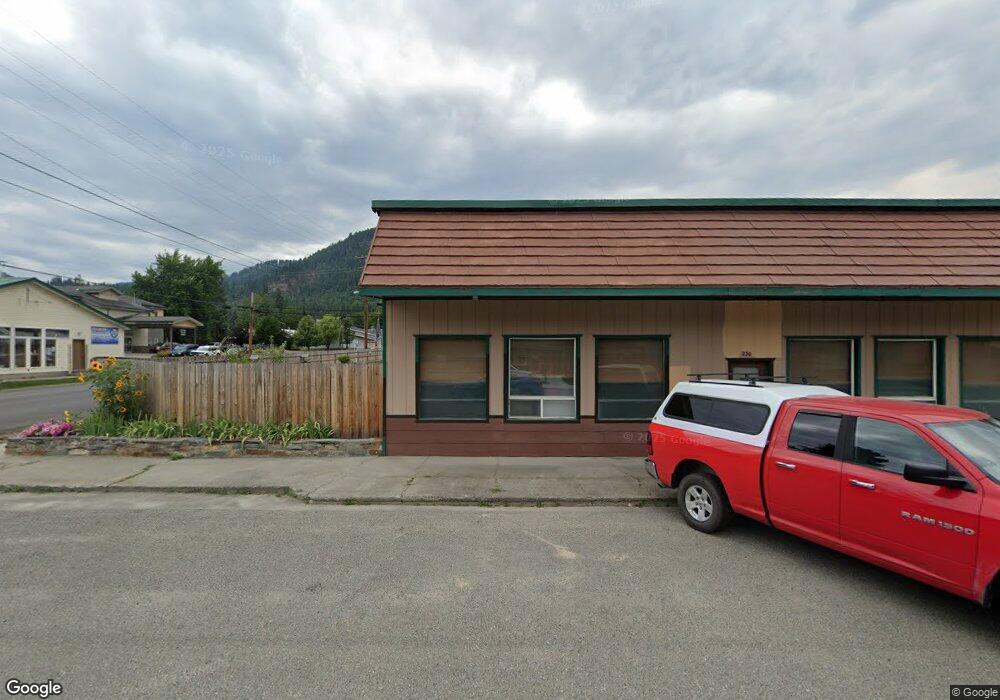
This home is located at 244 E Kootenai Ave, Troy, MT 59935 and is currently estimated at $517,301, approximately $358 per square foot. 244 E Kootenai Ave is a home located in Lincoln County with nearby schools including W.F. Morrison School, Troy Junior High School, and Troy High School.
Ownership History
Date
Name
Owned For
Owner Type
Purchase Details
Closed on
May 5, 2025
Sold by
Hutchings Anthony and Hutchings Danica
Bought by
Holmes David Ray and Holmes Terresa Mae
Current Estimated Value
Purchase Details
Closed on
Jan 12, 2023
Sold by
Conkel Fred
Bought by
Hutchings Anthony and Hutchings Danica
Purchase Details
Closed on
Jan 25, 2008
Sold by
Spears Norman Louis and Spears Hilda E
Bought by
Macleod Roderick J and Macleod Janice L
Create a Home Valuation Report for This Property
The Home Valuation Report is an in-depth analysis detailing your home's value as well as a comparison with similar homes in the area
Home Values in the Area
Average Home Value in this Area
Purchase History
| Date | Buyer | Sale Price | Title Company |
|---|---|---|---|
| Holmes David Ray | -- | Flying S Title & Escrow | |
| Hutchings Anthony | -- | -- | |
| Macleod Roderick J | -- | Lincoln County Title Co |
Source: Public Records
Tax History Compared to Growth
Tax History
| Year | Tax Paid | Tax Assessment Tax Assessment Total Assessment is a certain percentage of the fair market value that is determined by local assessors to be the total taxable value of land and additions on the property. | Land | Improvement |
|---|---|---|---|---|
| 2025 | $1,809 | $463,400 | $0 | $0 |
| 2024 | $2,458 | $381,500 | $0 | $0 |
| 2023 | $3,292 | $381,500 | $0 | $0 |
| 2022 | $2,421 | $296,400 | $0 | $0 |
| 2021 | $2,604 | $296,400 | $0 | $0 |
| 2020 | $2,038 | $213,400 | $0 | $0 |
| 2019 | $1,839 | $188,700 | $0 | $0 |
| 2018 | $1,762 | $181,500 | $0 | $0 |
| 2017 | $1,543 | $181,500 | $0 | $0 |
| 2016 | $1,655 | $175,700 | $0 | $0 |
| 2015 | $1,283 | $175,700 | $0 | $0 |
| 2014 | $1,550 | $111,035 | $0 | $0 |
Source: Public Records
Map
Nearby Homes
- Parcel A N Kootenai Dr
- Parcel B N Kootenai Dr
- 707 E Grant Ave
- 106 N 6th St
- 514 Mineral Ave
- TBD Dent Ave
- 318 E Kootenai Ave
- 209 Mineral Ave
- 206 Mineral Ave
- 205 E Spokane Ave
- 0000 Obrien Creek Rd
- 158 Twisted Branch Ln
- 708 N 3rd St
- 296 Riverside Ave
- 687 Iron Creek Rd
- 1278 Hunts Mill Rd
- 16995 Us Highway 2
- 181 Wapiti Way
- 48 Silvertip Way
- 87 Amber Rd
- 244 N Kootenai Dr
- 202 N Kootenai Dr
- 203 N Kootenai Dr
- NA N Kootenai Dr
- Lot 37 N Kootenai Dr
- 33 Pike Dr
- 142 Kootenai Dr
- 104 Kootenai Dr
- 32 Pike Dr
- 101 Pike Dr
- 902 E Missoula Ave
- 320 Kootenai Ave
- 904 E Missoula Ave
- 129 Pike Dr
- 320 N Kootenai Dr
- 714 E Missoula Ave
- 87 Kootenai Dr
- NHN N Kootenai Dr
- 914 E Missoula Ave
- 138 Pike Dr