Estimated Value: $201,132 - $229,000
3
Beds
1
Bath
1,489
Sq Ft
$143/Sq Ft
Est. Value
About This Home
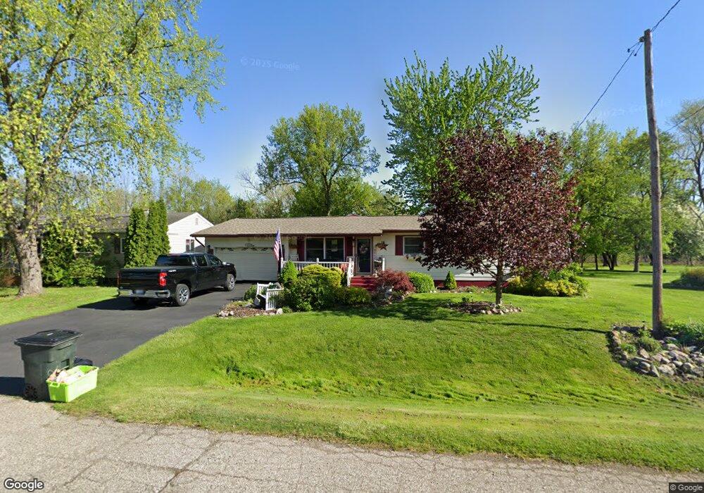
This home is located at 2440 Will Jo Ln, Flint, MI 48507 and is currently estimated at $213,033, approximately $143 per square foot. 2440 Will Jo Ln is a home located in Genesee County with nearby schools including Carman-Ainsworth High School and Madison Academy - Elementary School.
Ownership History
Date
Name
Owned For
Owner Type
Purchase Details
Closed on
Apr 15, 2019
Sold by
Moore Hugh M and Moore Renee A
Bought by
Moore Renee A and Cox James L
Current Estimated Value
Purchase Details
Closed on
Dec 28, 2018
Sold by
Cox Moore Renee A
Bought by
Moore Hugh M and Cox Moore Renee A
Home Financials for this Owner
Home Financials are based on the most recent Mortgage that was taken out on this home.
Original Mortgage
$104,000
Outstanding Balance
$91,626
Interest Rate
4.8%
Mortgage Type
New Conventional
Estimated Equity
$121,407
Purchase Details
Closed on
Oct 8, 2010
Sold by
Rider Adren E and Rider Betty J
Bought by
Moore Renee A and Cox Renee A
Purchase Details
Closed on
Jun 11, 2009
Sold by
Cox Moore Renee A and Estate Of James Everett Cox
Bought by
Cox Moore Renee A
Create a Home Valuation Report for This Property
The Home Valuation Report is an in-depth analysis detailing your home's value as well as a comparison with similar homes in the area
Home Values in the Area
Average Home Value in this Area
Purchase History
| Date | Buyer | Sale Price | Title Company |
|---|---|---|---|
| Moore Renee A | -- | None Available | |
| Moore Hugh M | -- | Cislo Title Co | |
| Moore Renee A | $17,000 | None Available | |
| Cox Moore Renee A | -- | None Available |
Source: Public Records
Mortgage History
| Date | Status | Borrower | Loan Amount |
|---|---|---|---|
| Open | Moore Hugh M | $104,000 |
Source: Public Records
Tax History
| Year | Tax Paid | Tax Assessment Tax Assessment Total Assessment is a certain percentage of the fair market value that is determined by local assessors to be the total taxable value of land and additions on the property. | Land | Improvement |
|---|---|---|---|---|
| 2025 | $2,385 | $112,000 | $0 | $0 |
| 2024 | $1,241 | $101,300 | $0 | $0 |
| 2023 | $1,184 | $87,900 | $0 | $0 |
| 2022 | $1,032 | $72,900 | $0 | $0 |
| 2021 | $2,107 | $68,300 | $0 | $0 |
| 2020 | $1,064 | $62,400 | $0 | $0 |
| 2019 | $1,049 | $56,600 | $0 | $0 |
| 2018 | $1,650 | $46,300 | $0 | $0 |
| 2017 | $1,587 | $46,300 | $0 | $0 |
| 2016 | $1,633 | $44,900 | $0 | $0 |
| 2015 | $1,454 | $38,000 | $0 | $0 |
| 2014 | $863 | $36,400 | $0 | $0 |
| 2012 | -- | $36,800 | $36,800 | $0 |
Source: Public Records
Map
Nearby Homes
- 2051 W Maple Ave
- 4462 Westmont Dr
- 2077 Kingswood Dr
- 2029 Gerard St
- G4203 van Slyke Rd
- 1489 Maria St
- 1408 Williamsburg Rd
- 1151 Bristol Rd
- 5366 van Slyke Rd
- 5131 Gateway Centre Blvd
- 1508 W Bristol Rd
- 4139 Moulton Dr
- 5141 W Bristol Rd
- 4444 Carmanwood Dr
- 4460 Bristolwood Dr
- 6042 Birch Dr
- 1203 Pickwick Place
- 1446 Stephens Ave
- 2502 Hutchinson Ln
- 1111 Trotwood Ln
- 2448 Will Jo Ln
- 2424 Will Jo Ln
- 2418 Will Jo Ln
- 2458 Will Jo Ln
- 2439 Will Jo Ln
- 2443 Will Jo Ln
- 4420 Sheldon Ln
- 2451 Will Jo Ln
- 2429 Will Jo Ln
- 2457 Will Jo Ln
- 2468 Will Jo Ln
- 2465 Will Jo Ln
- 2474 Will Jo Ln
- 2438 Sue Ann Ln
- 4409 Sheldon Ln
- 4409 Sheldon Ln
- 2432 Sue Ann Ln
- 2444 Sue Ann Ln
- 4417 Sheldon Ln
- 2471 Will Jo Ln
Your Personal Tour Guide
Ask me questions while you tour the home.