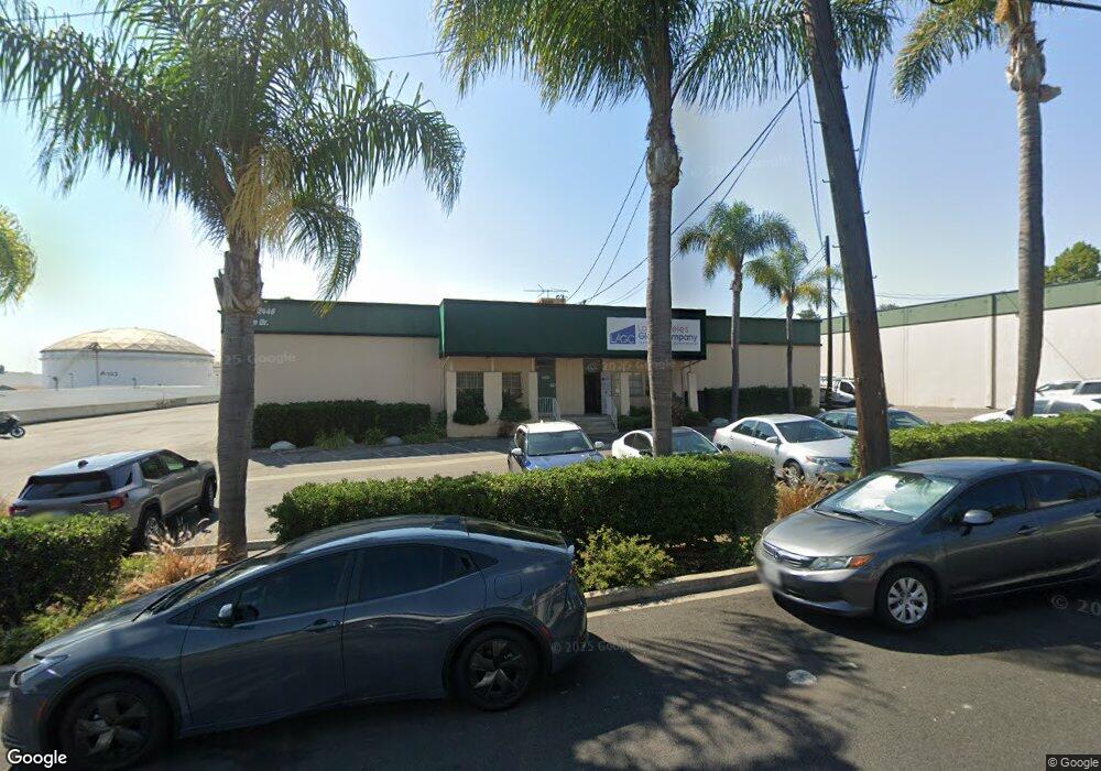
2446 N Palm Dr Signal Hill, CA 90755
--
Bed
11
Baths
43,600
Sq Ft
3.04
Acres
About This Home
This home is located at 2446 N Palm Dr, Signal Hill, CA 90755. 2446 N Palm Dr is a home located in Los Angeles County with nearby schools including Alvarado Elementary, Nelson Academy, and Woodrow Wilson High School.
Ownership History
Date
Name
Owned For
Owner Type
Purchase Details
Closed on
Dec 29, 2014
Sold by
The Herley Family Limited Partnership
Bought by
Herley David M and Orio Erin Patricia D
Purchase Details
Closed on
Dec 26, 2014
Sold by
Herley David M and Orio Erin Patricia D
Bought by
Herley Properties Llc
Purchase Details
Closed on
Aug 30, 2013
Sold by
Herley David M and Orio Erin Patricia D
Bought by
Herley Properties Llc
Purchase Details
Closed on
Dec 21, 2012
Sold by
Herley James E and The J E Herley 1990 Family Tru
Bought by
Herley David M and Dorio Erin Patricia
Purchase Details
Closed on
Dec 23, 1993
Sold by
Herley David M and Dorio Erin H
Bought by
The Herley Family Ltd Partnership Agreem
Create a Home Valuation Report for This Property
The Home Valuation Report is an in-depth analysis detailing your home's value as well as a comparison with similar homes in the area
Home Values in the Area
Average Home Value in this Area
Purchase History
| Date | Buyer | Sale Price | Title Company |
|---|---|---|---|
| Herley David M | -- | None Available | |
| Herley Properties Llc | -- | None Available | |
| Herley Properties Llc | -- | None Available | |
| Herley David M | -- | None Available | |
| Herley James E | -- | None Available | |
| The Herley Family Ltd Partnership Agreem | -- | -- | |
| Herley David M | -- | -- | |
| Herley James E | -- | -- |
Source: Public Records
Tax History Compared to Growth
Tax History
| Year | Tax Paid | Tax Assessment Tax Assessment Total Assessment is a certain percentage of the fair market value that is determined by local assessors to be the total taxable value of land and additions on the property. | Land | Improvement |
|---|---|---|---|---|
| 2025 | $21,505 | $906,860 | $394,712 | $512,148 |
| 2024 | $21,505 | $889,079 | $386,973 | $502,106 |
| 2023 | $21,256 | $871,647 | $379,386 | $492,261 |
| 2022 | $20,451 | $854,557 | $371,948 | $482,609 |
| 2021 | $19,868 | $837,802 | $364,655 | $473,147 |
| 2019 | $19,606 | $812,954 | $353,840 | $459,114 |
| 2018 | $16,549 | $797,014 | $346,902 | $450,112 |
| 2016 | $14,996 | $766,067 | $333,432 | $432,635 |
| 2015 | $14,619 | $754,561 | $328,424 | $426,137 |
| 2014 | $14,656 | $739,781 | $321,991 | $417,790 |
Source: Public Records
Map
Nearby Homes
- 2501 Temple Ave
- 2700 E Panorama Dr Unit 402
- 2199 Ohio Ave
- 2215 Molino Ave Unit C
- 2240 Stanley Ave Unit 5
- 2150 Ohio Ave Unit E
- 2125 Ridgeview Terrace Dr
- 2071 Crescent Dr
- 2205 Starlight Ln
- 3416 Hathaway Ave Unit 118
- 3456 Hathaway Ave Unit 338
- 3464 Hathaway Ave Unit 251
- 2722 E 20th St Unit 104
- 3247 E Grant St
- 1994 Stanley Ave
- 2271 Mira Mar Ave
- 1988 Junipero Ave
- 2231 Saint Louis Ave Unit 101B
- 2240 N Legion Dr Unit 217
- 2510 Termino Ave
- 2400 N Palm Dr
- 2400 N Palm Dr Unit 2446
- 2400 N Palm Dr Unit 2400
- 2400 N Palm Dr Unit 2444
- 2402 N Palm Dr
- 2444 N Palm Dr
- 2444 N Palm Dr Unit 2444
- 2995 Hathaway Ct
- 2488 Maxson Ct
- 2480 Maxson Ct
- 2472 Maxson Ct
- 2464 Maxson Ct
- 2456 Maxson Ct
- 2977 Hathaway Ct
- 2496 Maxson Ct
- 2448 Maxson Ct
- 2950 Hathaway Ct
- 2959 Hathaway Ct
- 2440 Maxson Ct
- 2950 Hathaway Ct