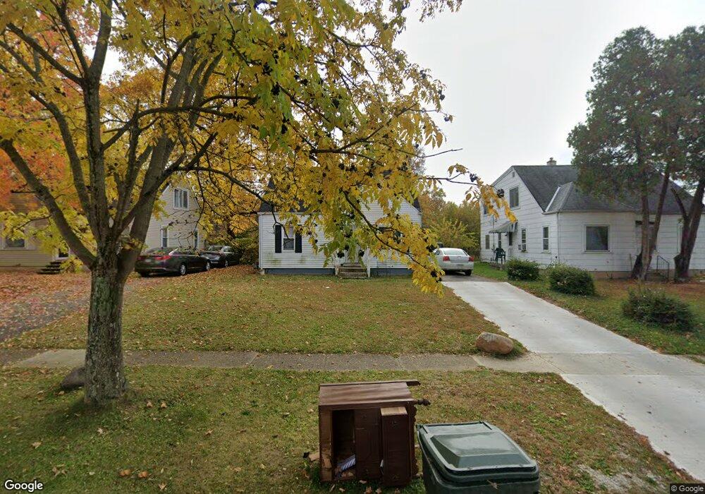
2447 Meredith Dr Columbus, OH 43219
Brittany Hills NeighborhoodEstimated Value: $113,000 - $195,000
3
Beds
1
Bath
1,044
Sq Ft
$140/Sq Ft
Est. Value
About This Home
This home is located at 2447 Meredith Dr, Columbus, OH 43219 and is currently estimated at $146,128, approximately $139 per square foot. 2447 Meredith Dr is a home located in Franklin County with nearby schools including South Mifflin Stem Academy (K-6), Linden-Mckinley Stem School On Arcadia, and Cesar Chavez College Preparatory School.
Ownership History
Date
Name
Owned For
Owner Type
Purchase Details
Closed on
Mar 18, 2002
Sold by
Hud
Bought by
Adedapo Samson O and Adedapo Veronica I
Current Estimated Value
Purchase Details
Closed on
Aug 15, 1997
Sold by
Stokes Jo Ann
Bought by
Eaves Wayne A
Home Financials for this Owner
Home Financials are based on the most recent Mortgage that was taken out on this home.
Original Mortgage
$45,594
Interest Rate
7.56%
Mortgage Type
FHA
Create a Home Valuation Report for This Property
The Home Valuation Report is an in-depth analysis detailing your home's value as well as a comparison with similar homes in the area
Home Values in the Area
Average Home Value in this Area
Purchase History
| Date | Buyer | Sale Price | Title Company |
|---|---|---|---|
| Adedapo Samson O | $49,000 | Contract Processing & Title | |
| Eaves Wayne A | $46,000 | Chicago Title |
Source: Public Records
Mortgage History
| Date | Status | Borrower | Loan Amount |
|---|---|---|---|
| Previous Owner | Eaves Wayne A | $45,594 |
Source: Public Records
Tax History Compared to Growth
Tax History
| Year | Tax Paid | Tax Assessment Tax Assessment Total Assessment is a certain percentage of the fair market value that is determined by local assessors to be the total taxable value of land and additions on the property. | Land | Improvement |
|---|---|---|---|---|
| 2024 | $1,587 | $34,620 | $8,020 | $26,600 |
| 2023 | $1,567 | $34,615 | $8,015 | $26,600 |
| 2022 | $774 | $14,560 | $2,310 | $12,250 |
| 2021 | $775 | $14,560 | $2,310 | $12,250 |
| 2020 | $1,922 | $14,560 | $2,310 | $12,250 |
| 2019 | $710 | $11,420 | $1,860 | $9,560 |
| 2018 | $835 | $11,420 | $1,860 | $9,560 |
| 2017 | $1,284 | $11,420 | $1,860 | $9,560 |
| 2016 | $1,684 | $15,550 | $2,560 | $12,990 |
| 2015 | $962 | $15,550 | $2,560 | $12,990 |
| 2014 | $964 | $15,550 | $2,560 | $12,990 |
| 2013 | $841 | $17,255 | $2,835 | $14,420 |
Source: Public Records
Map
Nearby Homes
- 2424 Holt Ave
- 2483 Vendome Dr
- 2228 Holt Ave
- 1794 Devonshire Rd
- 1785 Daisyfield Dr Unit 199
- 2398 Dunkirk Dr
- 1808 Brentnell Ave
- 1816 Brentnell Ave
- 1790 Marston Rd
- 1789 Marston Rd
- 2336 Edenburgh Dr S
- 1860 Meadowlawn Dr Unit 75
- 2288 Woodward Ave
- 2736 Bellero Way Unit 94
- 1367 Brookcliff Ave
- 1275 Woodnell Ave
- 2471 Mock Rd
- 1065 Sunbury Rd
- 1978 Argyle Dr
- 0 Mock Rd
- 2439 Meredith Dr
- 2453 Meredith Dr
- 2459 Meredith Dr
- 2433 Meredith Dr
- 2438 Argyle Dr
- 2444 Argyle Dr
- 2432 Argyle Dr
- 2465 Meredith Dr
- 2427 Meredith Dr
- 2424 Argyle Dr
- 2450 Argyle Dr
- 2448 Meredith Dr
- 2473 Meredith Dr
- 2421 Meredith Dr
- 2418 Argyle Dr
- 2442 Meredith Dr
- 2456 Meredith Dr
- 2436 Meredith Dr
- 2462 Meredith Dr
- 2464 Argyle Dr