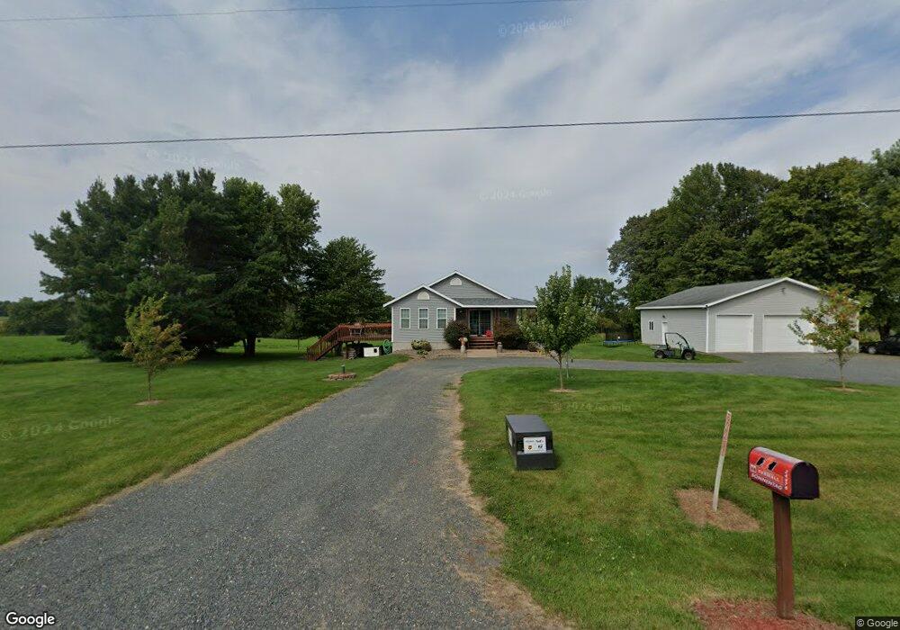
24476 10th Ave Cadott, WI 54727
Estimated Value: $306,000 - $342,000
3
Beds
2
Baths
1,704
Sq Ft
$193/Sq Ft
Est. Value
About This Home
This home is located at 24476 10th Ave, Cadott, WI 54727 and is currently estimated at $328,121, approximately $192 per square foot. 24476 10th Ave is a home located in Chippewa County with nearby schools including Cadott Elementary School and Cadott High School.
Ownership History
Date
Name
Owned For
Owner Type
Purchase Details
Closed on
Jul 29, 2013
Sold by
Plaster Heidi M
Bought by
Sonnentag Mitchell
Current Estimated Value
Purchase Details
Closed on
Aug 31, 2005
Sold by
Brisky Robert A and Brisky Robert
Bought by
Plaster Heidi M
Home Financials for this Owner
Home Financials are based on the most recent Mortgage that was taken out on this home.
Original Mortgage
$102,320
Interest Rate
5.82%
Mortgage Type
New Conventional
Purchase Details
Closed on
Dec 30, 2004
Sold by
Cobb Luke B and Teigen Jennifer J
Bought by
Brisky Robert
Home Financials for this Owner
Home Financials are based on the most recent Mortgage that was taken out on this home.
Original Mortgage
$110,400
Interest Rate
9.95%
Mortgage Type
Adjustable Rate Mortgage/ARM
Create a Home Valuation Report for This Property
The Home Valuation Report is an in-depth analysis detailing your home's value as well as a comparison with similar homes in the area
Purchase History
| Date | Buyer | Sale Price | Title Company |
|---|---|---|---|
| Sonnentag Mitchell | $142,000 | -- | |
| Plaster Heidi M | $127,900 | Chippewa County Abstract & T | |
| Brisky Robert | $138,000 | Reliance Title Services Llc |
Source: Public Records
Mortgage History
| Date | Status | Borrower | Loan Amount |
|---|---|---|---|
| Previous Owner | Plaster Heidi M | $102,320 | |
| Previous Owner | Brisky Robert | $110,400 |
Source: Public Records
Tax History
| Year | Tax Paid | Tax Assessment Tax Assessment Total Assessment is a certain percentage of the fair market value that is determined by local assessors to be the total taxable value of land and additions on the property. | Land | Improvement |
|---|---|---|---|---|
| 2024 | $2,660 | $176,100 | $19,800 | $156,300 |
| 2023 | $2,352 | $176,100 | $19,800 | $156,300 |
| 2022 | $2,364 | $176,100 | $19,800 | $156,300 |
| 2021 | $2,242 | $176,100 | $19,800 | $156,300 |
| 2020 | $2,444 | $176,100 | $19,800 | $156,300 |
| 2019 | $2,347 | $146,300 | $12,500 | $133,800 |
| 2018 | $2,485 | $146,300 | $12,500 | $133,800 |
| 2017 | $2,316 | $146,300 | $12,500 | $133,800 |
| 2016 | $2,168 | $146,300 | $12,500 | $133,800 |
| 2015 | $2,089 | $146,300 | $12,500 | $133,800 |
| 2014 | $1,990 | $146,300 | $12,500 | $133,800 |
Source: Public Records
Map
Nearby Homes
- E19152 County Road X
- 17085 E County Road D
- 21274 30th Ave
- Lots 20 & 21 250th St
- 1095 S 140th Ave
- 1510 198th St
- 17510 County Road Nl
- 22988 County Highway X
- E19460 County Road Nl
- 0 Wisconsin 27
- 24888 65th Ave
- Lot 42 181st St
- 439 Hartford St
- 445 Hartford St
- 232 E M D St
- 3 N Main St
- 4 N Main St
- 2 N Main St
- Lot 1 Main St
- 206 E Central St Unit 206 & 208
- 24514 10th Ave
- N2830 Oakdale Rd
- LOT 1 Oakdale Rd
- LOT 3 Oakdale Rd
- LOT 2 Oakdale Rd
- LOT4 Oakdale Rd
- 2830 N Oak Dale Dr
- 0 10th Ave Unit 4855850
- 0 Oakdale Rd
- Lot 1 240th St
- 0 240th St
- N2480 Oakdale Rd
- 25052 10th Ave
- 0 Oakdale Rd
- 2830 Oakdale Rd
- N2750 Gravel Pit Rd
- E22105 County Line Rd
- N2395 Gravel Pit Rd
- E18165 Grand View Dr
- N2450 Oakdale Rd
Your Personal Tour Guide
Ask me questions while you tour the home.