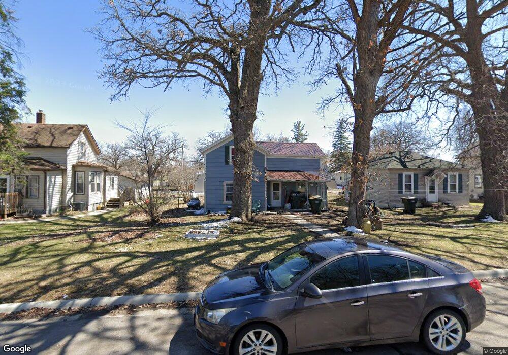
245 6th Ave N Brownton, MN 55312
Estimated Value: $141,147 - $213,000
3
Beds
1
Bath
1,182
Sq Ft
$155/Sq Ft
Est. Value
About This Home
This home is located at 245 6th Ave N, Brownton, MN 55312 and is currently estimated at $183,537, approximately $155 per square foot. 245 6th Ave N is a home located in McLeod County with nearby schools including Lincoln Elementary School, Lakeside Elementary School, and Glencoe-Silver Lake Jr. High School.
Ownership History
Date
Name
Owned For
Owner Type
Purchase Details
Closed on
Jan 1, 2025
Sold by
Neisen John
Bought by
Jj & Company Llc
Current Estimated Value
Purchase Details
Closed on
May 28, 2020
Sold by
Neisen John N
Bought by
Nelson Bryce L and Nelson Missty L
Purchase Details
Closed on
Sep 19, 2019
Sold by
Olson Nicholas M
Bought by
Neisen John N
Purchase Details
Closed on
Sep 24, 2010
Sold by
Neisen John N
Bought by
Olson Nicholas M
Create a Home Valuation Report for This Property
The Home Valuation Report is an in-depth analysis detailing your home's value as well as a comparison with similar homes in the area
Home Values in the Area
Average Home Value in this Area
Purchase History
| Date | Buyer | Sale Price | Title Company |
|---|---|---|---|
| Jj & Company Llc | $55,000 | -- | |
| Nelson Bryce L | -- | Mcleod County Abstract & Tit | |
| Neisen John N | $11,000 | Mcleod County Abstract & Tit | |
| Olson Nicholas M | $32,000 | -- |
Source: Public Records
Tax History Compared to Growth
Tax History
| Year | Tax Paid | Tax Assessment Tax Assessment Total Assessment is a certain percentage of the fair market value that is determined by local assessors to be the total taxable value of land and additions on the property. | Land | Improvement |
|---|---|---|---|---|
| 2024 | $1,918 | $99,500 | $17,900 | $81,600 |
| 2023 | $2,009 | $99,500 | $17,900 | $81,600 |
| 2022 | $1,692 | $84,700 | $15,600 | $69,100 |
| 2021 | $1,818 | $75,100 | $13,600 | $61,500 |
| 2020 | $2,556 | $79,700 | $13,600 | $66,100 |
| 2019 | $1,648 | $71,600 | $12,300 | $59,300 |
| 2018 | $1,660 | $0 | $0 | $0 |
| 2017 | $1,758 | $0 | $0 | $0 |
| 2016 | $1,688 | $0 | $0 | $0 |
| 2015 | $1,528 | $0 | $0 | $0 |
| 2014 | -- | $0 | $0 | $0 |
Source: Public Records
Map
Nearby Homes
- 531 2nd St N
- 752 2nd St N
- 237 5th St N
- 221 3rd Ave S
- 122 2nd Ave S
- 304 1st Ave N
- xxx Lot 3 Division St W
- 7612 Plum Ave
- Lot 2 U S Highway 212
- XXX US Hwy 212
- xxx Lot 2 Us Hwy 212
- 16452 90th St
- 11655 Sunset Cir
- 11742 Sunset Cir
- 7900 Lace Ave
- 13198 100th St
- 7900 Lace Ave N
- Lot 2 Tagus Ave
- 12893 County Road 7
- 15554 130th St