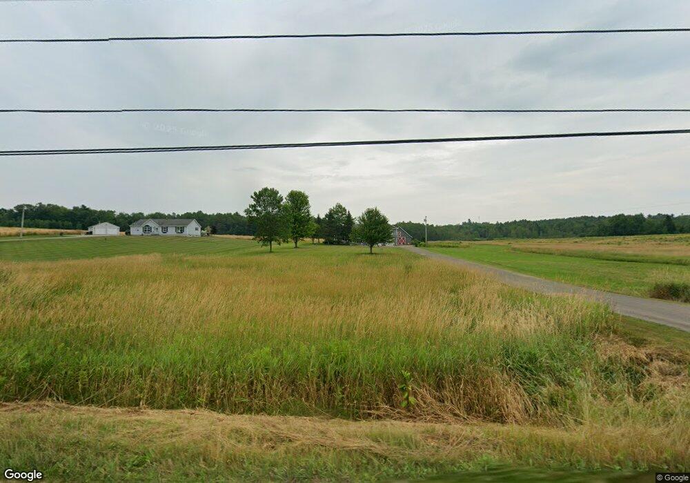
245 Coles Corner Rd Winterport, ME 04496
Estimated Value: $345,000 - $389,314
3
Beds
3
Baths
1,708
Sq Ft
$212/Sq Ft
Est. Value
About This Home
This home is located at 245 Coles Corner Rd, Winterport, ME 04496 and is currently estimated at $362,329, approximately $212 per square foot. 245 Coles Corner Rd is a home located in Waldo County.
Ownership History
Date
Name
Owned For
Owner Type
Purchase Details
Closed on
May 16, 2023
Sold by
Chasse Brent A
Bought by
Chasse Jennifer L
Current Estimated Value
Purchase Details
Closed on
May 30, 2013
Sold by
Fhlmc
Bought by
Jacobs Nathanial C and Jacobs Sara E
Home Financials for this Owner
Home Financials are based on the most recent Mortgage that was taken out on this home.
Original Mortgage
$121,500
Interest Rate
3.45%
Mortgage Type
New Conventional
Purchase Details
Closed on
Aug 25, 2011
Sold by
Warren Joseph M and Jpmorgan Chase Bank
Bought by
Cuso Mortgage Corp
Purchase Details
Closed on
Aug 9, 2005
Sold by
Heinly Lee A and Heinly Judy D
Bought by
Warren Joseph M and Warren Nancy L
Home Financials for this Owner
Home Financials are based on the most recent Mortgage that was taken out on this home.
Original Mortgage
$160,000
Interest Rate
5.63%
Mortgage Type
Stand Alone Second
Create a Home Valuation Report for This Property
The Home Valuation Report is an in-depth analysis detailing your home's value as well as a comparison with similar homes in the area
Home Values in the Area
Average Home Value in this Area
Purchase History
| Date | Buyer | Sale Price | Title Company |
|---|---|---|---|
| Chasse Jennifer L | -- | None Available | |
| Chasse Jennifer L | -- | None Available | |
| Jacobs Nathanial C | $135,000 | -- | |
| Jacobs Nathanial C | $135,000 | -- | |
| Cuso Mortgage Corp | $151,511 | -- | |
| Cuso Mortgage Corp | $151,511 | -- | |
| Warren Joseph M | -- | -- | |
| Warren Joseph M | -- | -- | |
| Warren Joseph M | -- | -- |
Source: Public Records
Mortgage History
| Date | Status | Borrower | Loan Amount |
|---|---|---|---|
| Previous Owner | Jacobs Nathanial C | $121,500 | |
| Previous Owner | Warren Joseph M | $160,000 |
Source: Public Records
Tax History Compared to Growth
Tax History
| Year | Tax Paid | Tax Assessment Tax Assessment Total Assessment is a certain percentage of the fair market value that is determined by local assessors to be the total taxable value of land and additions on the property. | Land | Improvement |
|---|---|---|---|---|
| 2024 | $4,034 | $303,300 | $49,100 | $254,200 |
| 2016 | $2,830 | $207,500 | $38,300 | $169,200 |
| 2015 | $2,762 | $207,500 | $38,300 | $169,200 |
| 2014 | $2,778 | $207,500 | $38,300 | $169,200 |
| 2013 | $2,749 | $207,500 | $38,300 | $169,200 |
| 2010 | -- | $199,000 | $0 | $0 |
Source: Public Records
Map
Nearby Homes
- 5 Vero's Way
- Lot #4 Vero's Way
- 115 Cove Rd
- 33 Comikev Ln
- 19 Schoolhouse Rd
- 35 Hackett Rd
- 160 Baker Rd
- 7 Moyse Rd
- 307 Lebanon Rd
- 23 The Landing
- 985 N North Main St
- 696 Lebanon Rd
- 33 Coles Corner Rd
- 20 Memorial Dr
- 1031 N Main St
- 34 Blind Owl Ln
- 55 Lower Oak Point Rd
- 415 Monroe Rd
- 187 Lebanon Rd
- 177 Lebanon Rd
- 253 Coles Corner
- 270 Coles Corner Rd
- 262 Coles Corner Rd
- 251 Coles Corner Rd
- 235 Coles Corner Rd
- 261 Coles Corner Rd
- 219 Coles Corner Rd
- 217 Coles Corner Rd
- 271 Meadow Rd
- 215 Coles Corner Rd
- 275 Coles Corner Rd
- 267 Meadow Rd
- 278 Coles Corner Rd
- 272 Meadow Rd
- 207 Coles Corner Rd
- 283 Coles Corner Rd
- 284 Coles Corner Rd
- 276 Meadow Rd
- 284 Meadow Rd
- 279 Meadow Rd
