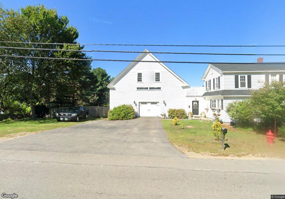
245 Dover Point Rd Dover, NH 03820
Dover Point NeighborhoodEstimated Value: $605,000 - $669,000
3
Beds
2
Baths
1,894
Sq Ft
$339/Sq Ft
Est. Value
About This Home
This home is located at 245 Dover Point Rd, Dover, NH 03820 and is currently estimated at $641,401, approximately $338 per square foot. 245 Dover Point Rd is a home located in Strafford County with nearby schools including Garrison School, Dover Middle School, and Dover Senior High School.
Ownership History
Date
Name
Owned For
Owner Type
Purchase Details
Closed on
Jul 16, 2013
Sold by
Degenaars Joel and Degenaars Paul L
Bought by
Degenaars Ft and Degenaars Joel
Current Estimated Value
Purchase Details
Closed on
May 1, 2006
Sold by
Castonguay Ft
Bought by
Smith Wayne A and Smith Sandra L
Purchase Details
Closed on
Feb 3, 1998
Sold by
Northam Bldrs Inc
Bought by
Castonguay Jeffrey W and Castonguay Sheree E
Home Financials for this Owner
Home Financials are based on the most recent Mortgage that was taken out on this home.
Original Mortgage
$128,221
Interest Rate
7.02%
Create a Home Valuation Report for This Property
The Home Valuation Report is an in-depth analysis detailing your home's value as well as a comparison with similar homes in the area
Home Values in the Area
Average Home Value in this Area
Purchase History
| Date | Buyer | Sale Price | Title Company |
|---|---|---|---|
| Degenaars Ft | -- | -- | |
| Smith Wayne A | $310,000 | -- | |
| Castonguay Jeffrey W | $130,000 | -- |
Source: Public Records
Mortgage History
| Date | Status | Borrower | Loan Amount |
|---|---|---|---|
| Previous Owner | Castonguay Jeffrey W | $128,221 |
Source: Public Records
Tax History
| Year | Tax Paid | Tax Assessment Tax Assessment Total Assessment is a certain percentage of the fair market value that is determined by local assessors to be the total taxable value of land and additions on the property. | Land | Improvement |
|---|---|---|---|---|
| 2024 | $10,046 | $552,900 | $180,700 | $372,200 |
| 2023 | $8,983 | $480,400 | $159,700 | $320,700 |
| 2022 | $9,011 | $454,200 | $159,700 | $294,500 |
| 2021 | $8,470 | $390,300 | $134,500 | $255,800 |
| 2020 | $8,551 | $344,100 | $134,500 | $209,600 |
| 2019 | $8,247 | $327,400 | $121,900 | $205,500 |
| 2018 | $7,700 | $309,000 | $109,300 | $199,700 |
| 2017 | $7,401 | $286,100 | $92,400 | $193,700 |
| 2016 | $7,046 | $268,000 | $85,200 | $182,800 |
| 2015 | $6,674 | $250,800 | $72,500 | $178,300 |
| 2014 | $6,523 | $250,800 | $72,500 | $178,300 |
| 2011 | $6,473 | $257,700 | $76,500 | $181,200 |
Source: Public Records
Map
Nearby Homes
- Slip B18 Little Bay
- 220 Dover Point Rd
- 21 Clearwater Dr
- 25 Fosters Dr
- 18 Deborah Ln
- 41 Clearwater Dr
- 0 Cote Dr Unit 55B
- 348 Dover Point Rd
- 354 Dover Point Rd
- 30 Cedar Point Rd
- 33 Little Bay Dr
- 13 Little Bay Dr
- 18 Little Bay Dr
- 65 Polly Ann Trailer Park
- 69 Polly Ann Trailer Park
- 16 Polly Ann Park
- 19 Lenox Dr Unit A
- 61 Beane Ln
- 4 Tanglewood Dr
- 6 Isaac Lucas Cir
- 10 Baldwin Way
- 247 Dover Point Rd
- 3 Baldwin Way
- 3 Roberta Dr
- 250 Dover Point Rd
- 14 Baldwin Way
- 248 Dover Point Rd
- 243 Dover Point Rd
- 9 Baldwin Way
- 253 Dover Point Rd
- 5 Roberta Dr
- 20 Baldwin Way
- 4 Roberta Dr
- 15 Baldwin Way
- 242 Dover Point Rd
- 241 Dover Point Rd
- 7 Roberta Dr
- 19 Baldwin Way
- 24 Baldwin Way
- 256A Dover Point Rd
Your Personal Tour Guide
Ask me questions while you tour the home.