Estimated Value: $1,564,000 - $1,628,000
3
Beds
3
Baths
18,768
Sq Ft
$85/Sq Ft
Est. Value
About This Home
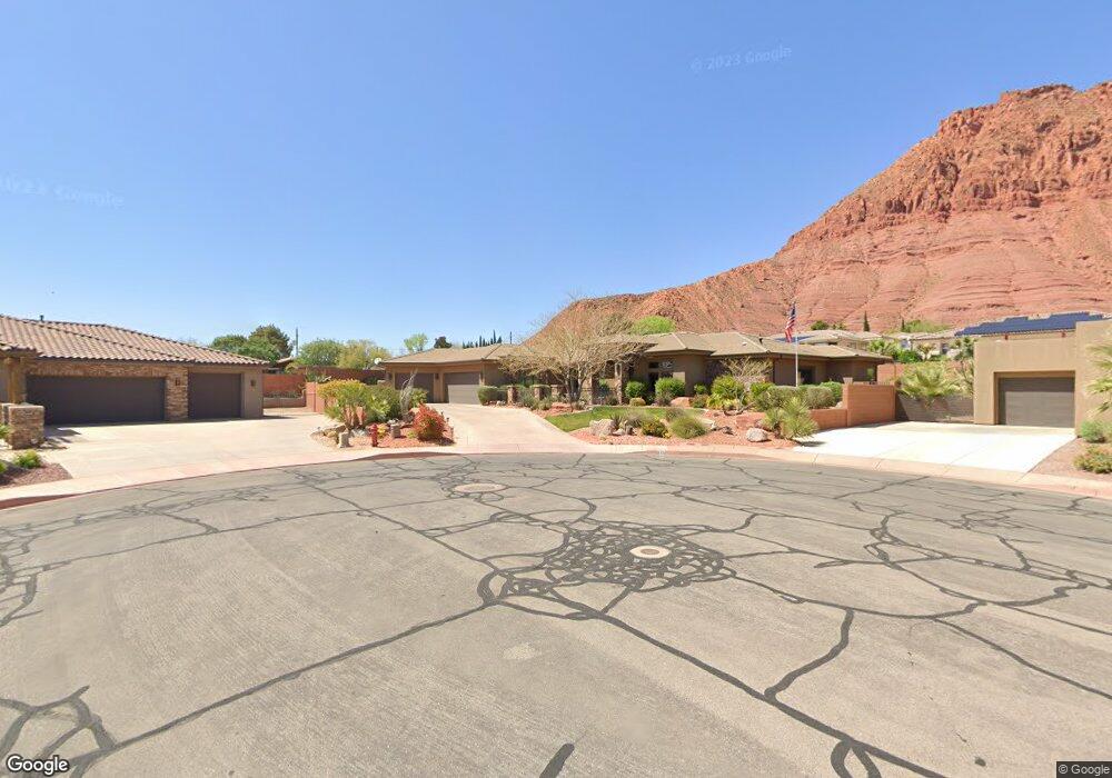
This home is located at 245 E 250 N, Ivins, UT 84738 and is currently estimated at $1,603,644, approximately $85 per square foot. 245 E 250 N is a home with nearby schools including Red Mountain School, Snow Canyon Middle School, and Lava Ridge Intermediate School.
Ownership History
Date
Name
Owned For
Owner Type
Purchase Details
Closed on
Feb 10, 2025
Sold by
Mcguire Kenneth E and Mcguire Evalyn B
Bought by
Mcguire Family Trust and Mcguire
Current Estimated Value
Purchase Details
Closed on
Mar 31, 2014
Sold by
Desert Sky Homes Llc
Bought by
Mcguire Kenneth and Mcguire Lyn
Home Financials for this Owner
Home Financials are based on the most recent Mortgage that was taken out on this home.
Original Mortgage
$75,000
Interest Rate
4.3%
Mortgage Type
Unknown
Purchase Details
Closed on
Feb 24, 2014
Sold by
Arbor Residential Properties L C
Bought by
Desert Sky Homes Llc
Home Financials for this Owner
Home Financials are based on the most recent Mortgage that was taken out on this home.
Original Mortgage
$75,000
Interest Rate
4.3%
Mortgage Type
Unknown
Purchase Details
Closed on
May 17, 2005
Sold by
Reverse Exchange Lc
Bought by
Simmons Legrande H and Simmons Coleen O
Create a Home Valuation Report for This Property
The Home Valuation Report is an in-depth analysis detailing your home's value as well as a comparison with similar homes in the area
Purchase History
| Date | Buyer | Sale Price | Title Company |
|---|---|---|---|
| Mcguire Family Trust | -- | None Listed On Document | |
| Mcguire Kenneth | -- | Skyview Title Ins Agency | |
| Desert Sky Homes Llc | -- | None Available | |
| Arbor Residential Properties Lc | -- | Meridian Title Co | |
| Simmons Legrande H | -- | Accommodation |
Source: Public Records
Mortgage History
| Date | Status | Borrower | Loan Amount |
|---|---|---|---|
| Previous Owner | Mcguire Kenneth | $75,000 |
Source: Public Records
Tax History
| Year | Tax Paid | Tax Assessment Tax Assessment Total Assessment is a certain percentage of the fair market value that is determined by local assessors to be the total taxable value of land and additions on the property. | Land | Improvement |
|---|---|---|---|---|
| 2025 | $5,422 | $846,340 | $181,500 | $664,840 |
| 2023 | $5,096 | $794,695 | $165,000 | $629,695 |
| 2022 | $5,513 | $788,865 | $155,100 | $633,765 |
| 2021 | $4,687 | $1,010,600 | $174,000 | $836,600 |
| 2020 | $4,487 | $870,300 | $138,000 | $732,300 |
| 2019 | $4,578 | $868,300 | $114,000 | $754,300 |
| 2018 | $4,393 | $428,780 | $0 | $0 |
| 2017 | $4,130 | $392,205 | $0 | $0 |
| 2016 | $4,259 | $373,560 | $0 | $0 |
| 2015 | $3,840 | $324,170 | $0 | $0 |
| 2014 | $1,167 | $99,000 | $0 | $0 |
Source: Public Records
Map
Nearby Homes
- 266 E 350 N
- 155 E 200 N
- 165 E 350 N
- 1312 Willow Way 1 Unit 1
- 543 W Fox Tail Way
- 310 N Main St
- 633 E Flint Rock Cir
- 676 E Palisades Dr
- 673 Coral Autumn Ln
- 163 S 480 E
- 691 Crimson Flare Ln
- 185 W Center St
- 88 N Apex Ln
- 143 N Apex Ln
- 328 N Harrier Ln
- 257 W Peaceful Ln
- 340 W Tonalli
- 278 N Falcon Ct
- 378 Redstone Ct
- 143 N Cortez Trail
Your Personal Tour Guide
Ask me questions while you tour the home.