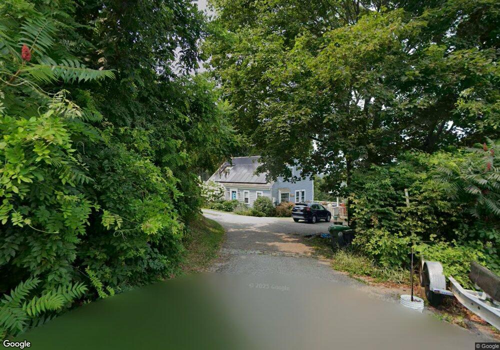
245 Elm St Marshfield, MA 02050
Estimated Value: $833,733 - $930,000
4
Beds
3
Baths
1,638
Sq Ft
$536/Sq Ft
Est. Value
About This Home
This home is located at 245 Elm St, Marshfield, MA 02050 and is currently estimated at $878,183, approximately $536 per square foot. 245 Elm St is a home located in Plymouth County with nearby schools including Eames Way School, Furnace Brook Middle School, and Marshfield High School.
Ownership History
Date
Name
Owned For
Owner Type
Purchase Details
Closed on
May 4, 2023
Sold by
Feeley Allison L
Bought by
Allison L Feeley T L and Allison Feeley
Current Estimated Value
Purchase Details
Closed on
May 2, 2003
Sold by
Tretheway Amy H and Tretheway Betsy D
Bought by
Desmond Maria J and Desmond Lawrence P
Home Financials for this Owner
Home Financials are based on the most recent Mortgage that was taken out on this home.
Original Mortgage
$42,350
Interest Rate
5.82%
Mortgage Type
Purchase Money Mortgage
Purchase Details
Closed on
Aug 1, 2002
Sold by
Leonard William J and Leonard Janet M
Bought by
Tretheway Amy H and Tretheway Betsy D
Home Financials for this Owner
Home Financials are based on the most recent Mortgage that was taken out on this home.
Original Mortgage
$400,000
Interest Rate
6.64%
Mortgage Type
Purchase Money Mortgage
Create a Home Valuation Report for This Property
The Home Valuation Report is an in-depth analysis detailing your home's value as well as a comparison with similar homes in the area
Home Values in the Area
Average Home Value in this Area
Purchase History
| Date | Buyer | Sale Price | Title Company |
|---|---|---|---|
| Allison L Feeley T L | -- | None Available | |
| Desmond Maria J | $423,500 | -- | |
| Desmond Maria J | $423,500 | -- | |
| Tretheway Amy H | $430,000 | -- | |
| Tretheway Amy H | $430,000 | -- |
Source: Public Records
Mortgage History
| Date | Status | Borrower | Loan Amount |
|---|---|---|---|
| Previous Owner | Desmond Maria J | $42,350 | |
| Previous Owner | Tretheway Amy H | $400,000 | |
| Previous Owner | Tretheway Amy H | $25,000 |
Source: Public Records
Tax History Compared to Growth
Tax History
| Year | Tax Paid | Tax Assessment Tax Assessment Total Assessment is a certain percentage of the fair market value that is determined by local assessors to be the total taxable value of land and additions on the property. | Land | Improvement |
|---|---|---|---|---|
| 2025 | $7,783 | $786,200 | $296,200 | $490,000 |
| 2024 | $7,510 | $722,800 | $282,100 | $440,700 |
| 2023 | $7,288 | $643,800 | $261,900 | $381,900 |
| 2022 | $6,933 | $535,400 | $211,500 | $323,900 |
| 2021 | $6,569 | $498,000 | $209,500 | $288,500 |
| 2020 | $6,397 | $479,900 | $191,400 | $288,500 |
| 2019 | $6,167 | $460,900 | $191,400 | $269,500 |
| 2018 | $5,980 | $447,300 | $191,400 | $255,900 |
| 2017 | $5,627 | $410,100 | $181,300 | $228,800 |
| 2016 | $5,399 | $389,000 | $171,200 | $217,800 |
| 2015 | $5,170 | $389,000 | $171,200 | $217,800 |
| 2014 | $4,826 | $363,100 | $157,100 | $206,000 |
Source: Public Records
Map
Nearby Homes