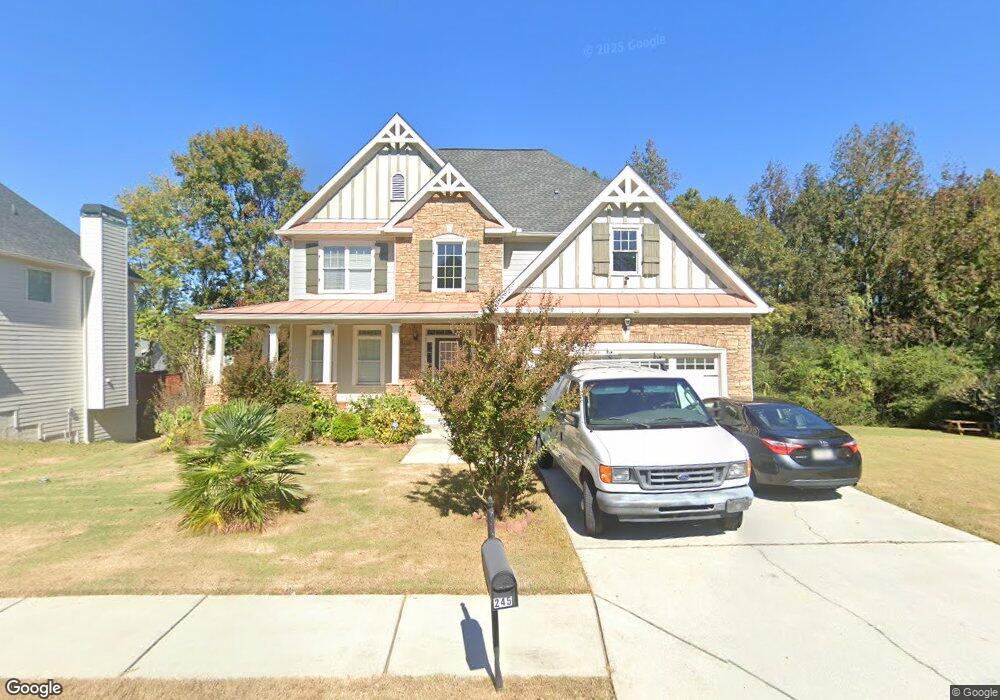
245 Emerson Trail Covington, GA 30016
Estimated Value: $338,714 - $401,000
--
Bed
2
Baths
3,209
Sq Ft
$114/Sq Ft
Est. Value
About This Home
This home is located at 245 Emerson Trail, Covington, GA 30016 and is currently estimated at $365,429, approximately $113 per square foot. 245 Emerson Trail is a home located in Newton County with nearby schools including West Newton Elementary School, Veterans Memorial Middle School, and Alcovy High School.
Ownership History
Date
Name
Owned For
Owner Type
Purchase Details
Closed on
May 2, 2008
Sold by
Stone Clinton L
Bought by
Stone Clinton L and Stone Janett
Current Estimated Value
Home Financials for this Owner
Home Financials are based on the most recent Mortgage that was taken out on this home.
Original Mortgage
$143,100
Outstanding Balance
$90,340
Interest Rate
5.82%
Mortgage Type
New Conventional
Estimated Equity
$275,089
Purchase Details
Closed on
Nov 6, 2007
Sold by
Deutsche Bk Natl Trust Co
Bought by
Invs Fremont
Home Financials for this Owner
Home Financials are based on the most recent Mortgage that was taken out on this home.
Original Mortgage
$146,250
Interest Rate
6.15%
Mortgage Type
New Conventional
Purchase Details
Closed on
Jul 19, 2006
Sold by
Scenic Home
Bought by
Roberts Angela
Home Financials for this Owner
Home Financials are based on the most recent Mortgage that was taken out on this home.
Original Mortgage
$258,490
Interest Rate
10.3%
Mortgage Type
New Conventional
Create a Home Valuation Report for This Property
The Home Valuation Report is an in-depth analysis detailing your home's value as well as a comparison with similar homes in the area
Home Values in the Area
Average Home Value in this Area
Purchase History
| Date | Buyer | Sale Price | Title Company |
|---|---|---|---|
| Stone Clinton L | -- | -- | |
| Stone Clinton L | $159,000 | -- | |
| Invs Fremont | $225,000 | -- | |
| Roberts Angela | $259,500 | -- |
Source: Public Records
Mortgage History
| Date | Status | Borrower | Loan Amount |
|---|---|---|---|
| Open | Stone Clinton L | $143,100 | |
| Previous Owner | Invs Fremont | $146,250 | |
| Previous Owner | Roberts Angela | $258,490 |
Source: Public Records
Tax History Compared to Growth
Tax History
| Year | Tax Paid | Tax Assessment Tax Assessment Total Assessment is a certain percentage of the fair market value that is determined by local assessors to be the total taxable value of land and additions on the property. | Land | Improvement |
|---|---|---|---|---|
| 2024 | $2,407 | $134,680 | $17,600 | $117,080 |
| 2023 | $2,843 | $132,000 | $8,000 | $124,000 |
| 2022 | $2,367 | $114,480 | $8,000 | $106,480 |
| 2021 | $2,077 | $96,000 | $8,000 | $88,000 |
| 2020 | $2,060 | $90,520 | $8,000 | $82,520 |
| 2019 | $2,071 | $89,920 | $8,000 | $81,920 |
| 2018 | $1,503 | $73,000 | $7,400 | $65,600 |
| 2017 | $1,531 | $73,800 | $6,600 | $67,200 |
| 2016 | $2,524 | $74,960 | $3,800 | $71,160 |
| 2015 | $2,375 | $70,640 | $3,400 | $67,240 |
| 2014 | $1,837 | $55,080 | $0 | $0 |
Source: Public Records
Map
Nearby Homes
- 25 Franklin Way
- 190 Timberlake Terrace
- 50 Trinity Ln
- 55 Emerson Trail
- 20 Greenway Dr
- 100 Adelaide Dr
- 345 Timberlake Terrace
- 330 Greenway Dr
- 380 Spring Lake Terrace
- 160 Charleston Place
- 130 Hazelhurst Dr
- 150 Charleston Place
- 145 Glynnshire Ct
- 417 Rosser Rd
- 175 Glynnshire Ct Unit 2
- 50 Freedom Ct
- 115 Jericho Dr
- 65 Jericho Dr
- 7 Glynnshire Ct
- 45 Salem Ridge
- 235 Emerson Trail
- 255 Emerson Trail
- 225 Emerson Trail
- 10 Harrison Cir
- 190 Dairyland Dr
- 200 Dairyland Dr
- 190 Emerson Trail Unit 141
- 190 Emerson Trail
- 180 Dairyland Dr
- 210 Dairyland Dr
- 265 Emerson Trail
- 215 Emerson Trail
- 15 Harrison Cir
- 180 Emerson Trail Unit 140
- 180 Emerson Trail
- 220 Dairyland Dr
- 170 Dairyland Dr
- 20 Harrison Cir Unit 143
- 275 Emerson Trail
- 230 Dairyland Dr