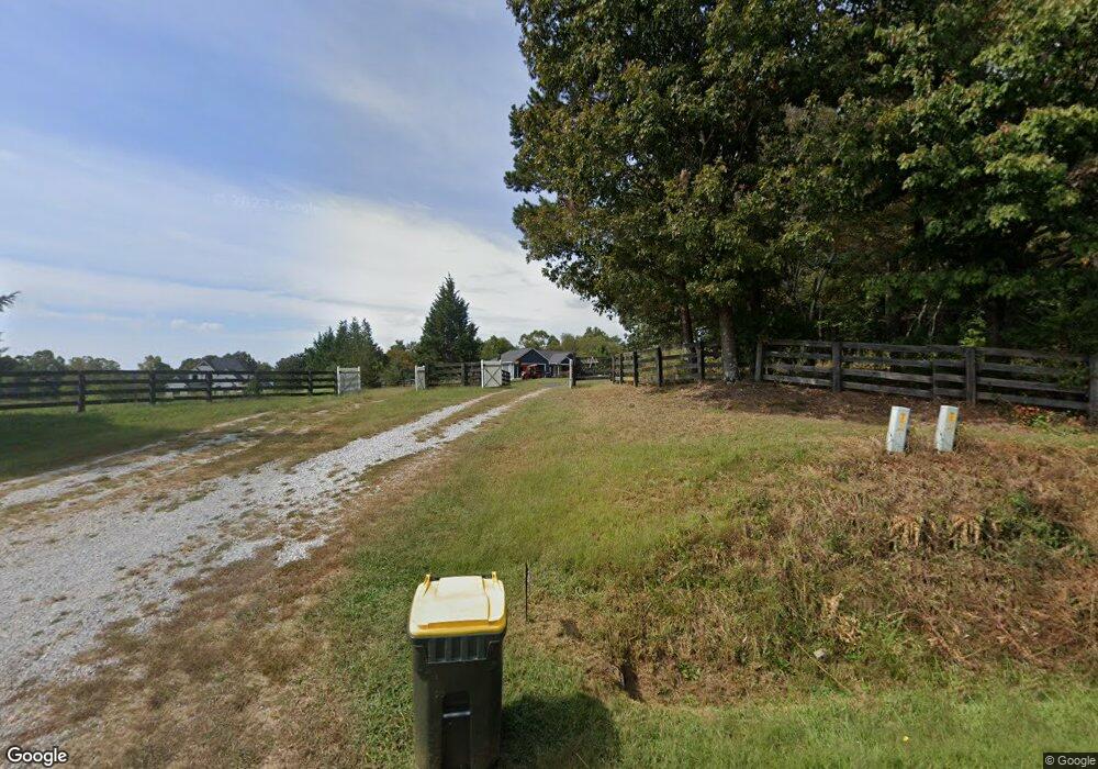
245 Fred Pitts Rd Unit A Demorest, GA 30535
Estimated Value: $456,000 - $682,118
3
Beds
2
Baths
1,714
Sq Ft
$305/Sq Ft
Est. Value
About This Home
This home is located at 245 Fred Pitts Rd Unit A, Demorest, GA 30535 and is currently estimated at $522,780, approximately $305 per square foot. 245 Fred Pitts Rd Unit A is a home located in Habersham County with nearby schools including Fairview Elementary School, North Habersham Middle School, and Habersham Success Academy.
Ownership History
Date
Name
Owned For
Owner Type
Purchase Details
Closed on
Sep 13, 2019
Sold by
Addis Ronnie
Bought by
Shields Thurnell and Smith-Shields Rhonda L
Current Estimated Value
Purchase Details
Closed on
May 15, 2018
Sold by
Addis Ronnie
Bought by
Crosby Timothy J and Crosby Lisa M
Purchase Details
Closed on
Jul 14, 2016
Sold by
Suzanne M
Bought by
Addis Ronnie and Addis Lisa
Home Financials for this Owner
Home Financials are based on the most recent Mortgage that was taken out on this home.
Original Mortgage
$270,000
Interest Rate
3.54%
Mortgage Type
New Conventional
Create a Home Valuation Report for This Property
The Home Valuation Report is an in-depth analysis detailing your home's value as well as a comparison with similar homes in the area
Home Values in the Area
Average Home Value in this Area
Purchase History
| Date | Buyer | Sale Price | Title Company |
|---|---|---|---|
| Shields Thurnell | $150,000 | -- | |
| Crosby Timothy J | $165,000 | -- | |
| Addis Ronnie | $135,000 | -- | |
| Addis Ronnie | $135,000 | -- |
Source: Public Records
Mortgage History
| Date | Status | Borrower | Loan Amount |
|---|---|---|---|
| Previous Owner | Addis Ronnie | $270,000 |
Source: Public Records
Tax History Compared to Growth
Tax History
| Year | Tax Paid | Tax Assessment Tax Assessment Total Assessment is a certain percentage of the fair market value that is determined by local assessors to be the total taxable value of land and additions on the property. | Land | Improvement |
|---|---|---|---|---|
| 2025 | $2,621 | $224,827 | $87,808 | $137,019 |
| 2024 | -- | $219,368 | $93,312 | $126,056 |
| 2023 | $1,765 | $197,192 | $93,312 | $103,880 |
| 2022 | $2,112 | $174,348 | $85,536 | $88,812 |
| 2021 | $1,887 | $164,748 | $85,536 | $79,212 |
| 2020 | $1,796 | $137,840 | $69,984 | $67,856 |
| 2019 | $1,893 | $183,688 | $115,832 | $67,856 |
| 2018 | $1,881 | $183,688 | $115,832 | $67,856 |
| 2017 | $215 | $115,832 | $115,832 | $0 |
| 2016 | $250 | $23,940 | $115,832 | $0 |
| 2015 | $193 | $18,740 | $115,832 | $0 |
| 2014 | $191 | $18,210 | $115,832 | $0 |
| 2013 | -- | $115,832 | $115,832 | $0 |
Source: Public Records
Map
Nearby Homes
- 415 Pardue Mill Rd
- 2600 Georgia 115
- 7 ACRES Wheeler Rd
- 0 Wheeler Rd Unit 22579726
- 132 Fairview Meadows Dr
- 1045 Fairview School Rd
- 320 Cainbridge Meadows
- 663 Wheeler Rd
- 368 Dixon Rd
- 121 Windchime Cir
- 186 Sweetbriar Dr Unit LOT 10
- 186 Sweetbriar Dr
- 385 Amys Rd
- 271 Panacea Ln
- 303 Chitwood Rd
- 0 N Falling Waters Dr Unit LOT 32B
- 512 Olde Rockhouse Ln
- LOT 4 Olde Rockhouse Ln
- 234 Dh Green Rd
- 350 Kitty Hawk Ln
- 245 Fred Pitts Rd Unit A
- 245 Fred Pitts Rd
- 245 Fred Pitts Rd
- 245 Fred Pitts Rd
- 245 Fred Pitts Rd
- 245 Fred Pitts Rd
- 241 Fred Pitts Rd
- 7 Oakcrest Dr
- 4 Oakcrest Dr
- 6 Oakcrest Dr
- 158 Jim Thomas Rd
- 110 Jim Thomas Rd
- 2967 Highway 115
- 145 Fred Pitts Rd
- 0 Jim Thomas Rd Unit 8415066
- 0 Jim Thomas Rd Unit 3 8226594
- 0 Jim Thomas Rd
- 0 Jim Thomas Rd Unit 3266167
- 0 Jim Thomas Rd Unit 7396591
- 0 Jim Thomas Rd Unit 3086592
