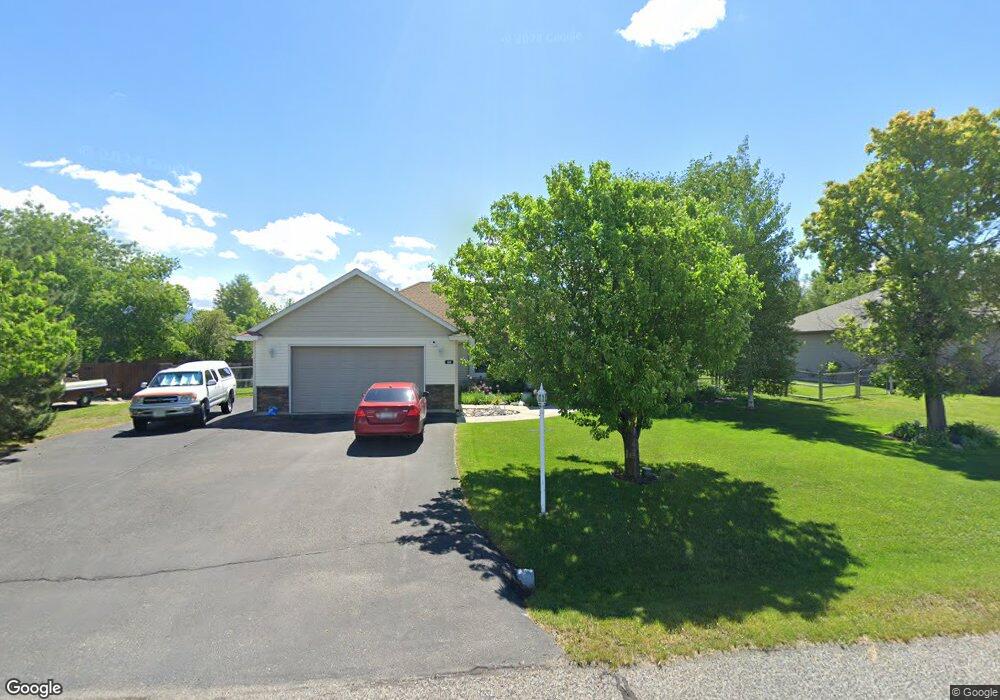
245 Lewis And Clark Trail Bozeman, MT 59718
Estimated Value: $769,713 - $833,000
3
Beds
3
Baths
2,156
Sq Ft
$376/Sq Ft
Est. Value
About This Home
This home is located at 245 Lewis And Clark Trail, Bozeman, MT 59718 and is currently estimated at $810,571, approximately $375 per square foot. 245 Lewis And Clark Trail is a home located in Gallatin County with nearby schools including Heck/Quaw Elementary School and Belgrade High School.
Ownership History
Date
Name
Owned For
Owner Type
Purchase Details
Closed on
Jun 27, 2008
Sold by
Trailer Reuben E and Trailer Grethe G
Bought by
Bennett Carl R and Bennett Karen G
Current Estimated Value
Home Financials for this Owner
Home Financials are based on the most recent Mortgage that was taken out on this home.
Original Mortgage
$331,800
Outstanding Balance
$213,184
Interest Rate
5.99%
Mortgage Type
Purchase Money Mortgage
Estimated Equity
$597,387
Purchase Details
Closed on
Sep 9, 2005
Sold by
Teslow Mikkel J and Teslow Susan S
Bought by
Trailer Reuben E and Trailer Grethe G
Create a Home Valuation Report for This Property
The Home Valuation Report is an in-depth analysis detailing your home's value as well as a comparison with similar homes in the area
Home Values in the Area
Average Home Value in this Area
Purchase History
| Date | Buyer | Sale Price | Title Company |
|---|---|---|---|
| Bennett Carl R | -- | American Land Title Company | |
| Trailer Reuben E | -- | Security Title Company |
Source: Public Records
Mortgage History
| Date | Status | Borrower | Loan Amount |
|---|---|---|---|
| Open | Bennett Carl R | $331,800 |
Source: Public Records
Tax History Compared to Growth
Tax History
| Year | Tax Paid | Tax Assessment Tax Assessment Total Assessment is a certain percentage of the fair market value that is determined by local assessors to be the total taxable value of land and additions on the property. | Land | Improvement |
|---|---|---|---|---|
| 2025 | $3,221 | $788,200 | $0 | $0 |
| 2024 | $4,752 | $785,300 | $0 | $0 |
| 2023 | $4,736 | $785,300 | $0 | $0 |
| 2022 | $3,531 | $471,100 | $0 | $0 |
| 2021 | $3,739 | $471,100 | $0 | $0 |
| 2020 | $3,395 | $423,400 | $0 | $0 |
| 2019 | $3,458 | $423,400 | $0 | $0 |
| 2018 | $3,099 | $357,800 | $0 | $0 |
| 2017 | $3,194 | $357,800 | $0 | $0 |
| 2016 | $2,769 | $306,200 | $0 | $0 |
| 2015 | $2,581 | $306,200 | $0 | $0 |
| 2014 | $2,626 | $189,952 | $0 | $0 |
Source: Public Records
Map
Nearby Homes
- 604 Morrison Ave Unit B
- 16 Tailwater Dr
- 11 Liberty Dr
- 9 Liberty Dr
- 6 Liberty Dr
- 13 Liberty Dr
- 5 Liberty Dr
- 17 Tailwater Dr
- 126 Pathfinder Trail
- 19 Tailwater Dr
- 370 Prospector Trail
- 12 Pathfinder Trail
- 21 Tailwater Dr
- Lot 10 Riparian Way
- Lot 3 Riparian Way
- Lot 11 Riparian Way
- 25 Tailwater Dr
- 283 Valley Grove Dr
- 23 Tailwater Dr
- 339 Mountain Lion Trail
- 221 Lewis And Clark Trail
- 267 Lewis And Clark Trail
- 167 Old West Trail
- 283 Lewis And Clark Trail
- 179 Old West Trail
- 219 Lewis And Clark Trail
- 143 Old West Trail
- 143 West Trail
- 203 West Trail
- 203 Old West Trail
- 121 Old West Trail
- 313 Lewis And Clark Trail
- 166 Old West Trail
- 341 Lewis And Clark Trail
- 178 Old West Trail
- 225 West Trail
- 166 West Trail
- 225 Old West Trail
- 142 Old West Trail
- 206 Old West Trail