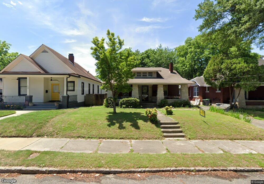
245 Pine St Memphis, TN 38104
Central Gardens NeighborhoodEstimated Value: $267,941 - $314,000
2
Beds
2
Baths
2,613
Sq Ft
$111/Sq Ft
Est. Value
About This Home
This home is located at 245 Pine St, Memphis, TN 38104 and is currently estimated at $288,985, approximately $110 per square foot. 245 Pine St is a home located in Shelby County with nearby schools including Bruce Elementary School, Bellevue Middle School, and Central High School.
Ownership History
Date
Name
Owned For
Owner Type
Purchase Details
Closed on
Nov 12, 2020
Sold by
Plant Collen Ducan
Bought by
Plant Colleen Dugan and Collen Dugan Plant Rlt
Current Estimated Value
Purchase Details
Closed on
Oct 10, 2016
Sold by
Akin Jeannine D
Bought by
Plant Colleen D
Purchase Details
Closed on
May 17, 2007
Sold by
Plant Colleen D
Bought by
Plant Colleen D and Akin Jeannine D
Purchase Details
Closed on
Aug 10, 2006
Sold by
Dugan Robert Patrick and Plant Colleen D
Bought by
Plant Colleen D
Purchase Details
Closed on
Aug 20, 2001
Sold by
Murphy Garnett A and Murphy Melia M
Bought by
Dugan Robert Patrick and Plant Colleen D
Home Financials for this Owner
Home Financials are based on the most recent Mortgage that was taken out on this home.
Original Mortgage
$42,000
Interest Rate
7.18%
Create a Home Valuation Report for This Property
The Home Valuation Report is an in-depth analysis detailing your home's value as well as a comparison with similar homes in the area
Home Values in the Area
Average Home Value in this Area
Purchase History
| Date | Buyer | Sale Price | Title Company |
|---|---|---|---|
| Plant Colleen Dugan | -- | Regency Title & Escrow Llc | |
| Plant Colleen D | -- | Alliance Title & Escrow Llc | |
| Plant Colleen D | -- | Alliance Title & Escrow Llc | |
| Plant Colleen D | -- | Lenders Title & Escrow Llc | |
| Dugan Robert Patrick | $117,500 | -- |
Source: Public Records
Mortgage History
| Date | Status | Borrower | Loan Amount |
|---|---|---|---|
| Previous Owner | Dugan Robert Patrick | $42,000 |
Source: Public Records
Tax History Compared to Growth
Tax History
| Year | Tax Paid | Tax Assessment Tax Assessment Total Assessment is a certain percentage of the fair market value that is determined by local assessors to be the total taxable value of land and additions on the property. | Land | Improvement |
|---|---|---|---|---|
| 2025 | $2,201 | $72,350 | $13,875 | $58,475 |
| 2024 | $2,201 | $64,925 | $9,500 | $55,425 |
| 2023 | $3,955 | $64,925 | $9,500 | $55,425 |
| 2022 | $3,955 | $64,925 | $9,500 | $55,425 |
| 2021 | $4,001 | $64,925 | $9,500 | $55,425 |
| 2020 | $3,752 | $51,775 | $9,500 | $42,275 |
| 2019 | $3,752 | $51,775 | $9,500 | $42,275 |
| 2018 | $3,752 | $51,775 | $9,500 | $42,275 |
| 2017 | $2,128 | $51,775 | $9,500 | $42,275 |
| 2016 | $1,699 | $38,875 | $0 | $0 |
| 2014 | $1,699 | $38,875 | $0 | $0 |
Source: Public Records
Map
Nearby Homes
- 1336 Peabody Ave
- 1486 Eastmoreland Ave
- 1464 Peabody Ave
- 1500 Eastmoreland Ave
- 1297 Peabody Ave
- 1431 Carr Ave
- 1276 Carr Ave
- 1391 Vinton Ave
- 1535 Monroe Ave
- 1361 Vinton Ave
- 1413 Court Ave
- 1515 Madison Ave
- 1429 Vinton Ave
- 1559 Eastmoreland Ave
- 1531 Peabody Ave
- 1480 Vinton Ave
- 1570 Linden Ave
- 1570 Eastmoreland Ave
- 1246 Vinton Ave
- 1584 Eastmoreland Ave Unit 3