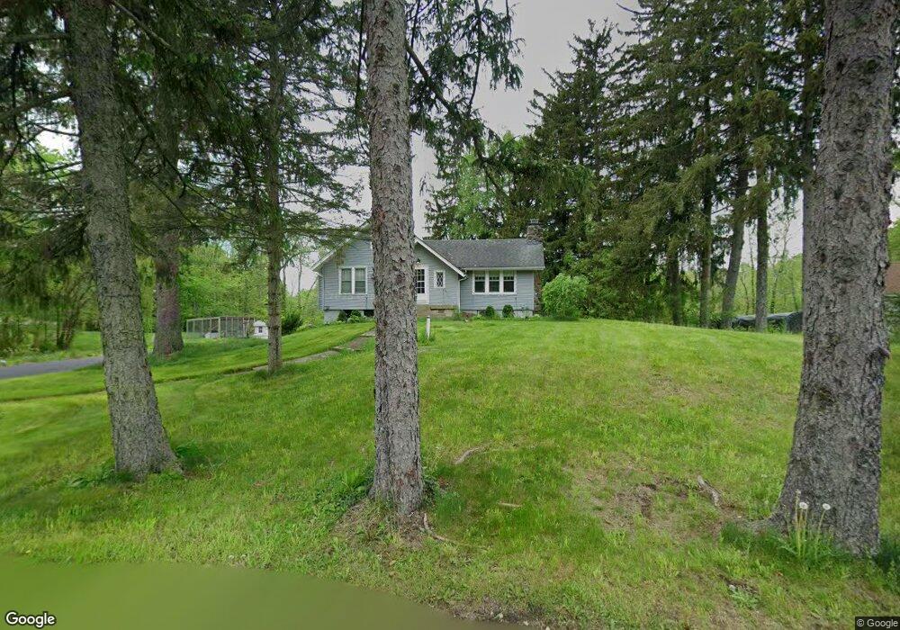
245 Rt 206 Byram Twp., NJ 07821
Estimated Value: $403,000 - $460,588
--
Bed
2
Baths
1,515
Sq Ft
$286/Sq Ft
Est. Value
About This Home
This home is located at 245 Rt 206, Byram Twp., NJ 07821 and is currently estimated at $433,397, approximately $286 per square foot. 245 Rt 206 is a home located in Sussex County with nearby schools including Byram Lakes Elementary School, Byram Township Intermediate School, and Lenape Val Regional High School.
Ownership History
Date
Name
Owned For
Owner Type
Purchase Details
Closed on
May 10, 2022
Sold by
Corzo and Samantha
Bought by
Tattoli Christopher and Dibernardo Cristian
Current Estimated Value
Home Financials for this Owner
Home Financials are based on the most recent Mortgage that was taken out on this home.
Original Mortgage
$298,000
Outstanding Balance
$283,144
Interest Rate
5.27%
Mortgage Type
New Conventional
Estimated Equity
$150,253
Purchase Details
Closed on
Nov 19, 2018
Sold by
Boepple Herman Paul
Bought by
Corzo Andrew and Losurdo Samantha L
Purchase Details
Closed on
Jul 31, 2017
Sold by
Copcutt Arthur S and Estate Of Esther S Boepple
Bought by
Beopple Heraman Paul
Purchase Details
Closed on
Aug 2, 2004
Sold by
Okeson Steven Wiley
Bought by
Okeson Steven W
Purchase Details
Closed on
Nov 10, 1999
Sold by
Boepple Esther S and Estate Of Herman J Boepple
Bought by
Boepple Esther S
Create a Home Valuation Report for This Property
The Home Valuation Report is an in-depth analysis detailing your home's value as well as a comparison with similar homes in the area
Home Values in the Area
Average Home Value in this Area
Purchase History
| Date | Buyer | Sale Price | Title Company |
|---|---|---|---|
| Tattoli Christopher | $378,000 | New Title Company Name | |
| Corzo Andrew | $240,000 | Westcor Land Title Ins Co | |
| Beopple Heraman Paul | -- | None Available | |
| Okeson Steven W | -- | -- | |
| Boepple Esther S | -- | -- |
Source: Public Records
Mortgage History
| Date | Status | Borrower | Loan Amount |
|---|---|---|---|
| Open | Tattoli Christopher | $298,000 |
Source: Public Records
Tax History Compared to Growth
Tax History
| Year | Tax Paid | Tax Assessment Tax Assessment Total Assessment is a certain percentage of the fair market value that is determined by local assessors to be the total taxable value of land and additions on the property. | Land | Improvement |
|---|---|---|---|---|
| 2025 | $6,814 | $177,900 | $59,500 | $118,400 |
| 2024 | $6,693 | $177,900 | $59,500 | $118,400 |
| 2023 | $6,693 | $177,900 | $59,500 | $118,400 |
| 2022 | $6,511 | $177,900 | $59,500 | $118,400 |
| 2021 | $6,412 | $177,900 | $59,500 | $118,400 |
| 2020 | $6,358 | $177,900 | $59,500 | $118,400 |
| 2019 | $6,349 | $177,900 | $59,500 | $118,400 |
| 2018 | $6,307 | $177,900 | $59,500 | $118,400 |
| 2017 | $6,196 | $177,900 | $59,500 | $118,400 |
| 2016 | $5,843 | $177,900 | $59,500 | $118,400 |
| 2015 | $5,690 | $177,900 | $59,500 | $118,400 |
| 2014 | $5,908 | $177,900 | $59,500 | $118,400 |
Source: Public Records
Map
Nearby Homes
- 3 Roger Dr
- 3 Knute Dr
- 7 Lakeview Trail
- 34 Allamuchy Trail
- 00 Forest Lakes Dr
- 56A Sleepy Hollow Rd
- 4 Bank St
- 288 Decker Pond Rd
- 9 Richmond Rd
- 24 the Rotunda
- 7 U S Highway 206
- 14 Hillside Terrace
- 0 Decker Pond Airport Rd Unit 3945534
- 40 Brookwood Rd
- 11 Joan Dr
- 2 Robert St
- 30 Ross Rd
- 28 Acorn St
- 8 Brighton Ave
- 5 Railroad Ave