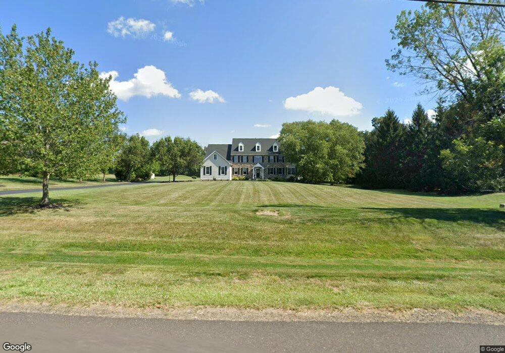
245 Walter Rd Chalfont, PA 18914
Estimated Value: $1,216,777 - $1,385,000
5
Beds
4
Baths
4,331
Sq Ft
$302/Sq Ft
Est. Value
About This Home
This home is located at 245 Walter Rd, Chalfont, PA 18914 and is currently estimated at $1,309,944, approximately $302 per square foot. 245 Walter Rd is a home located in Bucks County with nearby schools including Simon Butler Elementary, Unami Middle School, and Central Bucks High School - South.
Ownership History
Date
Name
Owned For
Owner Type
Purchase Details
Closed on
Sep 23, 2011
Sold by
Kowalski Timothy F and Kowalski Roseann T
Bought by
Kowalski Timothy F
Current Estimated Value
Home Financials for this Owner
Home Financials are based on the most recent Mortgage that was taken out on this home.
Original Mortgage
$225,000
Outstanding Balance
$154,005
Interest Rate
4.25%
Mortgage Type
New Conventional
Estimated Equity
$1,155,939
Purchase Details
Closed on
May 15, 2002
Sold by
Prime Properties Inc
Bought by
Kowalski Timothy F and Kowalski Roseann T
Home Financials for this Owner
Home Financials are based on the most recent Mortgage that was taken out on this home.
Original Mortgage
$300,700
Interest Rate
7.01%
Create a Home Valuation Report for This Property
The Home Valuation Report is an in-depth analysis detailing your home's value as well as a comparison with similar homes in the area
Home Values in the Area
Average Home Value in this Area
Purchase History
| Date | Buyer | Sale Price | Title Company |
|---|---|---|---|
| Kowalski Timothy F | -- | First American Title Ins Co | |
| Kowalski Timothy F | $619,955 | -- |
Source: Public Records
Mortgage History
| Date | Status | Borrower | Loan Amount |
|---|---|---|---|
| Open | Kowalski Timothy F | $225,000 | |
| Closed | Kowalski Timothy F | $300,700 | |
| Closed | Kowalski Timothy F | $150,000 |
Source: Public Records
Tax History Compared to Growth
Tax History
| Year | Tax Paid | Tax Assessment Tax Assessment Total Assessment is a certain percentage of the fair market value that is determined by local assessors to be the total taxable value of land and additions on the property. | Land | Improvement |
|---|---|---|---|---|
| 2025 | $12,879 | $74,310 | $11,480 | $62,830 |
| 2024 | $12,879 | $74,310 | $11,480 | $62,830 |
| 2023 | $12,468 | $74,310 | $11,480 | $62,830 |
| 2022 | $12,222 | $74,310 | $11,480 | $62,830 |
| 2021 | $12,084 | $74,310 | $11,480 | $62,830 |
| 2020 | $12,084 | $74,310 | $11,480 | $62,830 |
| 2019 | $11,935 | $74,310 | $11,480 | $62,830 |
| 2018 | $11,935 | $74,310 | $11,480 | $62,830 |
| 2017 | $11,842 | $74,310 | $11,480 | $62,830 |
| 2016 | $11,842 | $74,310 | $11,480 | $62,830 |
| 2015 | -- | $74,310 | $11,480 | $62,830 |
| 2014 | -- | $74,310 | $11,480 | $62,830 |
Source: Public Records
Map
Nearby Homes
- 105 Barry Rd
- 165 Township Line Rd
- 9 Barry Rd
- 94 Railroad Ave
- 115 Peggy Ln
- 0 N Limekiln Pike
- 4 Railroad Ave
- 193 Curley Mill Rd
- 113 Hamilton St
- 639 Chatham Ct
- 109 Upper Stump Rd
- 241 Coventry Rd
- 514 Windsor Ct
- 353 W Boulder Dr
- 201 Coventry Rd
- 300 Brookside Ct
- 326 Rocky Ct W Unit W
- The Brentwood Plan at Barclay Hill
- The Banbury Plan at Barclay Hill
- The Brookhaven Plan at Barclay Hill