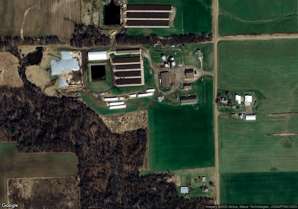
2450 Wilkinson Hwy Adrian, MI 49221
Estimated Value: $1,134,706
3
Beds
3
Baths
1,888
Sq Ft
$601/Sq Ft
Est. Value
About This Home
This home is located at 2450 Wilkinson Hwy, Adrian, MI 49221 and is currently estimated at $1,134,706, approximately $601 per square foot. 2450 Wilkinson Hwy is a home with nearby schools including Onsted Elementary School, Onsted Middle School, and Onsted Community High School.
Ownership History
Date
Name
Owned For
Owner Type
Purchase Details
Closed on
Oct 21, 2012
Sold by
Flevo Llc
Bought by
Halliwill Timothy C and Halliwill Detra L
Current Estimated Value
Home Financials for this Owner
Home Financials are based on the most recent Mortgage that was taken out on this home.
Original Mortgage
$727,300
Outstanding Balance
$120,430
Interest Rate
2.84%
Mortgage Type
Future Advance Clause Open End Mortgage
Estimated Equity
$1,014,276
Purchase Details
Closed on
Mar 10, 2000
Bought by
Halliwill Timothy C and Halliwill Detra
Create a Home Valuation Report for This Property
The Home Valuation Report is an in-depth analysis detailing your home's value as well as a comparison with similar homes in the area
Home Values in the Area
Average Home Value in this Area
Purchase History
| Date | Buyer | Sale Price | Title Company |
|---|---|---|---|
| Halliwill Timothy C | -- | American Title Co | |
| Halliwill Timothy C | $38,000 | -- |
Source: Public Records
Mortgage History
| Date | Status | Borrower | Loan Amount |
|---|---|---|---|
| Open | Halliwill Timothy C | $727,300 |
Source: Public Records
Tax History Compared to Growth
Tax History
| Year | Tax Paid | Tax Assessment Tax Assessment Total Assessment is a certain percentage of the fair market value that is determined by local assessors to be the total taxable value of land and additions on the property. | Land | Improvement |
|---|---|---|---|---|
| 2025 | $15,390 | $623,400 | $0 | $0 |
| 2024 | $6,560 | $611,100 | $0 | $0 |
| 2022 | $5,760 | $519,100 | $0 | $0 |
| 2021 | $13,863 | $500,300 | $0 | $0 |
| 2020 | $13,382 | $494,700 | $0 | $0 |
| 2019 | $1,465,028 | $486,200 | $0 | $0 |
| 2018 | $12,934 | $486,193 | $0 | $0 |
| 2017 | $12,797 | $490,409 | $0 | $0 |
| 2016 | $12,760 | $487,787 | $0 | $0 |
| 2014 | -- | $470,534 | $0 | $0 |
Source: Public Records
Map
Nearby Homes
- 10512 Rome Rd
- 9875 Stoddard Rd
- 8320 W Us-23 Hwy
- 11943 U S 223
- 10139 Cadmus Rd
- 10093 Shepherd Rd
- 6712 W Cadmus Rd
- 3150 State St
- 9024 W Carleton Rd
- 5576 W Beecher Rd
- 3601 Seneca St
- 4182 Whaley Hwy
- 3951 Woerner Rd
- 4691 & 4000 Woerner Rd
- 3953 Woerner Rd
- 15300 Rome Rd
- V/L Forrister Rd
- 11495 W Carleton Rd
- 12000 Us Highway 223
- 2025 Geneva Hwy
- 2246 Wilkinson Hwy
- 10816 Forrister Rd
- 10000 Forrister Rd Unit BLK
- 10000 Forrister Rd
- 10720 Forrister Rd
- 2413 Wilkinson Hwy
- 10725 Forrister Rd
- 10354 Forrister Rd
- 10354 Forrister Rd Unit FORRISTER
- 10495 Forrister Rd
- 2850 Wilkinson Hwy
- 10912 Forrister Rd
- 10977 Forrister Rd
- 2900 Wilkinson Hwy
- 9000 Hoddinott Rd Unit BLK
- 9000 Hoddinott Rd Unit BLK
- 9000 Hoddinott Rd Unit BLK
- 9000 Hoddinott Rd Unit BLK
- 9000 Hoddinott Rd Unit BLK
- 10212 Forrister Rd
