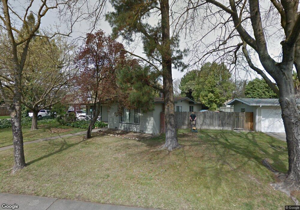
2451 W Swain Rd Stockton, CA 95207
Lincoln Village NeighborhoodEstimated Value: $363,769 - $388,000
3
Beds
1
Bath
1,144
Sq Ft
$325/Sq Ft
Est. Value
About This Home
This home is located at 2451 W Swain Rd, Stockton, CA 95207 and is currently estimated at $372,192, approximately $325 per square foot. 2451 W Swain Rd is a home located in San Joaquin County with nearby schools including Tully C. Knoles School, Sierra Middle School, and Lincoln High School.
Ownership History
Date
Name
Owned For
Owner Type
Purchase Details
Closed on
Jan 6, 2015
Sold by
Stone Jeffery T
Bought by
Stone Jeffery
Current Estimated Value
Home Financials for this Owner
Home Financials are based on the most recent Mortgage that was taken out on this home.
Original Mortgage
$96,000
Outstanding Balance
$73,748
Interest Rate
3.92%
Mortgage Type
New Conventional
Estimated Equity
$298,444
Purchase Details
Closed on
Jul 19, 1997
Sold by
Smith Thomas R
Bought by
Stone Jeffery T
Purchase Details
Closed on
Apr 3, 1996
Sold by
Stone Smith Ornella A and Stone Smith Ornella
Bought by
Smith Thomas R and Stone Smith Ornella A
Home Financials for this Owner
Home Financials are based on the most recent Mortgage that was taken out on this home.
Original Mortgage
$88,000
Interest Rate
7.41%
Create a Home Valuation Report for This Property
The Home Valuation Report is an in-depth analysis detailing your home's value as well as a comparison with similar homes in the area
Home Values in the Area
Average Home Value in this Area
Purchase History
| Date | Buyer | Sale Price | Title Company |
|---|---|---|---|
| Stone Jeffery | -- | Pacific Coast Title | |
| Stone Jeffery T | -- | -- | |
| Smith Thomas R | -- | First American |
Source: Public Records
Mortgage History
| Date | Status | Borrower | Loan Amount |
|---|---|---|---|
| Open | Stone Jeffery | $96,000 | |
| Closed | Smith Thomas R | $88,000 |
Source: Public Records
Tax History Compared to Growth
Tax History
| Year | Tax Paid | Tax Assessment Tax Assessment Total Assessment is a certain percentage of the fair market value that is determined by local assessors to be the total taxable value of land and additions on the property. | Land | Improvement |
|---|---|---|---|---|
| 2025 | $3,779 | $133,958 | $66,979 | $66,979 |
| 2024 | $3,656 | $131,332 | $65,666 | $65,666 |
| 2023 | $3,564 | $128,758 | $64,379 | $64,379 |
| 2022 | $3,333 | $126,234 | $63,117 | $63,117 |
| 2021 | $3,273 | $123,760 | $61,880 | $61,880 |
| 2020 | $3,239 | $122,492 | $61,246 | $61,246 |
| 2019 | $3,216 | $120,092 | $60,046 | $60,046 |
| 2018 | $3,139 | $117,738 | $58,869 | $58,869 |
| 2017 | $3,110 | $115,430 | $57,715 | $57,715 |
| 2016 | $2,895 | $113,166 | $56,583 | $56,583 |
| 2014 | $2,914 | $109,284 | $54,642 | $54,642 |
Source: Public Records
Map
Nearby Homes
- 2447 Calhoun Way
- 2252 Canyon Creek Dr
- 2128 Canyon Creek Dr
- 2421 Meadow Lake Dr
- 2252 W Benjamin Holt Dr
- 5734 Turtle Valley Dr
- 2014 Douglas Rd
- 2914 Prentiss Ct
- 5522 Teal Ct
- 2922 Prentiss Ct
- 1929 W Swain Rd
- 5713 Turtle Valley Dr
- 2009 Cedar Ridge Dr
- 6415 Plymouth Rd
- 2433 Pheasant Run Cir
- 2005 Cedar Ridge Dr
- 2935 Prentiss Ct Unit 1844
- 2039 W Benjamin Holt Dr
- 1864 Polk Way
- 2921 Rutledge Ct
- 2443 W Swain Rd
- 2456 Porter Way
- 2446 Porter Way
- 2431 W Swain Rd
- 2505 W Swain Rd
- 2458 W Swain Rd
- 2436 Porter Way Unit 21
- 2448 W Swain Rd
- 2506 Porter Way
- 2468 W Swain Rd
- 2438 W Swain Rd
- 2428 W Swain Rd
- 2504 W Swain Rd
- 2426 Porter Way
- 2517 W Swain Rd
- 2518 Porter Way
- 2413 W Swain Rd
- 2455 Porter Way
- 2445 Porter Way
- 2418 W Swain Rd