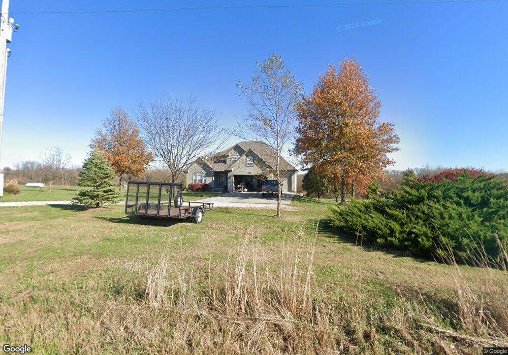
24510 171st St Leavenworth, KS 66048
Estimated Value: $557,000 - $604,000
4
Beds
3
Baths
2,069
Sq Ft
$279/Sq Ft
Est. Value
About This Home
This home is located at 24510 171st St, Leavenworth, KS 66048 and is currently estimated at $577,322, approximately $279 per square foot. 24510 171st St is a home located in Leavenworth County with nearby schools including Lansing Elementary School, Lansing Middle 6-8, and Lansing High 9-12.
Ownership History
Date
Name
Owned For
Owner Type
Purchase Details
Closed on
Sep 1, 1997
Bought by
Scheurer John R and Scheurer Sharon E
Current Estimated Value
Home Financials for this Owner
Home Financials are based on the most recent Mortgage that was taken out on this home.
Original Mortgage
$174,000
Outstanding Balance
$27,227
Interest Rate
7.58%
Mortgage Type
New Conventional
Estimated Equity
$550,095
Create a Home Valuation Report for This Property
The Home Valuation Report is an in-depth analysis detailing your home's value as well as a comparison with similar homes in the area
Home Values in the Area
Average Home Value in this Area
Purchase History
| Date | Buyer | Sale Price | Title Company |
|---|---|---|---|
| Scheurer John R | $28,000 | -- |
Source: Public Records
Mortgage History
| Date | Status | Borrower | Loan Amount |
|---|---|---|---|
| Open | Scheurer John R | $174,000 | |
| Closed | Scheurer John R | $189,000 |
Source: Public Records
Tax History Compared to Growth
Tax History
| Year | Tax Paid | Tax Assessment Tax Assessment Total Assessment is a certain percentage of the fair market value that is determined by local assessors to be the total taxable value of land and additions on the property. | Land | Improvement |
|---|---|---|---|---|
| 2025 | $6,398 | $67,562 | $11,164 | $56,398 |
| 2024 | $5,932 | $56,028 | $9,853 | $46,175 |
| 2023 | $5,932 | $54,464 | $9,853 | $44,611 |
| 2022 | $5,773 | $51,175 | $8,400 | $42,775 |
| 2021 | $5,030 | $44,128 | $7,611 | $36,517 |
| 2020 | $4,822 | $41,630 | $7,277 | $34,353 |
| 2019 | $4,827 | $41,595 | $6,932 | $34,663 |
| 2018 | $4,196 | $36,225 | $6,012 | $30,213 |
| 2017 | $4,131 | $35,546 | $5,891 | $29,655 |
| 2016 | $3,835 | $33,073 | $5,782 | $27,291 |
| 2015 | $3,661 | $31,709 | $5,782 | $25,927 |
| 2014 | $3,491 | $30,786 | $5,816 | $24,970 |
Source: Public Records
Map
Nearby Homes
- 24450 171st St
- 25030 177th Terrace
- 16430 Dana Ln
- 17860 Clearview Dr
- 25055 Woodridge Cir
- 25770 Tonganoxie Dr
- 00000 Gilman Rd
- Lot 6 163rd St
- 15280 Roger Rd
- 26277 187th St
- 22119 171st St
- 22617 155th St
- 1221 S Desoto Rd
- 1217 S Desoto Rd
- 833 Rock Creek Dr
- 17739 Eisenhower Rd
- 16781 Hollingsworth Rd
- 875 Clearview Dr
- 000 4-H Rd
- 15038 Fairmount Rd
- 24600 171st St
- 24490 171st St
- 24623 171st St
- 17052 Mcintyre Rd
- 16930 Mcintyre Rd
- 17085 Mcintyre Rd
- 24713 171st St
- 24369 170th St
- 16870 Mcintyre Rd
- 17017 Mcintyre Rd
- 16925 Mcintyre Rd
- 24250 172nd St
- 17203 Mcintyre Rd
- 16740 Mcintyre Rd
- 24241 170th St
- 17209 Mcintyre Rd
- 17311 Mcintyre Rd
- 24236 170th St
- 24229 172nd St
- 16736 Mcintyre Rd