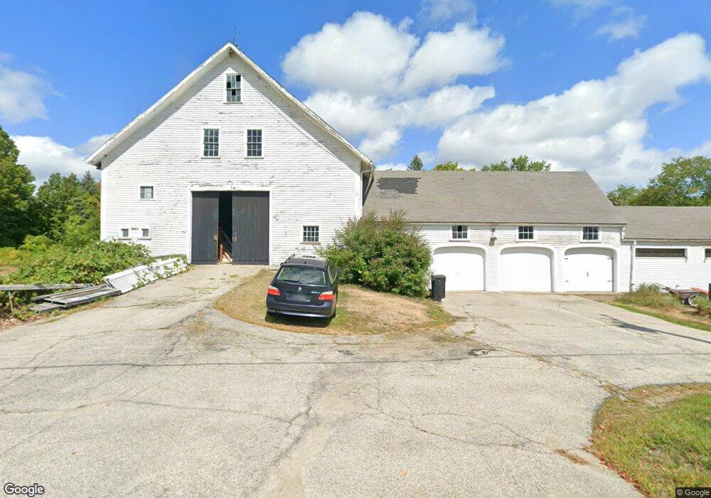
246 Center Rd Lyndeborough, NH 03082
Estimated Value: $530,000 - $564,308
4
Beds
2
Baths
2,908
Sq Ft
$190/Sq Ft
Est. Value
About This Home
This home is located at 246 Center Rd, Lyndeborough, NH 03082 and is currently estimated at $553,577, approximately $190 per square foot. 246 Center Rd is a home located in Hillsborough County with nearby schools including Lyndeborough Central School, Wilton-Lyndeborough Cooperative Middle School, and Wilton-Lyndeborough Cooperative High School.
Ownership History
Date
Name
Owned For
Owner Type
Purchase Details
Closed on
Mar 9, 2021
Sold by
True Kelley C
Bought by
True Kelley C and True Barry A
Current Estimated Value
Purchase Details
Closed on
Dec 20, 2010
Sold by
Vanblarigan Margaret A and Burke Martha L
Bought by
True Kelley C and Burke Martha L
Home Financials for this Owner
Home Financials are based on the most recent Mortgage that was taken out on this home.
Original Mortgage
$214,423
Interest Rate
4.23%
Mortgage Type
Purchase Money Mortgage
Create a Home Valuation Report for This Property
The Home Valuation Report is an in-depth analysis detailing your home's value as well as a comparison with similar homes in the area
Home Values in the Area
Average Home Value in this Area
Purchase History
| Date | Buyer | Sale Price | Title Company |
|---|---|---|---|
| True Kelley C | -- | None Available | |
| True Kelley C | $220,000 | -- |
Source: Public Records
Mortgage History
| Date | Status | Borrower | Loan Amount |
|---|---|---|---|
| Previous Owner | True Kelley C | $214,423 |
Source: Public Records
Tax History
| Year | Tax Paid | Tax Assessment Tax Assessment Total Assessment is a certain percentage of the fair market value that is determined by local assessors to be the total taxable value of land and additions on the property. | Land | Improvement |
|---|---|---|---|---|
| 2025 | $9,172 | $540,500 | $187,000 | $353,500 |
| 2024 | $10,608 | $410,200 | $105,700 | $304,500 |
| 2023 | $9,750 | $410,200 | $105,700 | $304,500 |
| 2022 | $9,065 | $410,200 | $105,700 | $304,500 |
| 2021 | $9,178 | $415,300 | $105,700 | $309,600 |
| 2020 | $8,863 | $415,300 | $105,700 | $309,600 |
| 2019 | $9,762 | $335,000 | $105,000 | $230,000 |
| 2018 | $9,450 | $335,000 | $105,000 | $230,000 |
| 2017 | $9,018 | $335,000 | $105,000 | $230,000 |
| 2016 | $9,293 | $335,000 | $105,000 | $230,000 |
| 2015 | $8,472 | $335,000 | $105,000 | $230,000 |
| 2013 | $7,711 | $321,300 | $105,000 | $216,300 |
Source: Public Records
Map
Nearby Homes
- 16 Cortland Rd
- 13 Dow Rd
- 7 Dow Rd
- 33 Falcon Ridge Rd Unit 33
- 143 Falcon Ridge Rd Unit 23
- 545 Elm St Unit 10
- 51 Singer Brook Rd
- 25 Burns Hill Rd
- 21 Singer Brook Rd
- 4 Trow Rd
- F-88-7 Aria Hill Dr
- F-88-12 Aria Hill Dr
- F-88-11 Aria Hill Dr
- 229 Mont Vernon Rd
- 0 Briar Cliff Dr
- 145 Westchester Dr
- 85 Intervale Rd
- 2-47 Old Amherst Rd
- 3 Abby Ln Unit 1
- 57 Patch Hill Ln
Your Personal Tour Guide
Ask me questions while you tour the home.